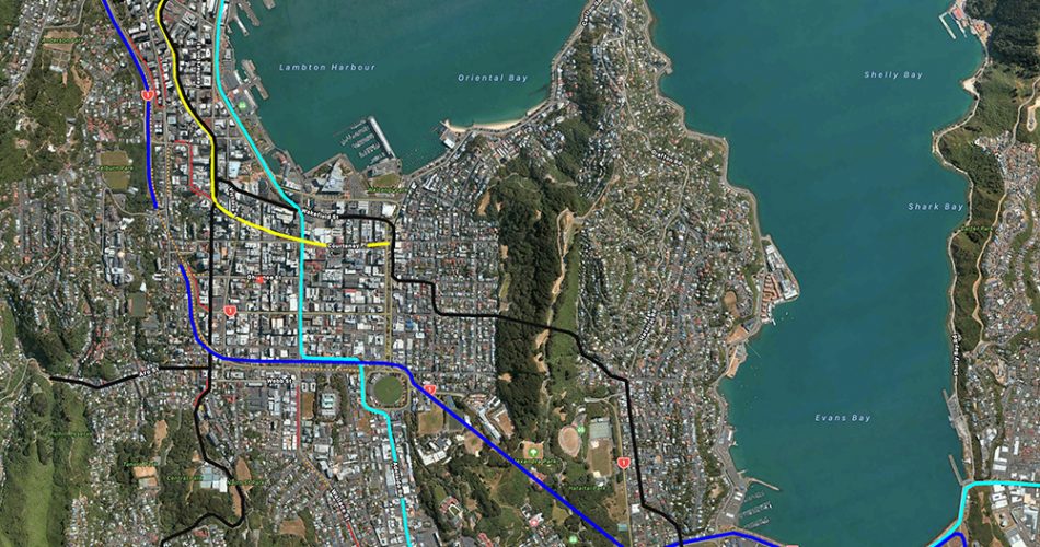
In the great tradition of the founders of this site, who tried to help and cajole the LGWM team into coming up with a plan for Wellington – to really get it moving – I thought that seeing as the semi-final FOUR possible solutions are presented to Wellington (starting next week on Monday 1st November), that I’d put my best flipper forward and see what the Eye of the Fish thinks may happen. Although there are Four options, possibly one involving Light Rail, and a couple proposing yet more Buses (although somehow magically faster and better, despite still being just a bloody bus), I’m going to skip that boring conversation for now. Some people will be getting very excited (for or against) over a tunnel under Mount Victoria. Not me. A new tunnel NEEDS to happen – the current one is substandard and unsafe, for everyone involved. We need a new tunnel, no matter what – the real question is how, and for whom? I’ll leave that for others to argue. For me, at least, the most interesting thing at present is the proposed route. From what I understand, this is the probable scenario in the actual city:
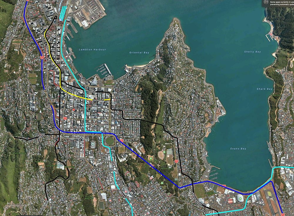
Yellow, of course, is the Golden Mile, while Black is used here to indicate the main (regular) bus routes. The snazzy new High Speed Rapid Public Transport (let’s just call it “Light Rail” for now, shall we, while we still live in hope?) is that sort of turquoise light blue colour that snakes through the city. And the darker blue indicates the undoubted proposed route of the SH1 vehicle traffic. I don’t think there is anything too contentious in all that – the Devil is in the Detail of course. This is all drawn from the leaked photo that appeared a couple of weeks back, and that Clr Daran Ponter has already denied as being final. But seriously folks (I’ve discounted the silly “long tunnel” as Ponter recommended) we are likely without a doubt to have “Light Rail” along the Quays, coming up Taranaki Street, which then does a magic wiggle and links to Adelaide Road. Let’s have a closer look:
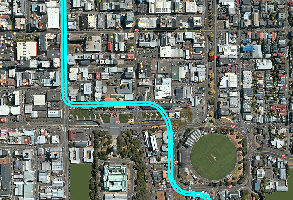
Unknown at this stage exactly where, of course, but I’ve been looking at this area over the last few weeks and it seems there is a possible route down the side of Martin Square and then curving gently past the end of Pukeahu Peace Park to go down Sussex St – or hopefully, demolishing the world’s ugliest buildings in that poor beleaguered street.
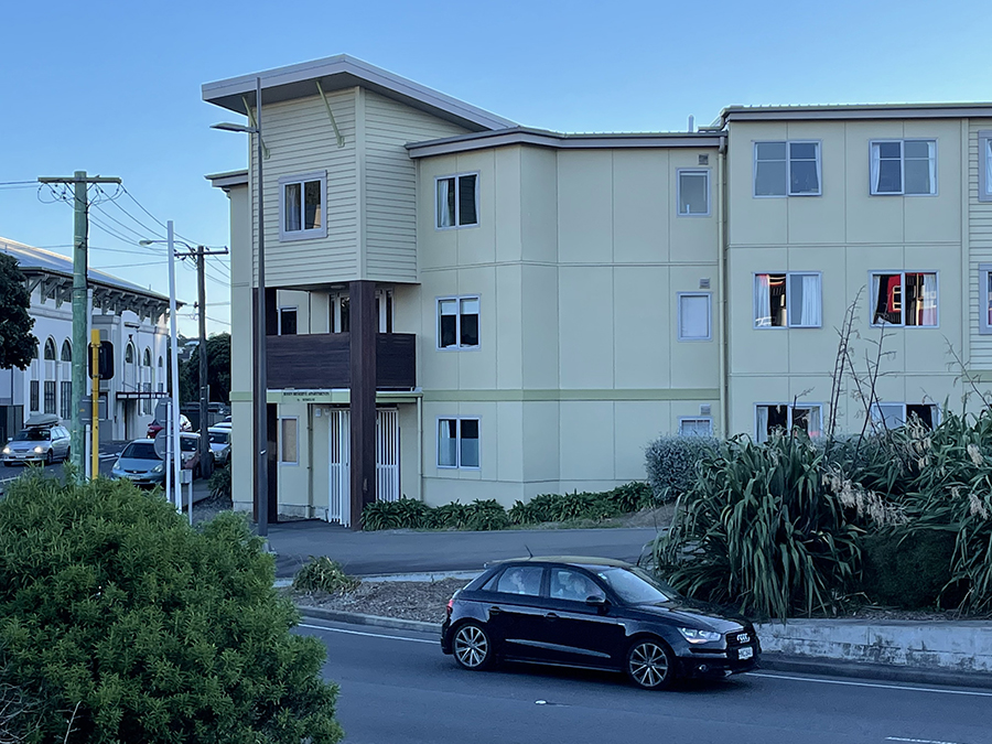
That’s because, of course, we need to get SH1 going UNDER Sussex St, heading west:
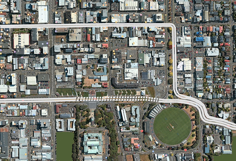
But of course that is shown keeping the SH1 going down Vivian Street, still, like it does now. I hate this – it ruins the Cuba St experience and the road is too narrow to do that safely – I’m guessing that what LGWM really wants to do is have both East and West routes going through there, with quite a bit of the Eastbound route being in a cut and cover tunnel like this:
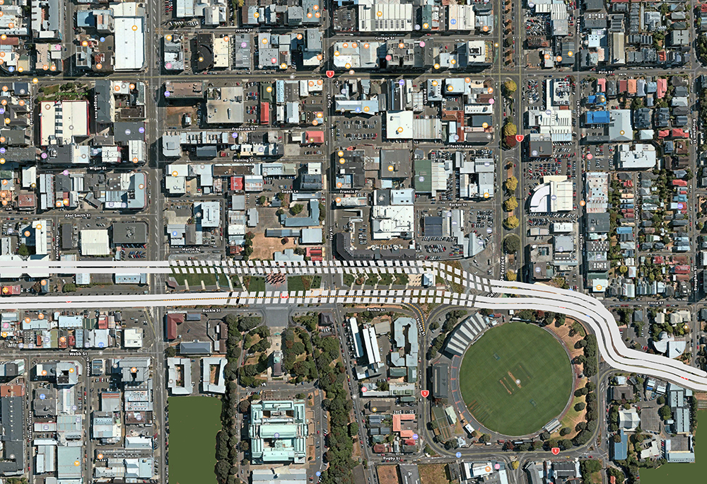
See? That actually works quite well – and very simply. But then again, what is missing at present is a Cycle Plan for Wellington. Remember in the Basin Bridge Debacle, where the various assorted “experts” were proposing a high-level aerial bike way running east-west, across the Basin, towards the Motorway? It never really made much sense to me. As far as I know, the main routes for cycling are more of a north-south desire line, and while Cambridge Tce is great for a Cycle route, I’m also picking Tory St as my personal favourite. So, I’m proposing something like this:
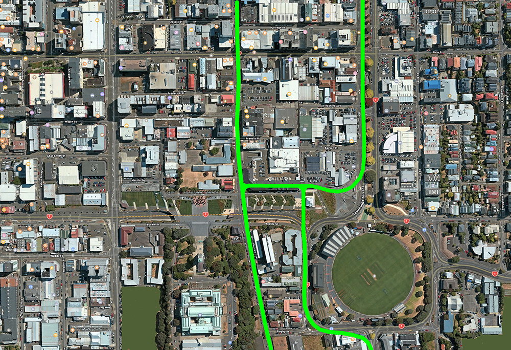
Those cycle routes will of course link up with Courtenay Place, which from what I understand from the existing “Transform” Golden Mile plans, is to have a cycle lane and bus lanes. Less so the back and forth in front of the War Memorial – forgive me if I’m wrong, but bikers really don’t want to be aiming for the Terrace Tunnel, do they? Well, do they, punk?
Anyway… so you may be asking to yourself – “Well Nemo, I get your logic so far, but what about the cars? Its all about the cars!” And so to you, I answer that yes, you’ll still be able to use your car – probably on a local car route something like this:
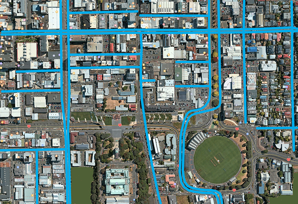
So far, nothing too contentious, right? But what about the green space? Wasn’t the WCC just this week debating Green Space (by the way – did anyone watch? what was the result? did anything happen? I’ve seen nothing reported in the news). So as they are promising a / some dramatic new major green spaces, I’m going to hedge my bets and say, that they will extend the Pukeahu Park after all this work is over, to make it into a green strip through the city. Perhaps something like this:
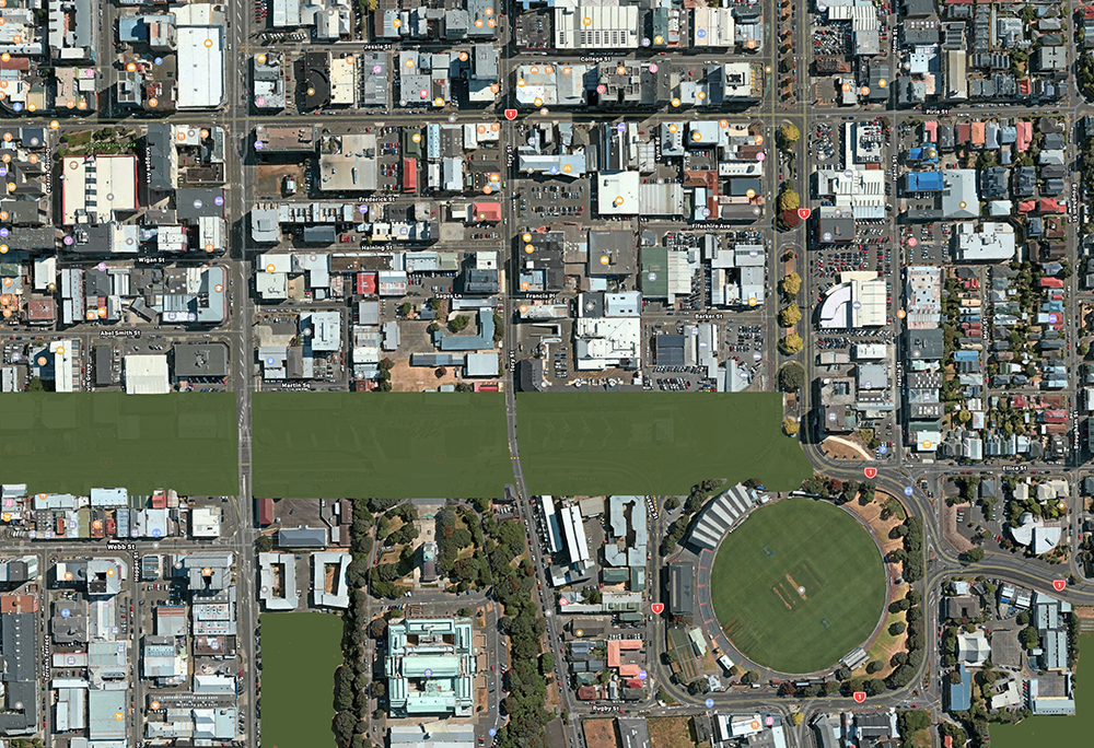
So, what happens when we put it all together? I’ve left this to last as I know that it will frighten the weak and feeble minded, but realistically, this effort of mine of at least 2 whole hours on Photoshop, should hopefully sum up the collected work of LGWM, NZTA, GWRC, and WCC’s collected 5-10 years on this project. It’s not that hard. Its very logical. Here is the finished product:
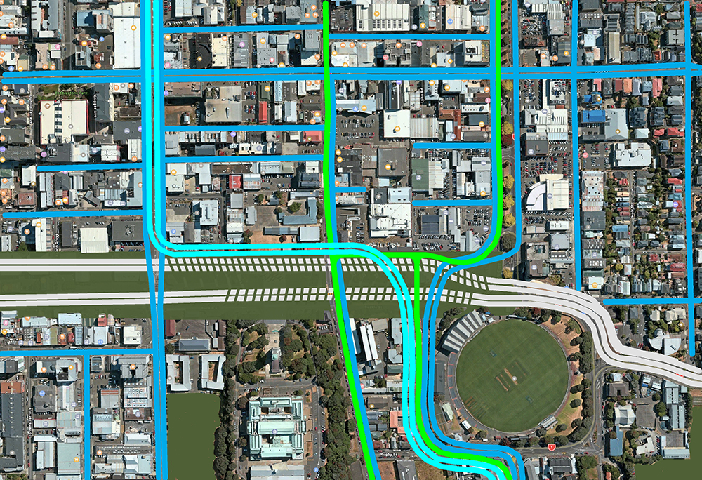
See? And there is already a route of properties, owned by NZTA or WCC, that allow all that to happen, straight away, along the “back” of Pukeahu Park. It has been sitting there in plain site for the past 7 years or so – carefully waiting for its day to come. That day is now dawning.
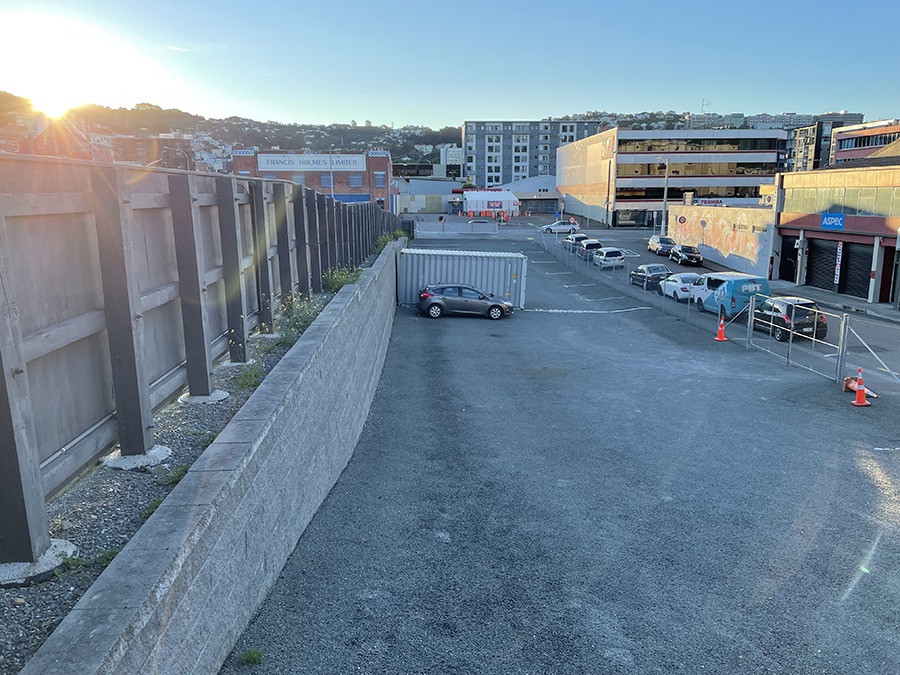
The new East-bound SH1 route, combined with the new “Light Rail” route, will turn into this yawning gravel chasm (carefully left out of the Pukeahu green lawning a few years ago – was it by Annette King?) and then straight on through the Covid Station car park:
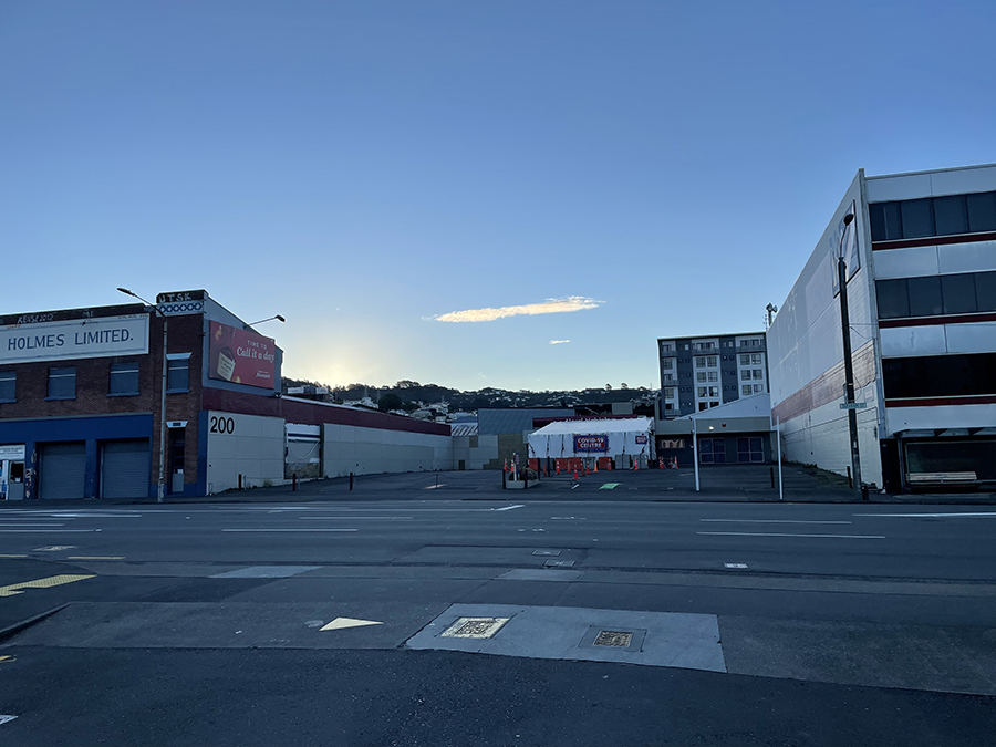
… and thence through / under Te Aro till it joins up with the Terrace Tunnel onramp. There are a few more tricky parts to negotiate along the way. There’s the former Temple of Taste from Tuatara Breweries that sits in the way – but, that has been moved once before, so it sits on a sled, and can be moved again, relatively easily. Personally, I’d rather take out that ugly PoMo building on the right. Time to Die !
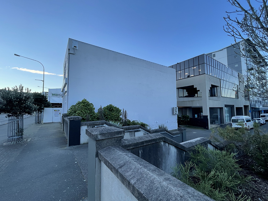
Then there is Cuba St and Tonks Ave. This is where it gets a bit trickier. Depending on your route, you could try and go though / under some old-looking buildings (cute, but basically completely rebuilt by Transit in the early 2000s, so not real heritage).
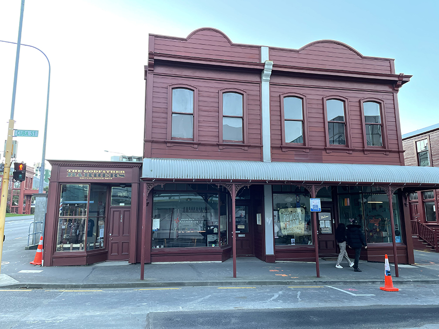
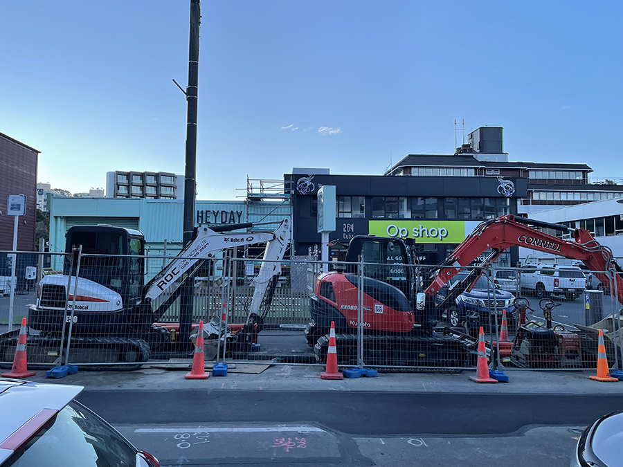
Or… you could demolish an OpShop (sorry Alice!) and a small HeyDay brewery. I know which one I’d put under the hammer… The width of these two architectural disasters is just perfect for the two lanes of traffic that NZTA will want to put through here – cut and cover, so it will take out nothing of value, and will get roofed over after, so that Wellington will get its Cuba St AND its Vivian St back, for the people. Cars: underground. See – they’ve already started digging…
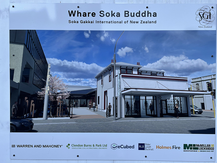
But seeing as all this is well known and not really a secret, I’m a trifle baffled as to why the WCC is letting the Buddhists build a temple that will pretty much sit right in the way…
So, what do you think? Have I got it right? Let me know in the comments below.
Please note: if you are from LGWM, and haven’t thought of this route, then that leaves you with the weekend in which to get your scheme updated. Pretend its all yours! You’re welcome!


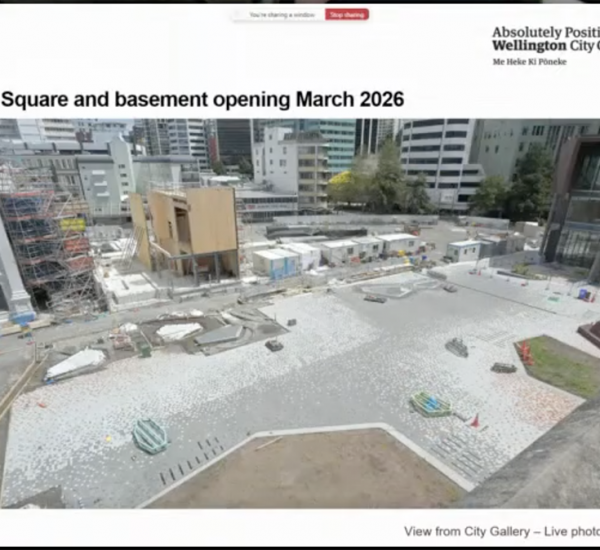
Widening Karo Drive isn’t That much of a problem If you take a wander on the Council’s property map
https://gis.wcc.govt.nz/LocalMaps/Gallery/
You find that HM the Queen owns both the Francis Holmes building and all the sites behind it until you reach the Tuatara “Temple”
At that point you could start waving the public works act around, (although I am told by someone who looked at buying one of the places NZTA had taken for the bypass that there is a covenant on the titles that allows them to purchase the site back without having to use the PW Act)
BUT, The Crown still own all the dirty carparks on the Southern side behind Martha’s pantry, ( and a squiz at the M Pantry building notes, A “Notice of Intention to Take a Right of Way Interest”
The hard bit it the existing trench, you would need to acquire properties, but again I think many of the wooden buildings in Inverlochy and oak park Ave have been moved around for the Karo Dr in the first place… + we might finally get to see a resolution on the building that is claimed by both the spellings of the Lebanese Society,
As an aside, while our friends at places like GA and the spinoff are mourning the death of surface running light rail the Commissioning agency, has published a paper on trackless trams, which basically says therir capacity is 2 double decker buses and they are not useful for really high density corridors
https://www.lightrail.co.nz/media/poxh1gxg/alr-trackless-tram-tech-note-sept-21.pdf
Thanks for the extremely useful information greenwelly – I hadn’t’t thought about using the GIS info to ascertain the ownership of the buildings, but yes, I’m broadly aware that NZTA aka the Crown, still own a lot of property around this part of Cuba / Willis / Victoria. They’re certainly not viewing it as a done deal yet – they have fingers in many pies.
And yes, interesting too about the “trackless trams” being as useful as a wet bus ticket – I don’t think anyone except the weak-minded former Mayor was taken in by them at all. I shouldn’t think that David Dunlop, the Acting Head of LGWM, is really taken in by them at all either.
Interestingly, and to me, somewhat bizarrely, one of those properties that I had noted as being a key likelihood for a SH1 route through, has noted on the GIS database as “No longer held for Better Utilsation” – not exactly sure what that means, do you?
Auckland City appears to be going through a similar cathartic process with their proposed Light Rail process. There’s a fascinating discussion going on over on the Greater Auckland website right now:
https://www.greaterauckland.org.nz/2021/10/29/light-rail-veers-off-course/#comments
I hope that we are not going to be having a conversation like that down here ! Another ten years of hell !
Be prepared to be wowed and disappointed
https://www.stuff.co.nz/dominion-post/news/126841631/lets-get-wellington-moving-could-see-21000-new-homes-built-along-mass-transit-route
“Wood said once consultation came to an end, decisions would be made by the three Let’s Get Wellington Moving partners by May, at the latest.
From there, it would take a couple of years to detailed design and planning, consenting, and land acquisition, before work could actually begin.”,
A little bird tells me that “a couple of years” is more like 7 or 8, with at least two more rounds of “consultation” during the indicative and detailed business cases, and the timetable has no construction on the Basin/MRT/Tunnel project before 2028….
Its curious to me that the NZTA etc have not started on the Basin ‘shortcut’ to the north – seeing as there is an empty site there, which was ‘temporarily’ planted after the Pukeahu Park was created. You can even see the way the property boundary with the car yard next door has been shaped, that they are anticipating exactly this solution. I wonder why they have not started yet? It would make life so much easier when they need to do the next phase.
Alan,
Because for the “Shortcut” to work you need to get the Newtown bound traffic from Kent Terrace either over or around, it… ( in the LGWM plan it will likely go westword and round the back of the stands with Sussex street becoming two way…
Nitting about the routes in Te Aro aside. I’m stumped how they’re thinking buses on an alignment through a new Mt Vic road tunnel to the basin trumps light rail connecting from Kilbernie to the Zoo end of Newtown.
If you go to Newtown with a hopefully high quality, segregated LRT anyway, then you look East, it’s natural extension to serve southern Newtown area and through to Kilbernie. It maximizes the investment in what you’ve built to get to Newtown and it connects the eastern suburbs we’ll with destinations in Newtown and Adelaide Rd without much compromise.
Yeah, it appears they have basically narrowed to project to exclude the whole Vivian street debacle, and they still expect 2 lanes of traffic from across town to go into a one lane tunnel at the Basin..
But with such a long lead time (at least two general and local elections) its highly likely this will change
Greenwelly – we’ll find out more this evening when it is unveiled!! No clues up on the DomPost website yet at 1.45pm…
Erentz – are you the same Erentz who used to write for the Fish many years ago ?
I thought they had ruled out light rail heading east of the basin?
Correct, the only MRT option for Miramar etc, is the bendy bus/trackless tram choice- but that is predicated on no light rail at all,
If light rail to Island Bay is chosen, the East get bus lanes…
And we are off
https://hello.lgwm.nz/explore/?option=01
hit skip and all the options in their details are here
Thanks for that greenwelly ! Interesting… I’m playing “Spot the Difference” as we speak !
Well….. that was underwhelming. 6 years in and we still just have lines on a map. I despair!
I’m searching for the Wellington Cycle Plan – the new one, called Paneke Pōneke – but I don’t know where it is or what it is. Anyone have any idea where it might live? I just did a google search for that phrase, but came up with a big fat zero. Where did it go?
Is this what you are after?
https://www.transportprojects.org.nz/current/bikenetwork/the-network-details/
Thanks Pedge – yep, that’s the one. Actually, when you click on the “More Details” button, then really THATs the one.
Good stuff.
I’d like to include the “don’t be scared” image (with attribution) in a submission to LGWM in support of an Option 4+, which would be LGWM’s Option 4 plus freeing Vivian St from its Traffic Sewer role. Is the content of this page shareable under say an “Attribution Share-Alike” Creative Commons licence, or is it “All Rights Reserved”?
I’m happy to share the submission for comment in advance, if desired.
The image might be less scary if it had a legend explaining the colours of the lines. Just saying…
Hi John, happy for you to share anything – just say it came from the Eye of the Fish . org
Hmmm, legend. Yes, you’re probably right – its sort of explained in the images above it, and it would have looked a lot less confusing if I had left everything as one single line, as LGWM have done, where one skinny yellow line = my four grey lines indicating two lanes, and two directions.