
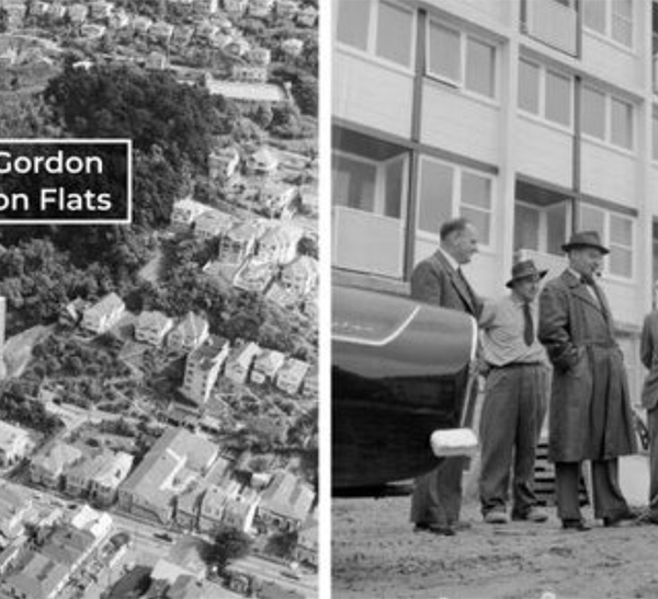
Given that everyone seems to agree that any new PT route needs to go down to Newtown to visit the Hospital (thereby removing any need for doctors, nurses and staff to have to drive to work) and then possibly the Zoo (as another main attraction) and then cross over to Kilbirnie for the large and growing population there, the Eye of the Fish decided to take a look at what may happen there.
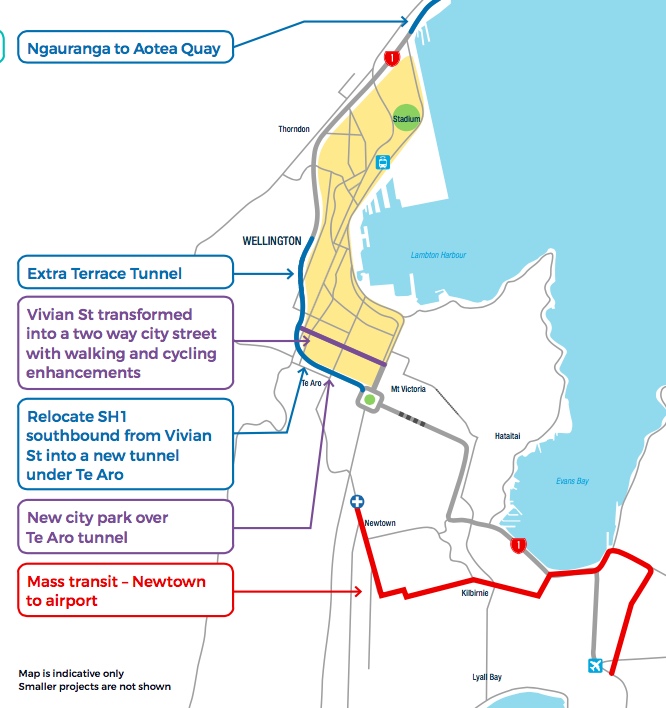
The little diagram above is from the LGWM RPI and shows the proposed route in something like 2039. It appears to show a line going to the Zoo, a zigzag, and then off to Kilbirnie. So I’ve tried to set that out on an actual picture of Wellington, to see what effect it may have. My version below is obviously not a highly informed top secret plan – instead, it is just a meander through the woods to see what the path may entail.
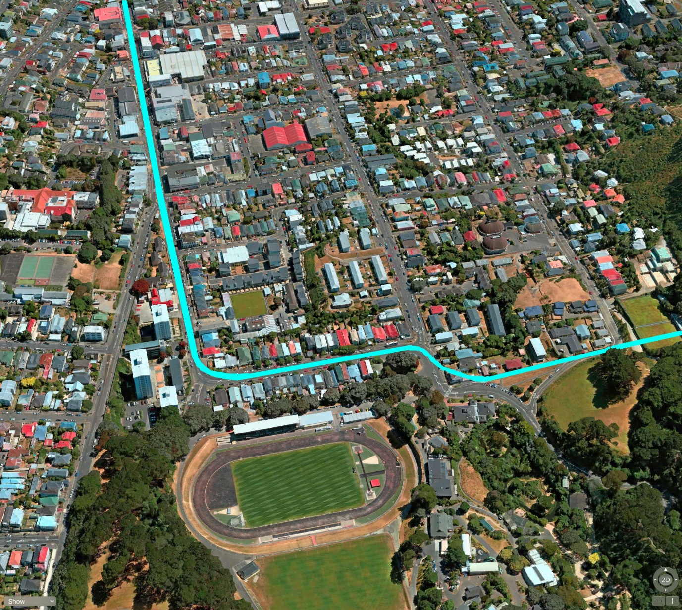
In the previous post we left the PT/LR racing off to Newtown down Adelaide Road – I’m leaving out the boring bits in the middle like the Hospital (cos it is not difficult to figure that one out) and I wanted to head off further south. In the picture above, I show (with a light blue line) a possible PT route that keeps pretty straight on through Newtown and direct towards the Zoo. There are a couple of awkward 90 degree bends at the end by the park / track / Zoo, but it should be feasible enough to fit a LR line through there. After all, they have done it before when Wellington Trams ruled the suburbs. So, assuming it can get past the Zoo alright, then the only way I can see it going is through a specially built tunnel under the mountain, and out the other side, in Kilbirnie.
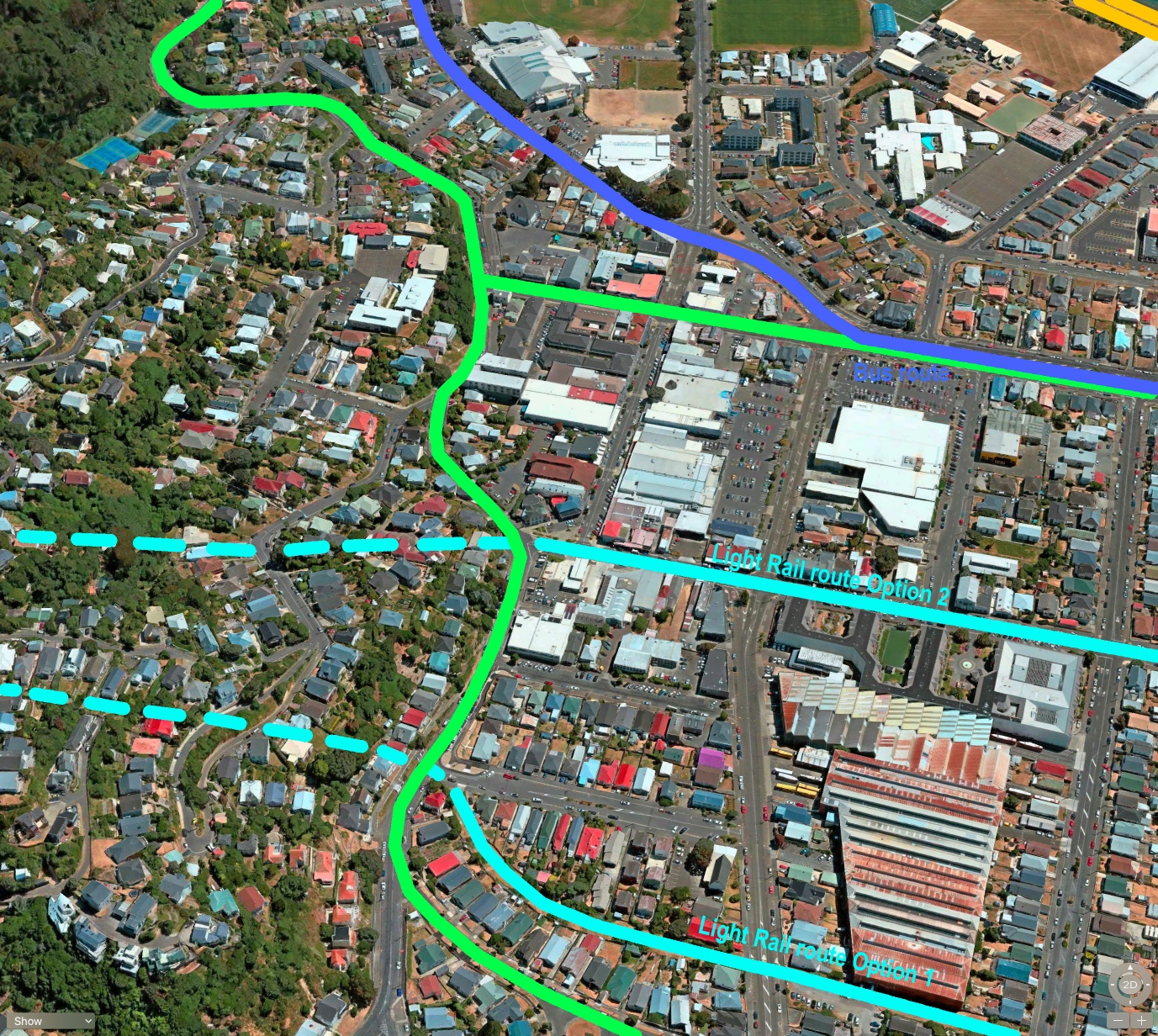
Obviously this part of the route is pure speculation – don’t get too excited if I have driven a Light Rail / tram-train through your house. I’m not the law, and this is just an exercise, OK? But it seems to me that there are probably three possible routes. One is shown in dark blue at the top, but in my scheme that particular route may need to stay for buses (the green is my pick for a beefed up cycle route). Instead I am proposing two possible routes – Option 1 through the current pleasant little back yard wander, named after a City Councillor who died a few years back. Leonie Gill?
It passes by the City Bus depot, which is prime for redevelopment – or possibly a new use as a Light Rail depot. Option 2 also runs past/near the City Bus depot, but on the north side rather than the south side, down Coutts St. The good thing abouts Coutts St is that it leads directly to the current pedestrian tunnel under the airport, which could be useful….
Actually – make it four routes – the LGWM team show something running along the waterfront at Evans Bay. I’d rather that we push a LR route through heavily populated areas, than zip along that windswept and deserted piece of waterfront.
If we go back and look at the LGWM plan for the future up the top of this post, they show what appears to be a route through Kilbirnie that can only be Rongotai Road and Troy Street to get up to Cobham Drive as shown in the picture directly above. That’s my green and dark blue line on the map above. The tunnel under the mountain would need to link up to Rongotai Road somehow – and not destroy all the other traffic routes surging through there like Bay Road and Onepu Road. There’s certainly enough width for twin tracks of LR running down Rongotai Road, but it seems a little crazy to me to take the LR down around the edge of the runway where we already have a very tight route.
That’s it for today. Coming soon: the trip to the Airport!
The Route to the Airport has been devised to try to “tick off” as many points of demand/interest …
Going via Miramar allows the development of feeder services from places like Seatoun etc to join up, and reduce the incentives for car travel into wellington.
If the Airport was the goal, the route would be maximised to achieve this and would have likely missed Newtown entirely and gone through Mt Vic (either in an existing or new Tunnel)- the fact its going through newtown shows that the airport is just another of the points on a “sting or pearls”, and not the main destination..
You’ve got a point there Greenwelly, but the route they have taken is a bit bizarre to me. They’ll be tantalising the people wanting to get to the airport. They would go round the north end of the runway and hear the jets roaring overhead and then then disappear off into suburbia again. Hmmmm.
Anyway – Airport designs on Friday for me! What are your views on the routes through Kilbirnie?
Given the GWRC are deeply involved in this, they are going to want to get as much mileage out of their “bus hubs” as possible, the LGWM plan clearly has LRT going through straight down Rongatai Rd (i.e your green cycleway)to get it as close as possible to the hub- I suspect they want to run it down the centre reservation to also reduce disruption (and cost)
I think you option 1 is too far from the centre of kilbirnie, that is centred around the shops/pool ( also the main areas of community housing are also north of the shops)
2 is better, but still think its possible to go down Rongatai Rd..
There’s a diagram somewhere in the welter of technical information that’s just appeared on the LGWM website that shows the tunnel from the zoo emerging at Rongotai Rd, heading along there to get to the east, with stops at the ASB Sports Centre, Miramar and the airport. A tunnel under the airport is discussed, but – rightly, I think – dismissed on grounds of cost and practicality.
People going to/from the airport may be tantalised by going through Miramar, but the peninsula is a much more significant traffic objective than the airport is, and one of the documents reckons that the time penalty for airport travellers would be just three minutes.
A route along Rongotai Rd then via Miramar and Hobart St makes an awful lot sense to me.
Leviathan, I use the #2 bus to get to the airport because it’s so much cheaper than the flier and still gets you pretty close. The fact it goes through Miramar is pretty inconsequential. For a high frequency, high quality service I wouldn’t mind the extra time to go through Miramar if it meant we had a more economically viable service that served the eastern suburbs better and reduced car dependency.
I guess there are competing concerns of regional versus city significance. Most citizens are going to recognise the value of a better urban network that connects our suburbs, while regional concerns rest with access to the airport only.
How all of this is negotiated, with national funding thrown into the mix, is anyone’s guess when there are so many competing versions of ‘common sense’.
In this light the Basin overbridge was scuppered because it went to the Environment Court, which privileged local concerns. To be sure, that’s a drastic simplification, but shows that this is pretty much par for the course for projects of this nature…
Betterbee – any idea where abouts in the welter of LGWM that diagram is? I’m still looking…
Levi, greenwelly has posted links to some of the welter in his comments on the Airport page.
Thanks, greenwelly!