One week to go – one week till the entire Wellington Bus system is completely revamped. I’ve been following what has been happening in Auckland with their AT bus revamp, and it must be a national thing, as Dunedin is also planning a similar revamp – and of course Wellington is rolling it out too.
It seeeeeems to be working in Auckland, but then their system was a lot more complex than ours. We have a curious system, with all our trains working well but stopping disastrously short, on the very edge of town. The bit where most of Wellington lives, ie Central, East, South, and most of West, have no trains at all, only cars, bikes or buses. You can see it clearly on the map here, with the great fat wide bar (denoting interchange) at the north end of Lambton Quay.
Curiously, when I do a google image search for “Wellington Transit map”, the best provider comes up as Eye of the Fish, rather than the plonkers at GWRC or whatever they are called this week. If you go to their website at Metlink, they don’t seem to offer any overall maps at all, either pre-change or post-change.
Come on, you complete and utter idiots at GWRC – post a transit map ! Honestly, how incompetent is Laidlaw and his bunch of boneheaded chums? This might be good for regular commuters, but its just a bunch of numbers for the rest of us:
Actually, on the remote chance that Metlink / GWRC is reading this, we need a lot more maps. Seriously, you need to assume that not everyone knows exactly what service they need. Ever heard of tourists?

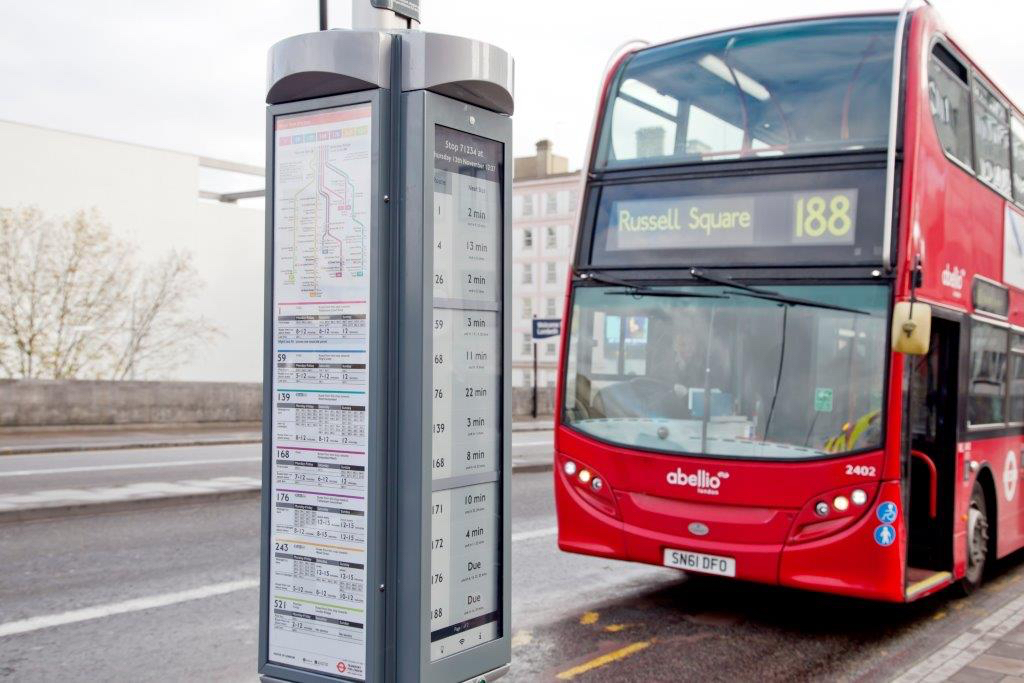
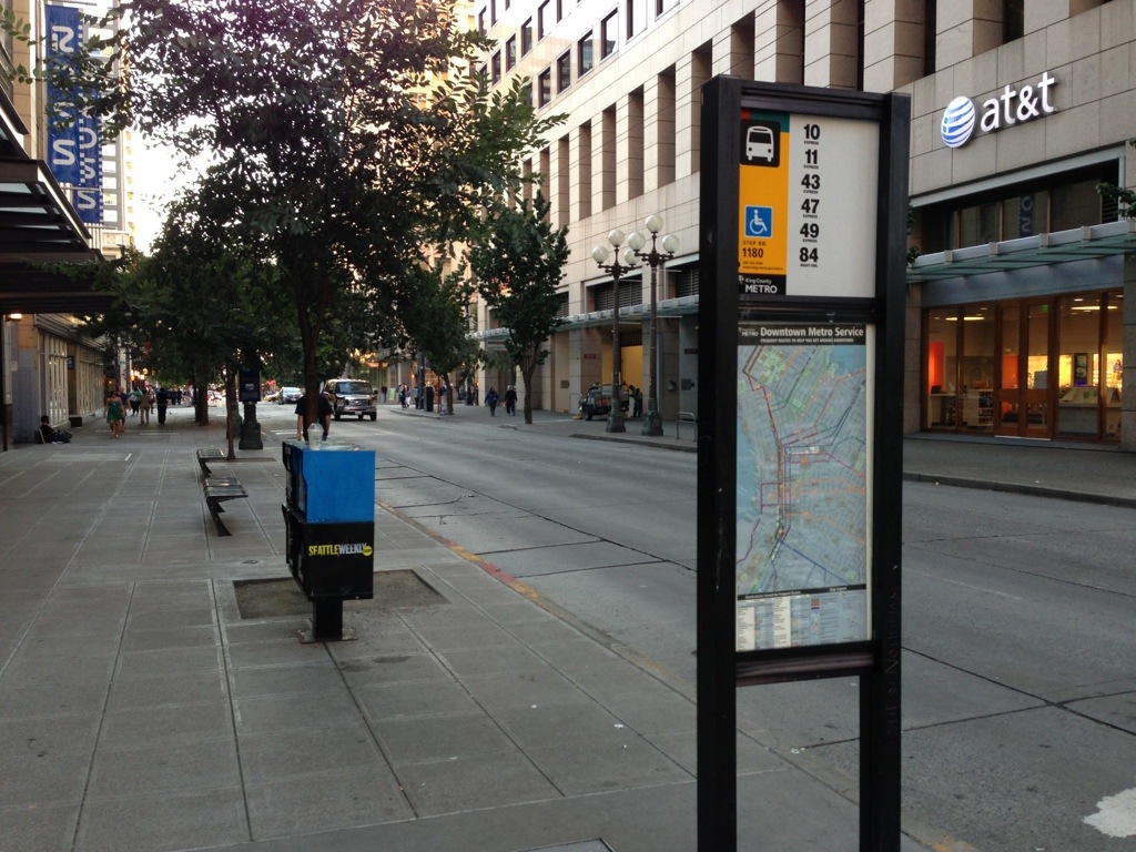
In my mind, every single bus-stop needs a map – and especially all large locations like Willis St and Lambton Quay and Courtenay Place. A list of bus numbers is not a map.
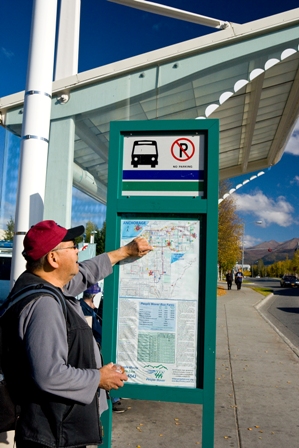
Maps, maps, WE NEED MAPS !!!!!!!
This is the map that GWRC used when they were seeking feedback a couple of years ago – true, it is a bloody ugly map, but at least it graphically gets a message across, even if it got a big thumbs down on the Transit Maps website.
But in the absence of anything else appearing online, its all I’ve got. Come on GWRC, get your appallingly shoddy act together.
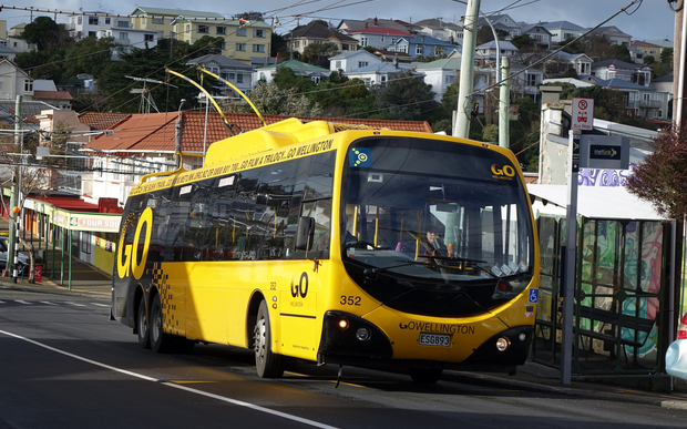
You’ve already removed the much-loved and totally green trolley-bus network, stupidly at least 6 months before you had a replacement service of a handful of new electric buses.
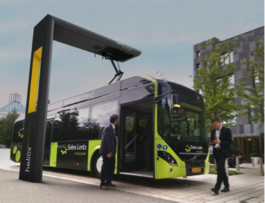
You’ve filled our city with shitty, belching, ex-Auckland throwaway diesels, which nobody wants. You’re replacing one bus system with another, but with bugger-all information about what it is.
Get. Your. Act. Together.
Here, below, lifted direct from the officials, is the new numbers:
North-south (Island Bay to northern suburbs): old bus numbers 1, 53, 54 and 55 become new bus number 1
East-west (Karori to Miramar/Seatoun): old numbers 2, 3 and 11 become new number 2
Lyall Bay, Rongotai: old numbers 3, 10 and 11 become new number 3
Strathmore Park: old numbers 25, 43 and 44 become new numbers 12 (shuttle) and 12e (peak-time Wellington extension)
Kowhai Park: old number 8 becomes new numbers 17 and 17e (peak-time Wellington extension)
Miramar-Karori: old number 18 becomes new number 18e. A separate local Miramar route will be the number 18
Mairangi: old numbers 22, 23 and 47 become new number 22
Houghton Bay: old numbers 21 and 23 become new numbers 23 and 23e (peak-time Wellington extension)
Miramar Heights/Broadmeadows: old numbers 24, 46 and 50 become new number 24
Khandallah/Highbury: old numbers 9, 20, 43 and 44 become new number 25
Ngaio: old number 45 becomes new number 26
Southgate/Owhiro Bay: old numbers 4, 22 and 29 become new number 29e (peak-time Wellington extension)
Scorching Bay/Moa Point Express: old number 30 becomes new number 30x
Miramar North Express: old number 31 becomes new number 31x
Houghton Bay Express: old numbers 4 and 32 become new number 32x
Karori South: old number 3s becomes new number 33
Karori West: old number 3x becomes new number 34
Hataitai: old number 5 becomes new number 35
Lyall Bay via Hataitai: old number 6 becomes new number 36
Karori (Wrights Hill)/Brandon St: old numbers 17 and 21 become new number 37
Tawa: old numbers 210 and 211 become new numbers 60 and 60e (peak-time Wellington extension)
No number change: Kingston (7), Mairangi (13), Wilton/Roseneath (14), Mt Victoria (20), Karori/Wrights Hill (21*), Beacon Hill Shuttle (28), Newlands, Woodridge, Paparangi (52), Paparangi (56), Woodridge (57) and Newlands (58).
*The 21 will include an all-day, high-frequency service between Courtenay Place and Kelburn Parade.
New service: Churton Park 19 (loop) and 19e (peak-time Wellington extension)
BY THE NUMBERS: WELLINGTON’S NEW BUS NETWORK​
45 per cent more weekend services
26 suburbs with more off-peak services
15 per cent more weekday services
12 suburbs with new evening and weekend services
10 fully electric double-deckers


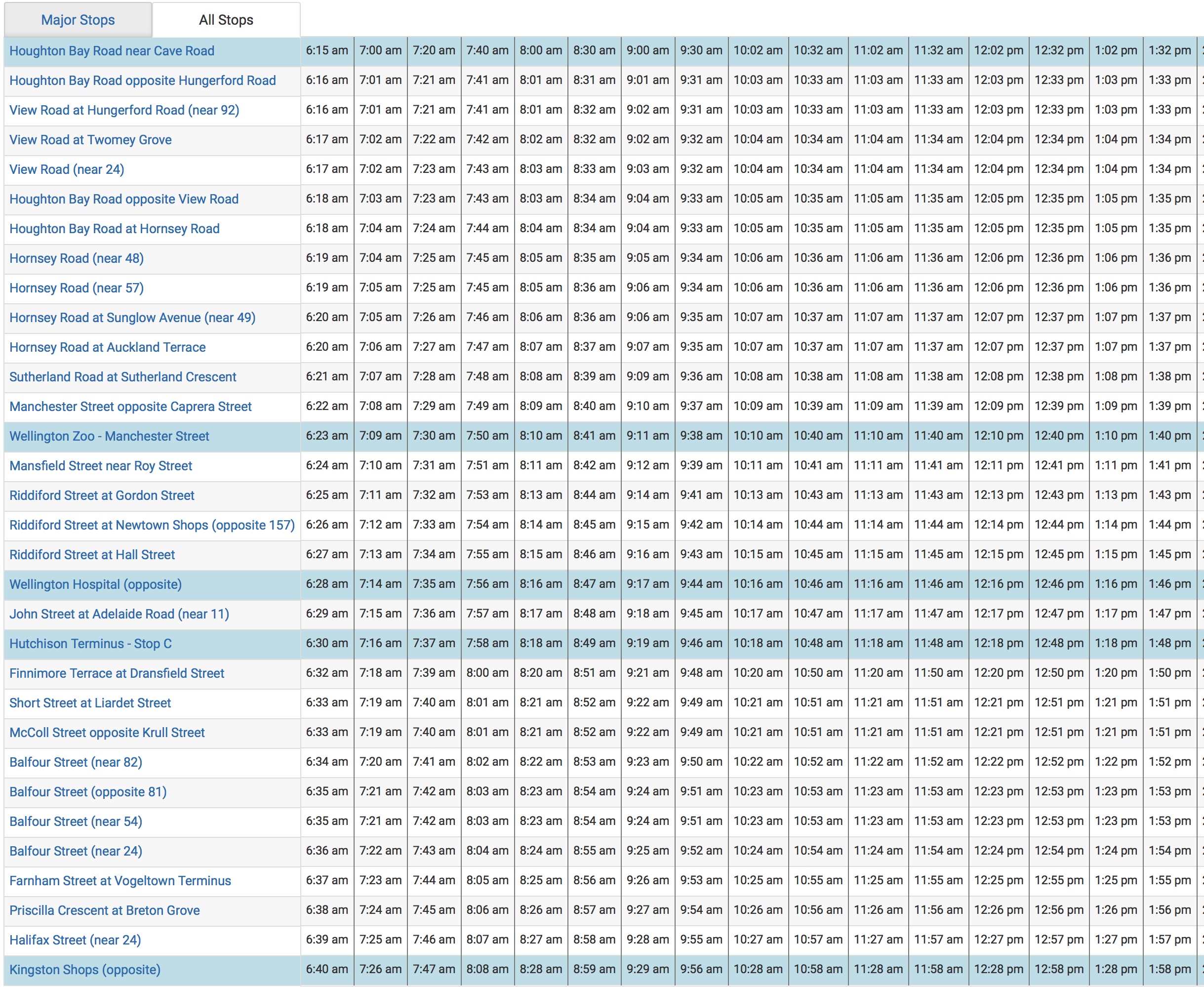


Aren’t these overall maps?
– Schematic: https://www.metlink.org.nz/assets/Uploads/WRC-Wellington-City-Schematic-Map-FINAL-26.06.2018.pdf and https://www.metlink.org.nz/on-our-way/wellington-city/wellington-city-schematic-bus-route-map/
Geographic: https://www.metlink.org.nz/assets/Uploads/3160-WRC-Future-bus-network-Geographical-Map-30.04.18.pdf and https://www.metlink.org.nz/on-our-way/wellington-city/wellington-city-geographic-bus-route-map/
They’re what you get when you click on “Bus route map”, but they also include the trains, ferries, and cable car.
I suppose they don’t include Porirua, the Hutt, and Wairarapa, if that’s what you mean by overall, but a map at that scale is going to be bloody useless. There were hard copies floating around some of the timetable shelves at one point too.
New network map:
https://www.metlink.org.nz/on-our-way/wellington-city/wellington-city-schematic-bus-route-map/
And geographic:
https://www.metlink.org.nz/on-our-way/wellington-city/wellington-city-geographic-bus-route-map/
And the current network map:
https://www.metlink.org.nz/getting-around/network-map/
For Wellington, and for the other areas (Hutt, Porirua, Kapiti), the network maps are stuck at the back of the new timetable PDFs on the website and so presumably will be in the print version too.
You mean like this?
https://www.metlink.org.nz/on-our-way/wellington-city/wellington-city-geographic-bus-route-map/
Or this?
https://www.metlink.org.nz/on-our-way/wellington-city/wellington-city-schematic-bus-route-map/
Thanks for that my fine, oddly-monikered correspondent. I’m trying to figure out if your cryptic name is a map reference, in a sort of “You’ve Sunk my Battleship” manner, but as I don’t have a map with those grid numbers on, i’m not actually sure that I’m on the right track.
Anyway, thank you for that info. Helpful, to me, but sort of proves my point – a tourist would need to know where to go and how to find the map first, when in fact they are more likely to need to consult a map first, and then find their route second.
Having just gone and released 3 more messages from Pending to Approved (anything with more than one URL is automatically sent to the Spam filter, as in most cases it is Russian Spam or Porn – presumably both).
Clearly I didn’t find those maps – which both makes me look like an idiot, but also reinforces my case – these maps need to be far more prominent (i did look, for quite some time, honest!) – but as they don’t come up when i do a google search then GWRC still needs to get its shit together.
Where I reckon it needs to be displayed is, however, not just “floating around on timetable shelves” somewhere, but actually at EVERY BUS STOP, and indeed, also, on EVERY BUS and TRAIN. Examples of these in the pictures above.
It’s a trolleybus pole number and the name of my blog :D
The new schematic map is still a graphic designer’s nightmare: take a look at the dotted peak service lines at the Terrace, it’s impossible to tell which one is which without actually checking the timetable — and why is there a random “52” blob in the golden mile? (Maybe to clarify that the #52 is the only standard route which terminates at Courtenay Pl, but it’s not a very clear clarification if that’s the case…)
I actually asked Metlink earlier this year why they decided to make every single route the same colour, apparently they did some market research and this is what people preferred? It just makes a network map like this harder to read IMHO (for example, you can’t tell just by looking at the map that the #20 terminates at Courtenay Place and doesn’t go down the golden mile, or that most of the express routes now terminate at Brandon St to avoid congestion on the golden mile.)
A more frequent network is well worth having to transfer every so often (especially once everyone gets used to the idea, it’s how the Hutt, Porirua, and Kapiti networks have been working for a long time but with trains and not high-frequency bus spines), but I’m not sure how clearly Metlink has been pushing that in advertising the new network, and if the maps aren’t all over every bus stop already (or at least a poster at every stop saying where to go to find them) then they could be doing their job a little better…
I believe the reason they don’t show up on a Google image search is that they’re PDFs – I just did a normal Google search and I found them (but I’m not sure if that’s personalised search results or not, so maybe not for tourists).
Timetables for buses to Zealandia/the zoo/Mt Vic/Miramar should also have something on the front to attract the attention of tourists, in Auckland the new #18 bus timetable specifically says “for the Zoo and MOTAT” on the front and I gather it’s been quite effective.
aaaah, m28a31, of course it is – I’ve visited your blog before. Good on you.
I was going to do a follow up post on the differences between the old and new bus routes, but you’ve already done an excellent one, or more, like this one on buses to Karori:
https://m28a31.wordpress.com/2018/06/26/new-bus-network-spotlight-karori/
Well worth reading.
You’re right too about the colours. In my mind, Melting have just committed one of the all-time-worst errors: they’ve changed the colour of lines on the map. For instance, the route to Island Bay used to be purple, and now it is red, while the route up to Brooklyn was green (or brown – can’t tell on the graphic on my screen) but now its gone purple.
All. Very. Confusing.
You’re being a little harsh on GWRC aren’t you? Especially when it’s just you that can’t find the map on their website?
No, i don’t think I’m being harsh at all. I truly do think they are incompetent. In fact, I honestly do think that the entire GWRC should be abolished really – there is no rationale for having an organisation operating within Wellington, running our public transport system, not listening to us – the people – not doing what we want. I went to a meeting the other day where a GWR Councillor was there – apparently voted in by someone, but they were clueless on the subject they were in charge of, absolutely clueless. Made me very annoyed. They need to go.
@PCB
The Biggest transport issue the Wellington Regional Council ( I refuse to use their self adopted “greater” title) has is that it is dominated by car centic commuters that have no idea about dense pedestrian centred public transport development,
On the COuncil
Wellington has 5 seats(votes)
Wairarapa, Kapiti and Upper/Lower hutt have 5
Porirua/Tawa have 2
Its no wonder everything is focussed on Roads and developing the Rail that services north of Wellington, While Wellington City’s trolley buss network is allows to wither on the vine, and diesel buses proliferate…
Thanks Greenwelly – ok – here’s a test for y’all – without cheating, ie looking things up – How many WCC Councillors can you name ? I think there are about 12 in total. And how many of those have you met or seen at public events?
Now – again, without looking it up – How many GWRC Councillors can you name? And have you ever met any of them ?
Not to toot my own horn (no pun intended in a comment on buses), but I’ve done another post on the pros/cons of the new network (of course, just my opinion but someone might find it interesting).
https://m28a31.wordpress.com/2018/07/13/final-thoughts-before-sunday/
TL;DR (relevant to the rest of this thread): Yes, I do think GWRC is incompetent, but I think PT can be fixed by making Metlink more autonomous from the council rather than splitting Wellington City off completely. (And I remember seeing some article somewhere – the dompost maybe – about a GWRC council vote being taken to speed up re-electrification, so they seem to be getting healthy amount of scared for their jobs before next year’s local election!) Maybe I should be more militant about Metlink as well, but as someone who used to live in the Hutt and is now in Wellington I think that all things considered they do a reasonable job. (There’s always lots of room for improvement, and I’m not saying I love every decision they make – but I am in favour of the new network at least).
[…] Note that some parts of this are taken from a comment I made on an Eye of the Fish post. […]