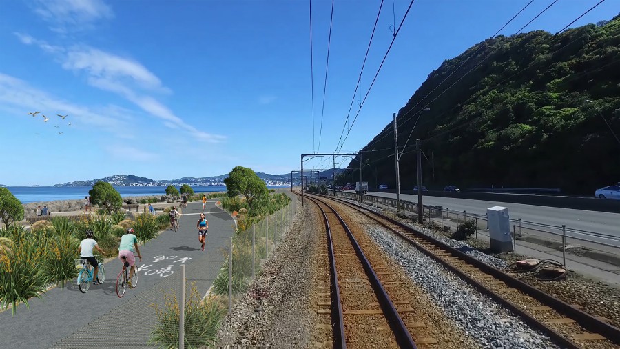
One of Wellington’s long-desired and much awaited projects is apparently to get underway as part of the Government’s shovel-ready infrastructure projects: Te Ara Tupua, aka the Ngauranga to Petone Cycleway.
It isn’t going to have to go through the usual lengthy Resource Consent process which I would normally be very supportive of – this is a project that has been proposed and discussed for the last hundred years or so and indeed was there long before the current motorway wiped it out. I’ve got no issues with it – indeed, the opposite – I’m much in support of it, but there is something that does need to be discussed in public: Where is the rock going to come from? And how is it going to get there?
It is a massive project extending along the harbour edge for several kilometres, and having a width of several metres, extending out into the sea, it will take several million cubic metres of rather large rock. I’m not exactly sure how much – let’s just say that we can all agree that it will be “a lot”. It is not the sort of project that sea floor sand and silt can be used – it needs big boulders of several hundred kilograms each, rough edged so they can interlock together and not get dislodged by fierce seas during a raging southerly.
It is drastically needed as the present road is just way too dangerous for cyclists and pedestrians – but not just that. It will provide some much needed resilience to the whole travel corridor. Yes, it is along a major fault line – and that is all the more reason why it needs to be done and done well.
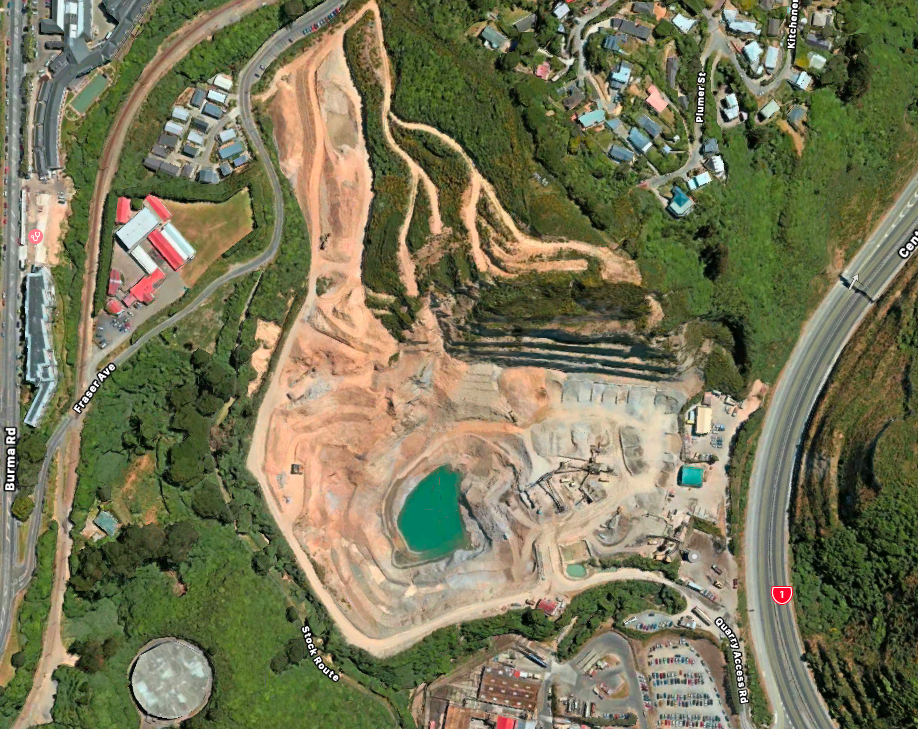
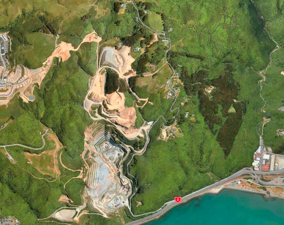
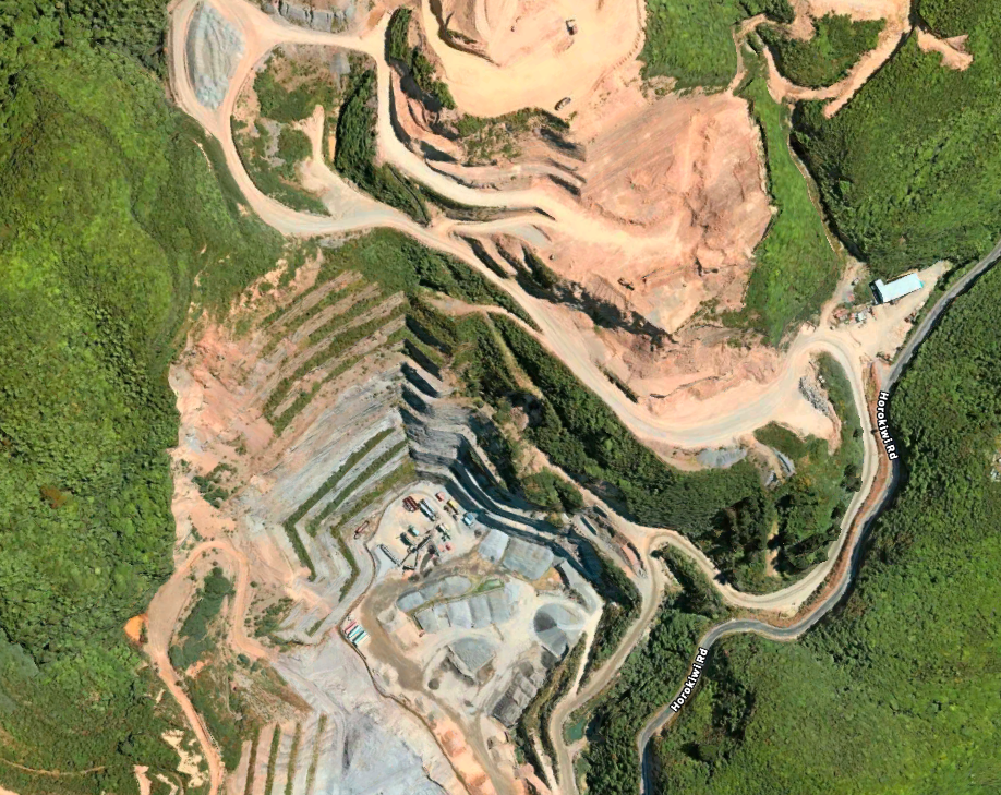
Luckily there are a couple of massive quarries nearby – one in Ngauranga and another at Horokiwi. All that sits between them and the work site is a 4-6 lane motorway and the most busy railway tracks in New Zealand. I don’t know, but I suspect, that the proposal will be that the rock is quarried from Horokiwi and put into large trucks who will then join the motorway, drive north to Petone and cross over into Petone, drive south to dislodge 30-40 tonnes at a time, then resume onto the motorway, head south until Ngauranga and do a U-turn, back up north to the quarry. And that this will be repeated about 250,000 times.
I’m not keen on that.
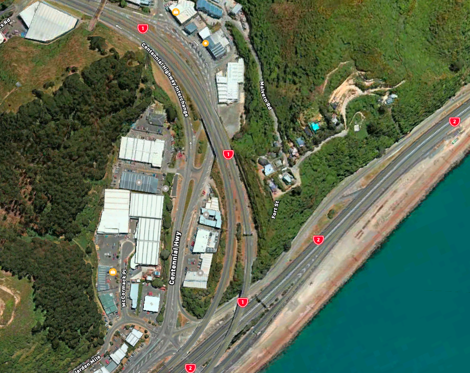
Even if there were 250 trucks doing that trip each 1000 times, or 25 trucks doing the trip 10,000 times each, the plain truth is that this is a massive amount of road traffic and will effectively help destroy the motorways that are there already, so we will need to undertake significant extra maintenance work at some stage – and note that this would be even worse of we use the quarry at Ngauranga as well.
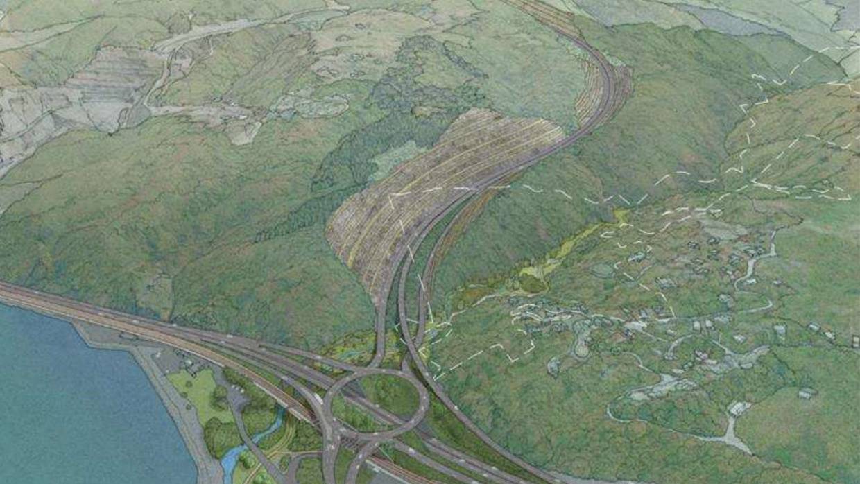
I think the original plan was, of course, that excavation of the Petone to Grenada Link Road was going to provide the roading material – remember that there was a massive dig proposed and the road was eventually cancelled as the amount was going to have to be so vast.
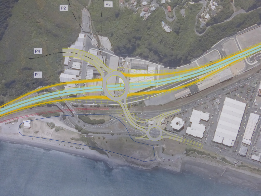
The Link Road is still being redesigned – or is more likely totally shelved at present, but will resurface at some stage. Personally, I think the two projects need to go hand in hand – do one, and you have to do the other at the same time.
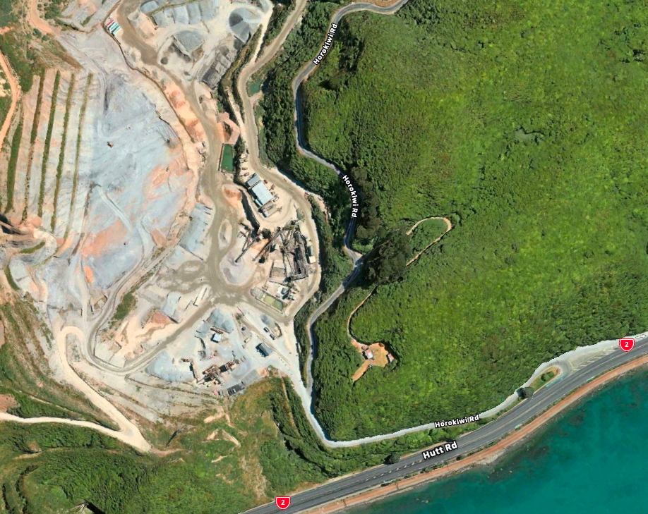
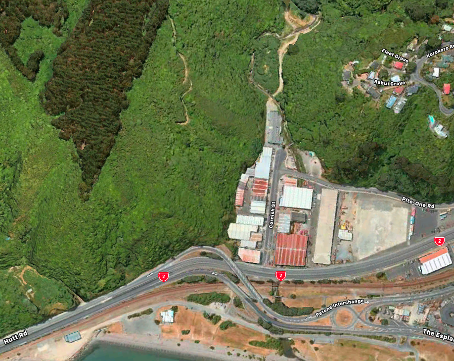
The Horokiwi quarry is in precisely the wrong position to be the major link road through to Grenada – almost, but not quite. The Link Road was planned to go through at the start of Petone with a massive new roundabout above the existing SH2, with the Link itself disappearing up Cornish Street (where Ulrich Aluminium is now) and tracking up besides the Koromiko Stream where it exits the Belmont Regional Park. Although the route and the amount of rock excavated needs to be redefined, it is the only logical place for the rock to come from for Te Ara Tupua. Taking more rock from Howokiwi makes no sense here – but purposely excavating along a more useful route would make a lot of sense. May I remind any readers that Horokiwi has been operating for many decades and is reaching its limits (of boundary) and is effectively digging a Very Big Hole in the Middle of Nowhere. We can’t put the Link Road into a Very Big Hole – it needs to be a routed along a Very Shallow Incline, in a place that is in the Middle of Somewhere Useful.
I’d like to propose two things: firstly, that the Link Road be the source for the rock (not Horokiwi nor Ngauranga), and that the projects are linked. And secondly, that the overpass planned at Petone is started first, to allow the rock to come over the motorway safely without coming into contact with either people, cars, or trains. They can finish the entire Roundabout later, but what would be needed now is at least one massive bridge over the highway and tramlines, so that the rock can get from one side to another swiftly and safely.
Under this “shovel-ready” system, I don’t know what the process is, but this needs to be mandated before any further progress is made.
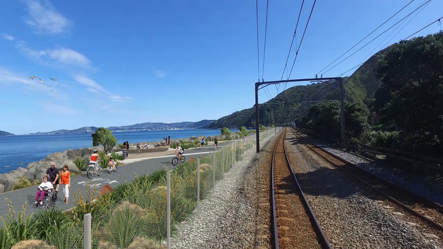


Where did those pictures of the walking / cycling track come from? Assuming that the existing train line stays where it is, the width of the walkway is MASSIVE !!! Looks like 6-10m wide x at least 3m high above water – lets say at least 20m3 per metre of length.
But on that basis, I think your numbers are a bit off. You say several million cubic metres – and 250,000 truck journeys – let’s break that down.
The new section required from Ngauranga to Petone is at least 4km long – so 4000m x 20m3 = 80,000m3 – not the several million cubic metres you speak of. Even if you double that to allow for more rock under water, that’s only going to be 160,000m3 – not even a fifth of a million cubic metres. Given that a standard Kenworth type truck and trailer can take about 30m3 (about 33 tonne) of rock at a time, that only equals about 5,330 truck movements, not 250,000 truck movements. So that could be ten trucks doing 533 trips overall – if they did just 5 trips per day then that would only take 107 days.
Anyone want to check my math?
Its definitely nowhere near a million CuM….
The airport company say they need ~1.5 million CuM for the Runway extension and a back of the envelope calculation is around 80,000 sq m,, 360m x 230m
(ignore depth)
This is 40,000 sqm @10 metres wide by 4km,
So at the same ratio of the Airport extension, which is in *way* deeper water, its only 750,000 Cum,
So you should be able to do this for 2-500,000 cum….max.
@Grant,
The section they are showing is one of the “rest and recreate” stops along the way, which gives the best impression possible,
To be honest I suspect that for most of the length it will be much narrower
Thanks Grant and Greenwelly ! Good to see some thinking about the numbers.
What do you think about my argument?
How about taking advantage of the location and barging the rock in from another source? No truck movements on a congested motorway and no more holes in Wellingtons wonderful hills (saving flora and fauna).
@Levi, Petone-Grenada will be a pig of a road to build, and its a fair way from being “Shovel ready” so I think the chances of it happening concurrently are low to nil.
The Amount of Fill and Rock isn’t huge so either of those quarries should be able to supply it, plus they could always bring it down from the Belmont quarry
The one they should try to drag forward is the Melling link….
When “they” we’re building the motorway, wasn’t there a temporary bridge over the rail tracks and the existing road to cart away the fill created by the terracing between Kaiwharra and Ngauranga?
Perhaps it’s in storage somewhere (beside the floral clock from Lower Cuba Street?) and could be recycled in the interests of keeping the construction traffic from destroying SH2. . .
Caster – YES ! Totally agree with barging – but where is the source? For realistic reasons, it couldn’t be outside the Wellington heads. I mean, there’s lots of rock round on the South coast, but how to get there? I reckon it would have to be at Eastbourne? Or Seaview?
Henry
I have pics of the temporary Bailey Bridge that you speak of, I believe that the motorway as we currently know it was not in the way at the time
The Bailey Bridge was set up by the army sappers (Engineers) so it will have gone back to Trentham or Waiouru afterwards
I understand that the bridge jumped off from Jarden Mile around where BJ Ball Paper is currently – there is a crib wall there now which may be extant?
As for rock supply and proximity, how about benching above SH2?
It would be fairly simple to set up a pair of steel towers either side of the motorway
with a conveyor belt frame suspended between them, sheath the thing in scaffold and plastic wrap to cut down the dust, loaders feeding the hopper on the uphill side and loaders filling trucks on the downhill seaward side
It would minimise the amount of rock which will fall on SH2 when the big one hits and could be planted in pohutukawa trees when finished
Great to see some good ideas posted up here – thanks 60 and Caster for thinking laterally. I too had been thinking that a large conveyor belt over the SH2 would be a sensible move, loading rocks and unloading on the seaward side makes much more sense than multiple trucking missions. The barging option is good too, except that it does pose the question of exactly where the rock would come from.
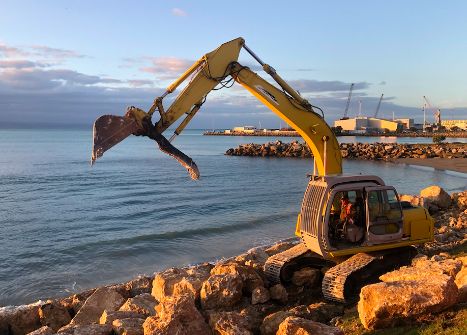
The picture (up above, third from the top) of a tracked vehicle with a big grabbing arm (what do I call that 60 – is it just an excavator or is there a more fancy name?) – is the sort of thing that we would need several of. There are dozens if not hundreds of these on Transmission Gully at present, and presumably they are coming to the end of their work phase, so there should be plenty of them to go around. We would need the big grunt ones – what was interesting with the picture I took in Napier is that the rocks were being incredibly carefully placed – being Hawkes Bay it is all limestone of course, so a lot weaker than the rock we have in Wellington – but this guy on the grabber was carefully placing the larger rocks one by one, tamping them down and then later backfilling the gaps with smaller material.
I think we would probably have a slightly different placing procedure alongside SH2 – not just dumping the rocks/construction rubble in as they did in the past, but nonetheless the sea action from a Wellington southerly is probably a lot harsher than a regular Hawkes Bay northerly. I’m also interested to know what, if anything, they would do with the sea bed and all the creatures that live in it. I guess the answer is – do nothing – just dumb rock on top of them and they can move out if they are still alive…
Just a regular digger (excavator/ US backhoe) with a hydraulic thumb attachment
No special name but they just have auxiliary hydraulic lines to attach different things like augers/compactors/WHY
There’s loads of info at https://www.nzta.govt.nz/projects/te-ara-tupua/frequently-asked-questions/
Where will the material come from to construct the Ngauranga to Petone coastal reclamation and rock seawall?
It is too soon to say exactly where the material will be sourced.
The project will require an estimated 180,000m3 of fill material. Of this, approximately 100,000m3 is rock, which is needed to create the revetment (the sloping rock seawall) which will protect the reclamation and the path from the sea. This rock will likely be brought in from outside Wellington, because our region’s quarries don’t have the size and quality of rock needed to create a resilient coastal edge.
The remaining 80,000m3 is general fill. There are a number of potential sources for this material.
Thank you Patrick, you are a national living treasure and probably deserve a knighthood for your work promoting cycling. Thanks for the link – i never got further than the pretty pictures….
Hmmmm….. I’m puzzled by their phrase “our region’s quarries don’t have the size and quality of rock needed to create a resilient coastal edge” Given that our whole region is effectively one giant resilient coastal edge, composed of some bloody hard, sharp, exceptionally fractured rock that seems to sink ships and rip hulls apart, I would have thought that we would have rocks aplenty….
Thanks for another great article Levi and everyone for all the comments.
It’s brilliant news that the Petone – Ngauranga shared path (Te Ara Tupua) is being accelerated,even though I share your concerns Levi that environmental considerations are not ignored in the sped up RMA process. My understanding is that there are only very limited values along that coastline as it is all completely modified already.
In terms of rock source – all rock won’t be the same. Taking rock from quarries would be an issue in terms of reducing their lifespans – we recently ran a Plan Change to allow Kiwi Point (Ngauranga) to extend its life (was down to 3 or 4 years). Reality is that we will run out of quarries which are really important for roading and building projects. There may be lower quality ‘waste’ rock which can be used, but I could be wrong but I would think the project will need rock from elsewhere.
Just taking rock out of the Hutt escarpment probably likely to raise its own environmental issues. One place – that if the timing works – would be good – is to take the 35,000 cubic metres of rock and soil which will need to be dug out for Omaroro reservoir – saving landfill (cleanfill) fees as well as cost to the shared pathway.
Another
Thanks Mayor Foster – looks like you were going to say more and then… stopped? Perhaps it was time to sleep (at least you didn’t say cofefe…). Don’t work too hard – we want our Mayor alert and solving city problems!
It’s an interesting proposal re the rock at the Reservoir site. I just had a look at Beca’s report on the Prince-of-Wales-Omaroro-Reservoir-Geotechnical-Factual-Report – available for download at https://www.wellingtonwater.co.nz/work-in-your-area/omaroro-reservoir/ but it doesn’t look hopeful to me that the soil type would be suitable. At the top of the hole it was:
‘Dense’, silty medium to coarse sandy fine to coarse GRAVEL, minor cobbles, trace boulders (<220mm diameter) clay; light brown, mottled orange; saturated (drilling induced), non plastic. Gravel / cobbles: angular, SW-HW, greywacke. (Logged downhole).
5m down it has turned to: Loose, silty fine to coarse GRAVEL, minor fine to medium sand, trace clay; light brown; moist, low plasticity (matrix). Gravel: angular to subrounded, SW-HW, greywacke. Matrix supported.
10m down it was logged as: Very weak to weak, MW-HW, greyish brown stained orange GREYWACKE. Defects: very closely spaced (recovered as 6-20mm blocks). Drilling disturbed.
9.60m: defects: very closely spaced (recovered as 15-50mm blocks). FeO stained, minor coarse sand, minor silt. Drilling disturbed.
9.80m: ARGILLITE.
9.95m: greyish brown GREYWACKE. Defects: very closely spaced (recovered as 6-30mm blocks). FeO stained, some silt.
10.10m: extremely weak, MW-CW, orange-brown GREYWACKE. Defects: very closely spaced (recovered as 6-60mm blocks). FeO stained, some silt, minor fine to medium sand, trace clay.
That's possibly a good solution for the backfilling behind the riprap rock edge – but doesn't sound like there is likely to be a source of much big rock members down there. Plus, you'd have to consider the relatively short route from Reservoir site to the Tip site, vs the longer route all the way through town and out to the Hutt and back. There's certainly no easy answer on this one! (although, I have to say, my original suggestion of taking rock from the proposed site of the Link Road is looking more and more likely as the best option….).