
Well, we were surprised again, but we should not have been.
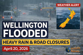
Slow off the mark here, I know, but i really needed some days of sunshine before i could write about the deluge of crap weather we’ve been having lately. I must say, though, that this city never ceases to amaze me. I mean, look at this picture below:

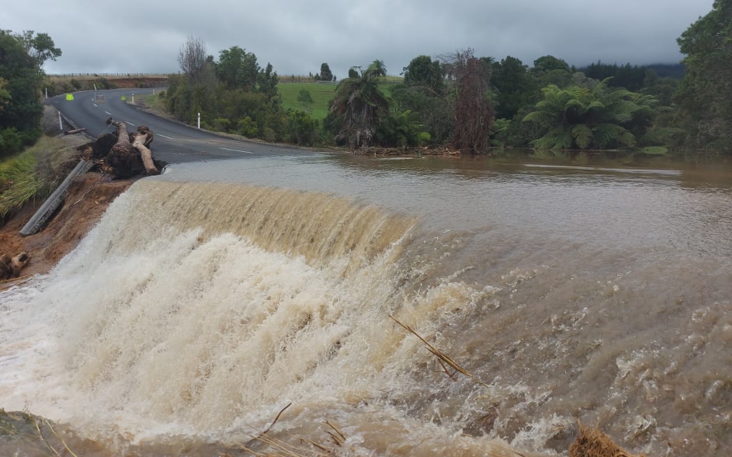
The video is as harrowing as hell – no-one’s front door should be doing imitations of a hydro dam. That was… quite a torrent. Clearly there is a problem with overflow route paths getting too real and far too close to floor level – ie arriving ABOVE floor level, and not passing underneath it. Here’s another overflow route misbehaving – from further up country I believe. But clearly beyond the capabilities of the under-capacity pipe under the road. Nothing that a few mega-girthed ducts under the road couldn’t fix.
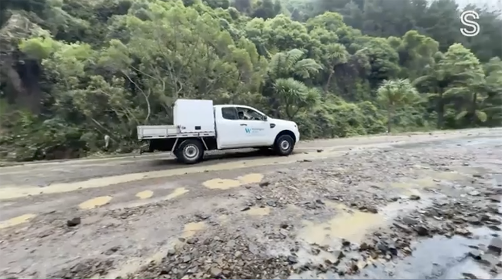
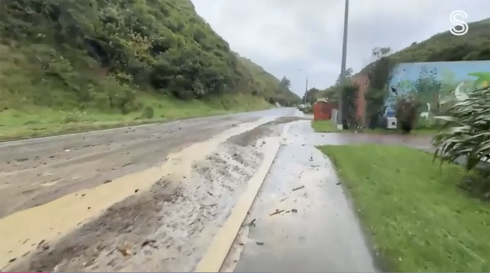
I forget where some of these pictures have come from – this one obviously thanks to Stuff, but is it of a back road bush whackers access road? Or is it just the Ohiro Road, which is obviously the route of a stream as well as probably a fault line as well. There’s a lot of rubble coming down the street. Wellington Water sitting there thinking: “We’re going to need a bigger pipe…”
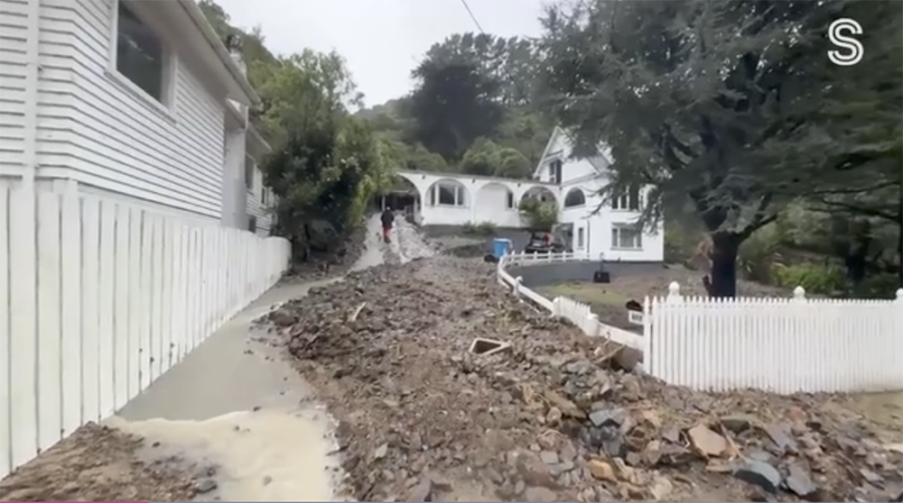
But not as much as the rubble coming down this person’s drive…. along with a torrent of water, which I understand that they were also finding coming through the house as well – so I think they were scooping up some of this rubble to form a rough boulder-bank, to help keep more of the water out. So, a lot of crap to clean up, but not a total disaster I hope. Good swift sensible action, but it also shows that our hills are not so much clay and mud, but instead fractured, weathered greywacke stone, that can be washed away piece by piece. I mean, that material belongs in a riverbed, not a driveway. But then again, also, that driveway is part of the problem. There’s an awful lot of non-porous surface right there.
More Ohiro Road – but where is the usual route for water? It is clearly a river-valley, so there should normally be a river / creek here, but from memory it does not usually come down next to the road.
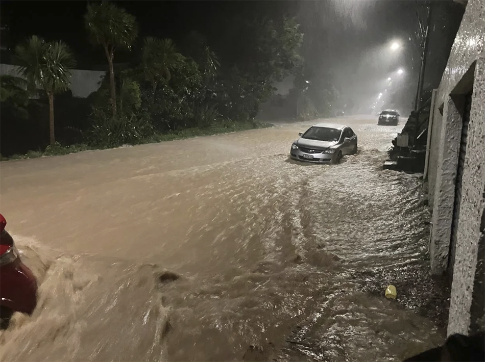
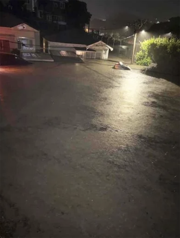
And I think that this picture (below) is of the same Ohiro Road as shown above, but at the peak of the storm in the depths of the night – that’s a massive volume right there, cascading down the street.
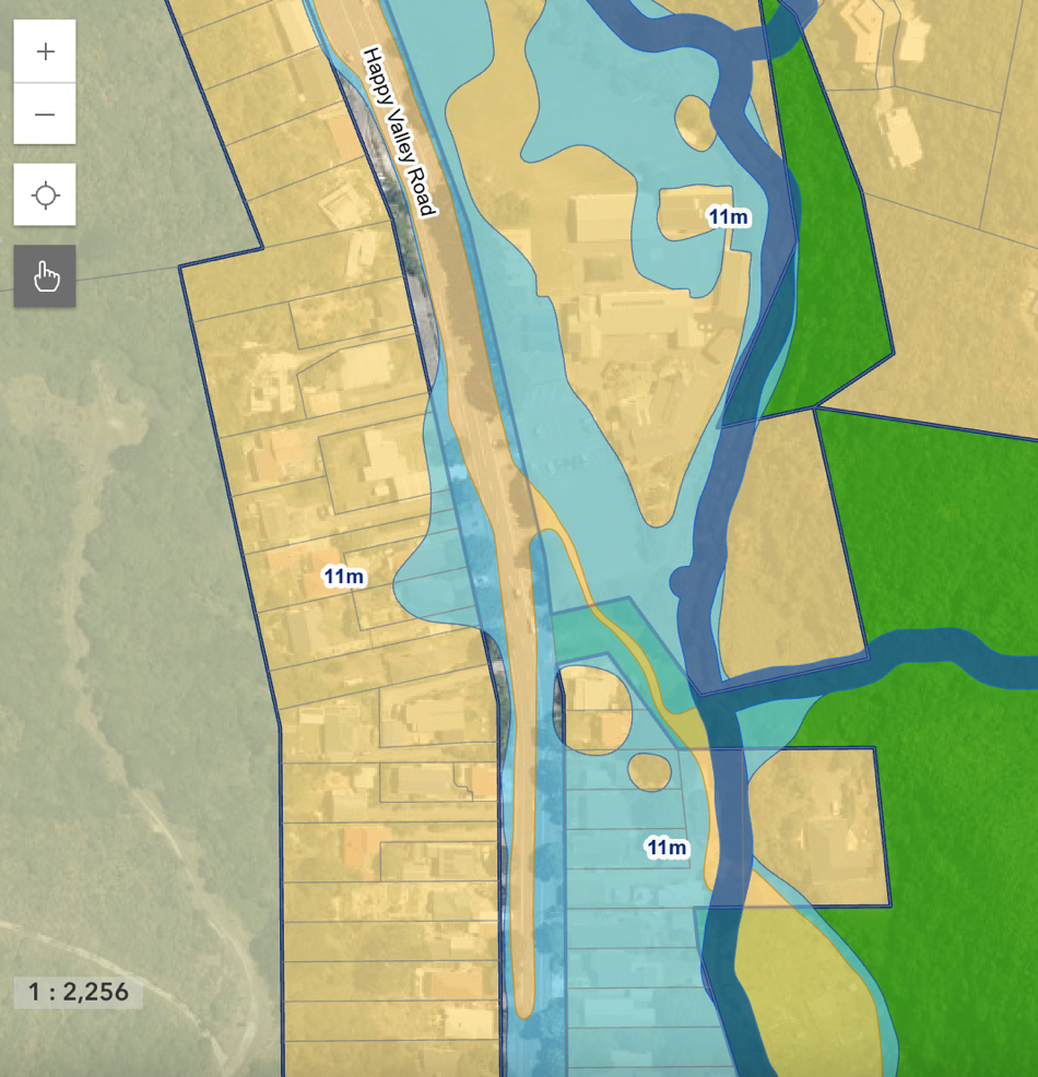
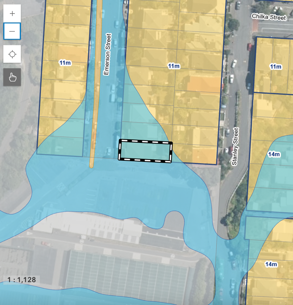
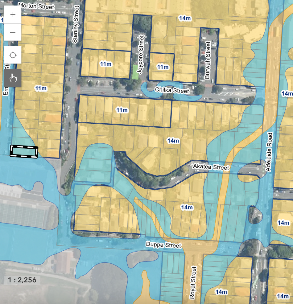
Here’s a WCC ePlan picture of why:
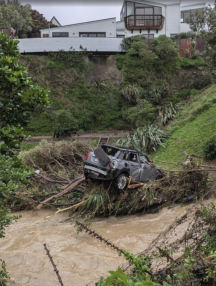
There were undoubtedly a few cars washed away in that storm – below is one sad looking Mini that has washed down a stream. And possibly the house is going to join it.
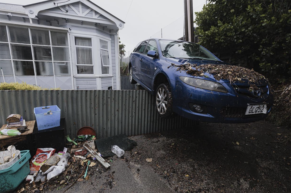
Officially there was a peak flow of 77mm in an hour, which is probably just a typical Thursday if you live in Greymouth, but is more unusual in Wellington. But it is not completely unheard of or unprecedented in Poneke before – I recall 75mm about 20 years ago, where a sudden deluge in Taranaki Street flooded into a basement garage in Wakefield Street and there were photos of a brand new Beetle floating around in water 6 foot deep. And when the waters recede, they can leave surprises in choice of parking…
And: not enough pipes
That final picture, of a lake, is down the end of Emerson Street, Berhampore, and also the site of the carparking fence on the picture above. The reason it has turned from a quiet suburban street into a greasy brown lake, is because the City Council has built a concrete retaining wall across the end of the road, taking what was a natural watercourse and abruptly stopping it from working. But it is not like this was news – the retaining wall has been there for decades, and the area is noted on the WCC District Plan as being smack in the centre of a major flooding area.
Only made worse, of course, by the retaining wall curiously not shown, making this situation far, far worse. Here’s the context in the wider Berhampore region:
And another key area for flooding was just up the road a little: Palm Grove made a few headlines for inundation too, and here’s why.
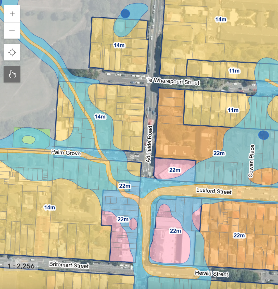
We all know that corner, with the Grammercy bakery and badly timed traffic lights, sitting at the curious dip in the road. And now we can tell exactly why there is a curious dip: it’s Godrick’s Hollow, a conspiring confluence of conflicting contributionary streams rampaging through the working class housing in Berhampore. If you are wondering why your feet are always wet round there, this is why.
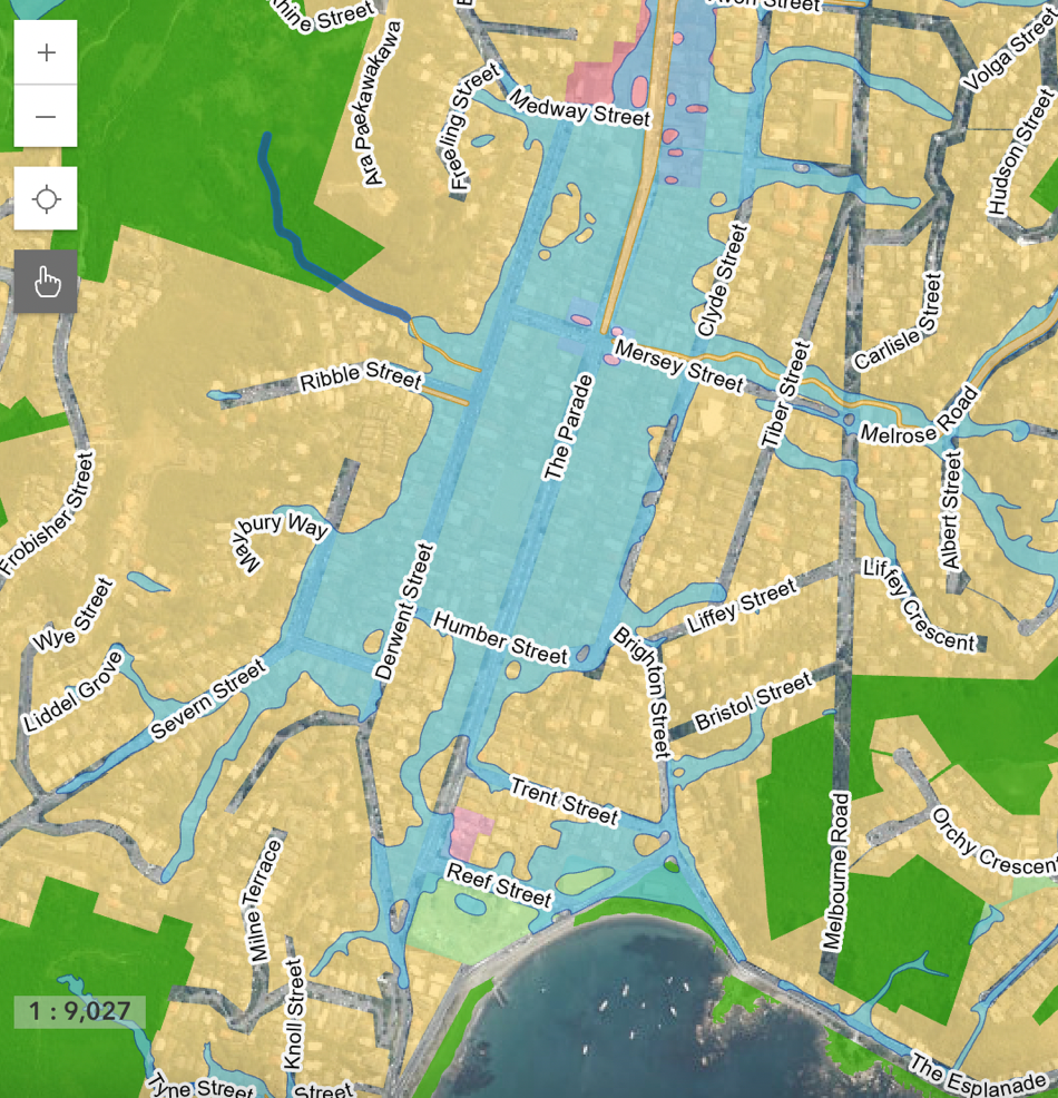
I’ll just finish up for now with another of Wellington’s repeating wonders of excessive irrigation: Island Bay. Not only is it a major route for tsunami inwards, it is also a logjam for waters trying to get out again. Never mind whinging about the cycleway, here’s the site of your shopping area and a prime zone for urban density. Maybe we don’t need to raise the height level so much as to raise the ground level?
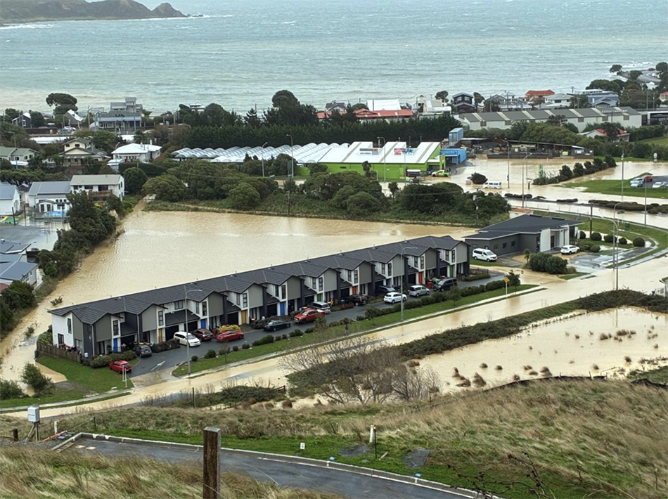
Post script: Raising the ground level was what these developers did out at the Plimmerton roundabout – make a big tall compacted patch of gravel, clearly working fine on their site, but pushes even more water onto the sites next door. Flooding shown from April 18 2026 flood. Earthworks from the next mega-subdivision across the road (bottom right hand corner) caused extensive run-off (and horrid brown water) from all the land they are carving away at the edge of the Taupo Swamp. Future problems happening right now… Idiotic development !!


Island Bay has nowhere for excessive rainwater to go.
The large pipes under the road (1800Ø, 2100Ø and 1350Ø at the southern end) are already at capacity when a big storm hits – they are flat and cannot be made any deeper due to the level of the ocean outfall. There is no room for any extra pipes in the road, unless you want to do some very expensive rerouting.
Like you said, it is just a geographic consequence of building in a valley where, pre-settlement, there was a large volume of water that went through there. What did they think was going to happen? ¯\_(ツ)_/¯
Thanks Seamonkey – great to have that knowledge. I wonder if many people living in Island Bay know that is the case with the pipes already?
Logical consequence of not having enough depth though, would be to make sure that the ground floor slab in the shops is constructed up higher. Maybe even raise the level of the road as well? It is noticeable that the Island Bay New World supermarket did not flood, to my knowledge, as that is already constructed higher…
Council should mandate / require / assist with relocation of existing homes and shops to be at least a metre higher along the Parade. Relatively simple exercise to do – hydraulic rams under the bearers, and up she goes. Maybe the Insurance industry will mandate that this happens….?
Out of idle curiosity, how do you lift anything that’s been built with a single concrete slab as foundations?
I had someone (repeatedly flooded) ask me exactly that question – and the answer to me is that it is not as easy as with a timber floor – in fact it is really tricky and not cheap. Almost impossible, but in theory it is doable. I’ve seen a few vids from the Chch rebuild where they used giant truss girders slipped underneath the house and then they jacked off those, presumably leaving the old slab in place.
Seeing as the house is flooded already and they will have to replace the GIB internally, the time to do it would be now – the house is unliveable (and unsaleable) at the present. But while the GIB is off, the thing to do would be to go around the house with a reciprocating saw and cut off the timber walls from the concrete slab. Presumably you would try and separate the bottom plate from the slab – and then when it is all cut through, to install jacks and raise the walls.
Then you would need to :
A) Build new timber floor, at a much higher level than the existing slab. Probably raise it over 2m high in the air, so that workmen can get around and install the following:
B) That involves floor joists, bearers, and of course installing new piles etc below – through the old slab. Build the new floor really strongly, and with new Plywood floor etc.
C) Lower the house back down onto the new floor and fix securely.
D) Install new GIB to the walls and then fix all the internal surfaces etc.
E) Build new stairs and ramps where before there was level access.
So from that, I take it that in almost all cases the course of action would be demolish and re-build – on top of a set of fibreglass piles. ;)
Excellent suggestion – made even more impossible in the case i speak of, as her house was one of three all joined together. Impossible situation.
77mm in an hour is extreme even for the west coast,
Greymouth’s highest hourly rainfall was 70mm in 1968…
https://niwa.co.nz/sites/default/files/West_Coast_Climatology_NIWA_web.pdf
The storm that flooded Taranaki street was in 2015, it was no where near than it was 23mm over 2 hours,
https://www.odt.co.nz/news/national/torrential-rain-causes-flooding-wellington
But the total rainfall was much,much larger and the area was huge, soaking all of Wellington and the Manawatu.
https://www.stuff.co.nz/dominion-post/news/68560719/video-flooding-around-the-wellington-region
https://www.gw.govt.nz/your-region/news/yesterday-s-rainfall-by-the-numbers/
As you mention Emmerson street is a disaster waiting to happen as the Council Nursey blockades the end of the street meaning the only way for rainfall to get out is a single brick stormwater pipe (75cm in Diameter) that was installed in 1933….
Great resources – thanks Greenwelly ! You and Seamonkey are incredible ! I mean – how did you find out that Emerson St has a single pipe @ 75mm diameter installed in 1933 ? !!!
Re the Taranaki St flood, that was the Second time it happened – i was working on a project back in the early 2000s where the basement got flooded – but I can’t remember the exact date – but definitely about 10 or 15 years before the even you are talking bout. Not quite sure how to search that one, as Stuff / Dom Post don’t really seem to have a working archive of their own work.
WCC online property maps also has all the pipes both sewage and stormwater,
Get in quick because I suspect as soon as Wellington Water take over they’ll all be made private and hidden from the public..
https://gis.wcc.govt.nz/LocalMapsViewer/?map=95a0685dff724fc19035abd59c630b14
I may be thinking of this event that AI has found:
“Key 2002 Wellington Rainfall Events: January 10: A intense thunderstorm produced torrential rain, with approximately 40 mm falling in 30 minutes and 52 mm in an hour. This event, which caused flash floods in the city center, was considered a 100-year return period event.”
But there is also this event: “AI Overview – On October 3, 2003, a severe, slow-moving storm caused extreme rainfall in the Wellington region, with over 300 mm falling in some areas within 24 hours….
Paekakariki Deluge: Paekakariki experienced over 100 mm of rain, with an estimated 75 mm falling in just three hours… Damage: The deluge triggered massive mudslides that buried cars, homes, and the Paekakariki motel, leading to a state of emergency.”
This is fascinating! (to me) – here’s 2004:
In February 2004, Wellington experienced extreme rainfall, with some parts of the region receiving over 400–600% of their average February total. Major flooding occurred around February 15–17, 2004, following a very wet January. Key events included heavy, localized, and intense rainfall particularly impacting Miramar on February 17, 2004.
Intense Event (17 Feb): A storm event centered over Wellington caused major flooding, with the suburb of Miramar receiving 29.7 mm of rain in just one hour.
And here is 2005:
A major, record-setting storm hit the Wellington region on 5–6 January 2005, driven by a stationary front that caused intense rainfall, particularly in the Kapiti Coast and Tararua ranges. Key impacts included 145mm in 24 hours at MacKay’s Crossing (a 1-in-40-year event) and significant flooding, causing over 20 homes to be evacuated near Waikanae.
And 2006:
In 2006, Wellington was the wettest of New Zealand’s five main centres, recording an annual total of 1,579 mm of rain, which was 126% of its normal annual rainfall. July 4–7 Storms: Significant storm events occurred between July 4–7, bringing widespread flooding and landslides to the region. Some areas in the Wairarapa (part of the wider region) saw 3-day totals of over 400 mm, with an estimated return period of 80 years. Wainuiomata received over 330 mm during this period.
and 2007:
Generally a dryer year, but still: 2 May 2007: A localized, high-intensity downpour occurred, reaching 60 mm/hour at Karori Reservoir, causing surface flooding in downtown Wellington.
2008 ?
In 2008, Wellington experienced extremely wet conditions, recording its third-highest annual rainfall since records began in 1864, with a total of 1,662 mm of rain.
2009:
May 2009: Very wet, with about double the long-term average rainfall in areas like Petone, Lower Hutt, and Wainuiomata, leading to significant flood flows.
2010:
nothing much. 2011 – drier than most 2012 – March 3-4, 2012: A “weather bomb” brought heavy rain and extremely strong winds to the lower North Island. The Hutt River burst its banks, leading to floods and landslides.
I could go on, but I won’t, except to note that records seem to be set and broken on regular intervals. Perhaps, as Geoffrey Palmer once said, “We are a very pluvial nation”.
Hmmmm….
https://www.youtube.com/watch?v=U4klQWIAJ0k
Wonder how they would perform in earthquakes?
Quite nice and reverberant I would think? Not stiff and unyielding. Looks like they would maybe even flex a little ?
It’s too late for Wellington now, but Muscat in Oman is built around a whole bunch of wadis (dry river beds) which run through the middle of the city to the sea and which are never built on – just occasionally channeled.
Why?
Because when it rains, they flood, and when they flood they flood deep and fast.
In Wellington, the roads (like The Parade) have to be able to act as drains (surface floodways?) in heavy rain. I think this means that in those places, buildings have to be above road level.
But hey, what do I know?
Perhaps we should re-name Island Bay Parade to Great Southern Wadi. ? Might be more honest?
One other option, which the city has done at the end of Taranaki St and Cuba St – giant underground stormwater refuge pits. Several Olympic pool sized volumes for catchment and slow release.
Aren’t those for wastewater?
https://eyeofthefish.org/building-on-top-of-a-sewer-tank/
https://www.wellingtonwater.co.nz/projects/taranaki-street-pump-station
But very expensive… Porirua has just built one at a cost of about $30 million…
I think that Yes, it is all for sewerage ie “waste water” but in Wellington it is still often contaminated with the “storm water”. Not 100% certain which is which…
The volume of rain hitting Wellington the other day would have filled an Olympic-sized pool (approx 2,500,000lt) in nothing flat. The only effective response is unimpeded gravity-fed torrents straight into the sea.
Sadly, this means demolishing both the Town Hall and the Michael Fowler Centre to allow Cuba Street to reach its full hydrodynamic potential.
$30 million .., hah …as typical with many council projects it’s it’s blown out to $99 million …
.
https://www.thepost.co.nz/nz-news/360960761/cost-porirua-wastewater-tank-blows-out-99-million
Oh no – that IS depressing. I thought it had tripled in budget from $10 mill to $30 mill, not going from $30 to $99 million ! I drive past it often – how on earth could that boring concrete box cost a hundred million ! It is just concrete and steel reinforcing and lots of waterproofing layers – there is no earthly reason why that should triple to that astronomical cost. I wonder if the PCC have got the guts to publish a cost-breakdown?
From the article in The Post:
“With enough room for three Olympic swimming pools of wastewater, the tank between State Highway 59 and the rail lines had a $48 million budget when construction began in 2022.
Subsequent issues – relocating native skinks, inflation, moving fibre ducts and upgrading wastewater infrastructure – pushed it to $97m.”
Oh please!! Who are they trying to kid? “relocating native skinks, inflation, moving fibre ducts and upgrading wastewater infrastructure” more than doubled the cost? Bloody skinks?!?! I mean, it is a piece of grass / wasteland at the side of the motorway, the skinks were not the problem ! More likely the complete incompetence of the Project Manager and the Contractor ! I was driving past there almost daily (ie twice daily!) and they were the most dis-organised bunch of idiots I’ve seen for quite some time. A bunch of 4th formers could have done better with a toy spade in a sand-pit ! Pffist!
Yay for managerialist micro-management.
/S
Oh give us a break !!! https://www.stuff.co.nz/nz-news/360974054/two-waves-wild-weather-nz-set-rain-wind-and-rough-weekend
I’ve had enough of this shit !