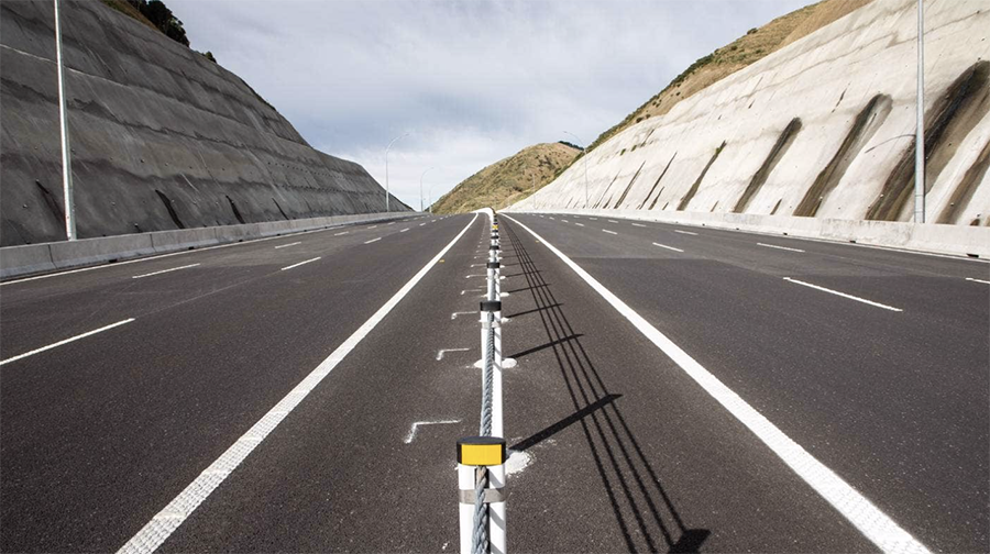
So today Transmission Gully was opened – blessed, ribbon cut, journos let through, and a few selected souls have had access. Tomorrow, it opens to the public, as Te Ara Nui o Te Rangihaeata, or the Big Pathway of Rangihaeata (Te Rauparaha’s nephew). No doubt he would feel honoured to have such a beast of a road named after him – and probably also a little shocked to see the vast scarring of the landscape that he used to walk across. As well, probably, bewilderment as to what all those honkies were doing with those thousands of cars each day. I’m not sure what Uncle Te Rauparaha would have made of it either – probably not too keen, I suspect.
The Encyclopaedia of NZ, Te Ara, says: “Te Rangihaeata was feared and disliked by the whaling communities living under his aegis. He exacted tribute in the form of numerous demands for the gifts he considered they owed him for his tolerance, demands which the whalers saw as extortion and bullying. Europeans who encountered him in the late 1830s or 1840s tended to regard him as Te Rauparaha’s ‘fighting general’ or as his lieutenant. Te Rauparaha was credited with the greater cunning, but Te Rangihaeata was thought to be more ferocious.”
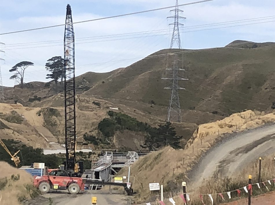
I’m not going to review what the new road is like or how it is designed etc – I’ll leave the journalists to do that, and they can mention the 25 badges and 32 cuttings, or whatever it is. There is one great bridge in there, Te Ara a Toa, that sadly no one will see as it is all beneath you, somewhere up a gully at the back of Cannon’s Creek – I went up there a couple of times to see it under construction and it was interesting as a piece of work and a problem for the engineering bods to plan, but it is hardly any sort of glorious, poetic, dynamic bridge. In fact, I’m going to wager that probably the big thing about this new road will be that it is completely boring. Safe, unexciting, nothing that is going to frighten the horses.
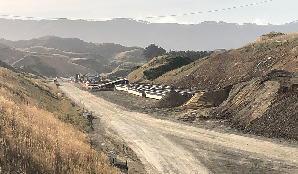
Ben Strang, the “Senior Reporter” from the DomPost, says this about the Te Ara a Toa bridge: “Over about a year it was pushed into place from the higher northern end, engineers doing so with careful precision, using every bit of algebra they could to ensure the bending, sloping and descending bridge linked up with the other side as the architect intended.” Really? There was an architect involved? Hmmm… I don’t know who that might have been – seems like a very engineering response to me – extremely clever. But even that brief snippet is wrong – it was pushed into place from the southern end, and I know that, because I stood there and watched it get pushed. Plus, I’m pretty damn sure the southern end is lower too.
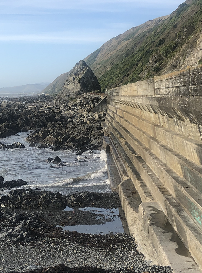
Unlike the old Coast Road / Centennial Highway through Pukerua and along the coast of the wild raging Pacific Ocean / Tasman Sea to Paekakariki, which has certainly been exciting and beautiful every single day of its 82 year life. Of course, the people most looking forward to the opening of Rangihaeata’s pathway are the people of those two coastal villages – along with Mana and Plimmerton I guess. At long last, they will get their life back – having been severed in two by a State Highway for the last eight decades, perhaps at last they will be able to cross the road without fear of death. I think the statistics speak for themselves – yesterday’s paper said that since the Dominion Post had been advocating for an alternative to the Coast road, there had been 32 deaths on the road, in just a 10km stretch of road.
On the other side of the coin of course is those who are going to suffer as a result of this new road – Pauatahanui is going to get a lot more traffic, whether it likes it or not, and some of the entry/exits onto the new highway will significantly open up the edges of what was formerly a fairly undesirable part of the region. That could be good, or it could also have downsides, I guess.
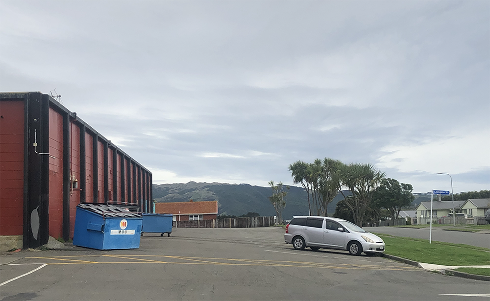
Warspite Avenue in Cannons Creek has for a long time been a fairly run down neighbourhood, with tired buildings, gang affiliations, and half-dead or fully closed local shops, but that is set to change significantly. Instead of being stuck at the back of the saddest suburb in Porirua, now they are sitting on the front row seat of access to the fast road into town. Property prices are likely to rise, I guess, but then again, if it is a state house there will be no change for the individuals living there.
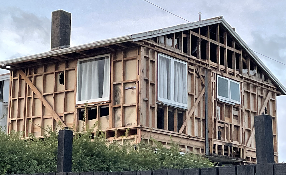
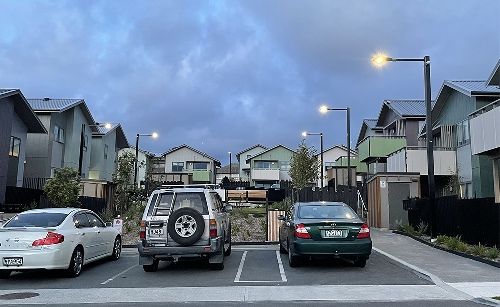
But the great thing here is that someone has been doing up / rebuilding houses there to a huge extent. Some of the projects are Kainga Ora housing projects with some lovely new, slightly denser living, while I think that other parts are being done by Ngati Toa Rangatira themselves – great to see that the local iwi are stepping up and providing some quality new housing for their own people.
Overall then, this road is going to have mixed effects, and we still don’t know the finished cost. Originally it was going to cost about $800 million, but its way past that now, and is on its way to $2 billion. Or $3 billion probably, by the time it has been paid off over 25 years, with the Gov paying the incompetent contractors something like $125 million a year for the next quarter century. The biggest effect could, unfortunately, be on the use of public transport in the region. If the road proves too efficient, then less people will take the train. For the train to perform at its best, it needs to be faster, cheaper, safer and more pleasant to use than the road – and vice versa. So, ironically, the best way for the Big Pathway to succeed would be for it to fail miserably, and to force people back onto the trains – but of course, that won’t happen. Even if only half the current road users change to the new road, that will still mean that there will only be 50% of the previous totals on the old road – not a bad result at all. The key thing that it will have is the brand new effect of duality – not just a single road, but now a choice of two. Is that worth $2 billion? Too early to tell.
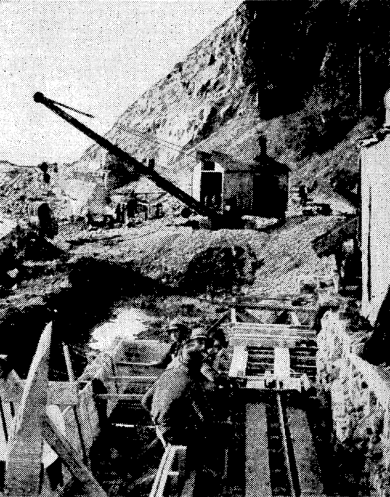
Post-script: I got to searching, because I knew I had seen a picture somewhere, of the testing of those Centennial Highway sea walls under construction – and under design.
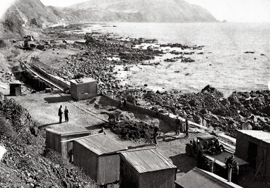
I know everyone else will be raving about the modern new road and all that new cool stuff – but I just thought – wouldn’t it be nice to look back for a minute at how things were done in the old days? Bit of a change in terms of men, money, machinery, and attitudes towards health and safety.
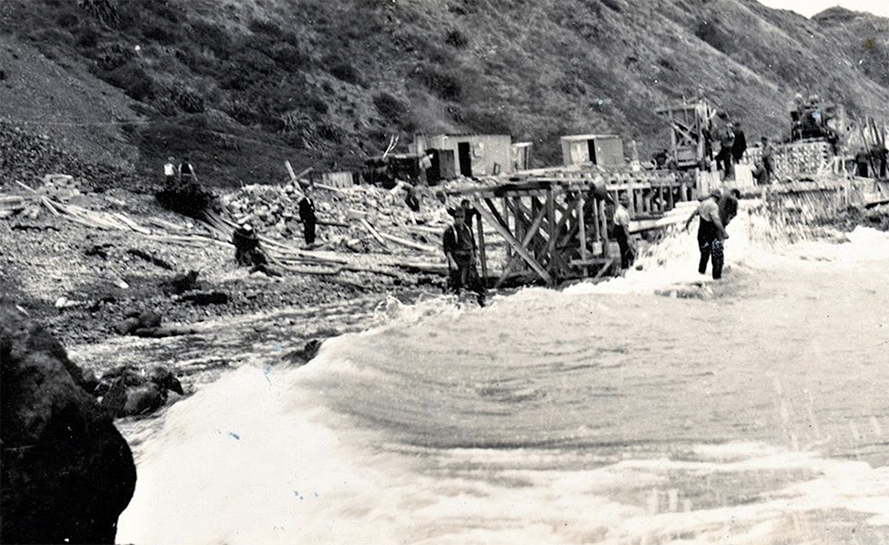
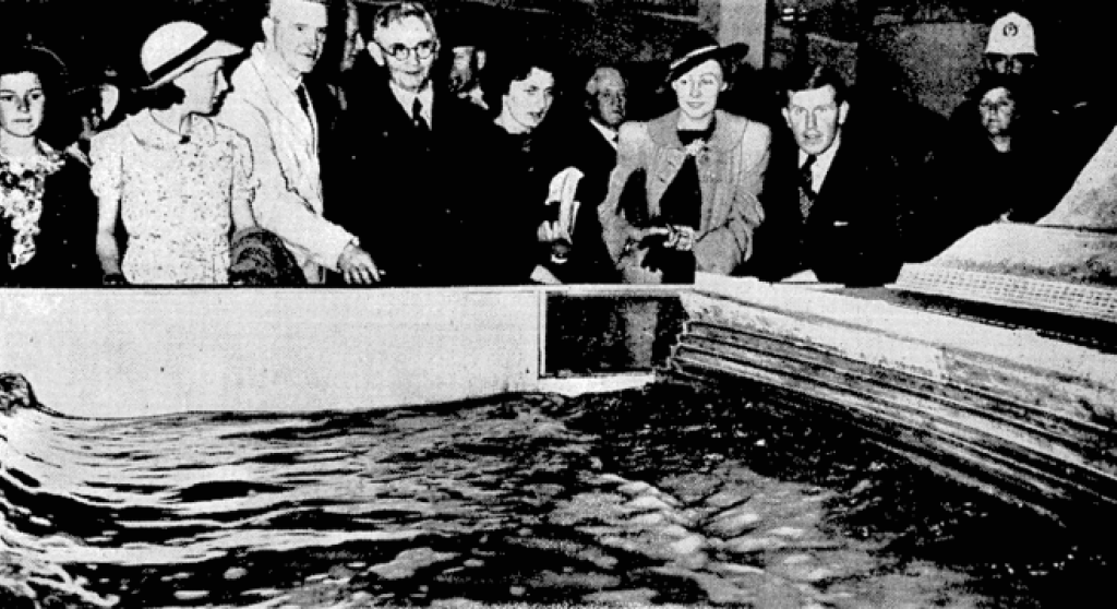
Amazing to think that in 1937 there was no road up the coast – of any kind, except for the Paekakariki Hill Road I guess – and all there was was a train north, or a road to Masterton. So in honour of NZ’s 100th upcoming birthday, in 1938 they started to build a road, sitting along the edge of the rugged coast line, and here also is a lovely picture of PM Michael Joseph Savage, being shown the wave testing tank where they were putting the proposed sea wall profiles to the test.
Conditions were fairly primitive back then – but heck, here we are 82 years later and the wall is still standing….
..



Welcome back… you had me worried there.
As an intermittent user of the Kāpiti Expressway over the last five or six years, I would guess that Transmission Runway will exhibit the same pathology. At first there will be a noticeable improvement in circulation, but soon enough clots will form and sclerosis return. The Otaki bypass will then shift some of the symptoms further into the patient’s extremities.
The plan presumably is to extend Wellington’s arteries ever outward until they can be grafted on to Auckland’s and Tauranga’s in the heartland somewhere around Tongariro.
Why thank you Monsieur Starkive, I was just having a cup of tea and a lie down, being shagged out after a long squawk. Hmmm, how else to explain that… I’ve been working. Day job, you know the kind of thing.
Nice analogies with the clots forming. Apparently some traffic engineers believe that traffic flow design is akin to computational fluid dynamics – crucial difference being, of course, that if you squeeze more water into a hose, the water comes squirting out faster at the other end. And the water particles don’t mind jostling together. Whereas car doors etc mean that this is seldom the case with real cars in real life. The more cars you push down the hose, the more slowly the cars drip out at the other end…
For the Kapiti rail service to succeed, the trains need to be on the tracks and running as per the timetable.
Day after day after day.
That’s not happening at the moment, and hasn’t happened for years.
“Even if only half the current road users change to the new road, that will still mean that there will only be 50% of the previous totals on the old road”
Lol.
https://en.wikipedia.org/wiki/Induced_demand
The old road will have 100% of the previous totals and the new road will also have 100%, doubling the amount of total traffic.
There is some limit in the sense that at the end there is a bottleneck, but of course there is a reason that LGWM is pushing for building a couple of new highways through the city centre of Wellington.
That’s a very cynical viewpoint Ralf…. so yes, you’re probably right. At the moment it sounds like it is just 50% actual, and 100% potential – if it does indeed get to be 100% actual on both routes, then we really are screwed.
Here’s those Stats for you Nemo:
27 kilometres long
More than 12 million work hours to complete construction
11.4 million cubic metres of earth excavated/moved
660,000 tonnes of aggregate brought to site
104,000 cubic metres of concrete used
7,900 tonnes of reinforcing steel used in bridges and other structures
Over 115,000 tonnes of asphalt laid
25 bridges and large culverts, all built to withstand a 1 in 2500 year earthquake
Longest bridge: Te Ara a Toa – 230 metres
Highest bridge: Te Ara a Toa – 60 metres
Largest cutting: Pouāwhā – Wainui Saddle – 70 metres deep
534 hectares of ecological mitigation and replanting (includes planting 2.5 million native trees and plants)
Eight major streams modified/diverted
At least 27km of streams protected by planting to provide shade and improve stream habitat
Over the course of the construction around 7,700 people have worked on site
Oh, gee, thanks…
And here is Stuff’s verdict on “The Race”
The official results of the race:
It came down to the wire with first and second, with the coastal route much faster now that traffic is diverted to the new Transmission Gully motorway. The train was way behind, but Kate is adamant that the relaxing journey was worth the delay.
First: Ben on Transmission Gully, in 37 minutes
Second: Sophie on the coastal route, in 40 minutes
Third: Kate on the train from Paraparaumu, in 1 hour 10 minutes
https://www.stuff.co.nz/dominion-post/news/wellington/128190379/live-reporters-test-out-the-rush-hour-commute-on-transmission-gully
So: 30 minutes faster by car than by train. That doesn’t bode well for the Public Transport sector
Well if the railways had near on $1.5 billion pumped into them, I’m sure it could double its capacity as well. :D
The Race times are rubbish…
The Train user caught the 7.24 from Paraparaumu and arrived at Wellington Station at 8.17..53 minutes,
They included her walk from the station to Willis Street where Stuff’s office is….
Also we are still in the middle of Red COVID restrictions, its clear that commuter road use is currently no where near what it used to be,,,
Also there was no mentioned of parking costs, (which by the way are gonna go through the roof in the Future if LGWM get their way and part fund themselves out of a new parking surcharge)
Fantastic older photos Nemo!
Engineering (and the construction that followed) back in the day was truly a marvel. No calculators, computer analysis or CAD. Blows my mind sometimes.
I like that you can see a small glass window in the Savage picture – so the scientists could study the angle of the waves hitting the sea wall. Sort of implies that somewhere in the National Archives, there will likely be a report on. this, somewhere…. Assuming that the MoW records were kept and given to Archives, of course…
Nice. I would like to read more about the housing work out there, it sounds like a massive project: https://poriruadevelopment.co.nz/
https://www.stuff.co.nz/national/108265320/15b-revitalisation-of–porirua-will-see-thousands-of-new-state-and-kiwibuild-homes-built
Pre-dating even the Centennial Highway, big-ups need to go to the engineers and workers of the Wellington Manawatu Railway Company who from 1881 got their railway line out of Wellington (surviving today as the Johnsonville Branch line) by running it up the Ngaio Gorge, hacking a terrace into near vertical cliff faces, with spoil from the cutting and the tunnels being fed back down the line and used for reclamation. They actually surveyed what is now the Transmission Gully route as a possible option for their railway line north of Porirua as they faced the problem of trying to get their tracks (and exceedingly heavy steam trains) across the Taupo Swamp. Both were problematic but the Taupo Swamp was deemed to be the least-crap option. They then faced further terrace cutting and tunnel building into more near-vertical cliffs north of Pukerua Bay; it’s remarkable to think that those railway tracks had that route to themselves for more than 50 years until the coast road was built below them. After getting as far as Paekakariki, I imagine that the rest of the route to Longburn would have been a doddle. That the railway line was completed (largely using picks, shovels and gunpowder) in six years, with tracks laid and stations built is extraordinary.
Especially with the tiny population and tiny pot of money back then !!
Conor – your comment got held back in the Spam queue for a while, sorry about that. And yes, you are right, it is a massive project – just one thing, is that the report you highlighted on Stuff was actually a news article from 2018, so of course there has been 4+ years work on that since then. And yes, it is happening, and yes, it is massive. Worth a trip out to Porirua just to see the work