I met a bloke in a pub a few weeks ago, who to my amazement said that he came from Horokiwi. I confess, that as I am a stupid young thing, and did not know it to be more than a quarry, I teased him about being born under a rock. He took it good naturedly, and fortunately did not hit me – no one wants to pick on a Fish, after all, even a geographically confused Fish with no idea where Horokiwi is.

To cut a long story short, I now find that Horokiwi is in the news, both on this website and elsewhere. Indeed, NZTA have proposed to build a road through there, not just for the hell of it, but because they, like any good chicken, want to get to the other side. So, like any good investigative journalist, I went to do some research, and drove to Horokiwi. The sign, that i have often seen from the Hutt Road / motorway, points not just to a quarry, but – blow me down with a feather – what a magnificent quarry it is too.
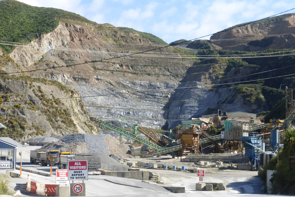
It strikes me that if NZTA had been clever, and planned coherently for the future, they could have had their road dug for free by the Quarrymen (no, not John and the gang for those of you who are sharp today, but the men who run the Quarry). I presume it is run by men – no Howard Roark figures visible when i took the Fishmobile for a run, but it’s pretty awesome heroic stuff indeed anyway.

The current road, which is honestly little more than a goat track, is obviously not suitable for any seriously large amounts of traffic – in fact, it rivals Takapu Valley for its cuteness and narrowness in many parts, and as summer swings into autumn (as it seemed to do so today), then so to the conversation focuses on the road that is proposed to connect Petone with Tawa, possibly via Takapu.
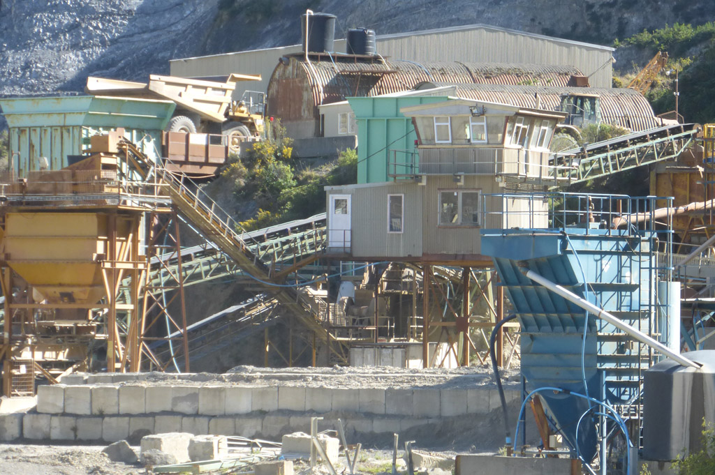
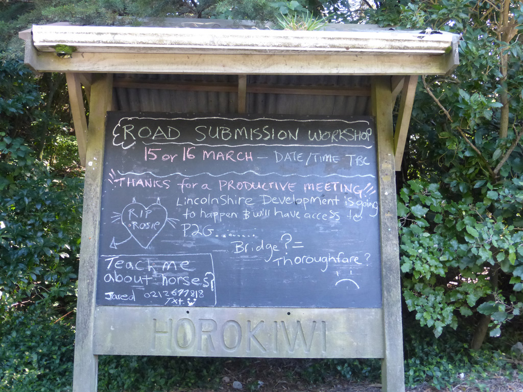
Once you’re out of the quarry, and have climbed up the steep hill, past the sign that warns you you are being watched (there is, after all, only one way in and out at present), past the other, much more welcoming sign – a blackboard – cute!
…and then you get to the top and – what a heavenly view. No wonder the locals have been keeping it a secret.
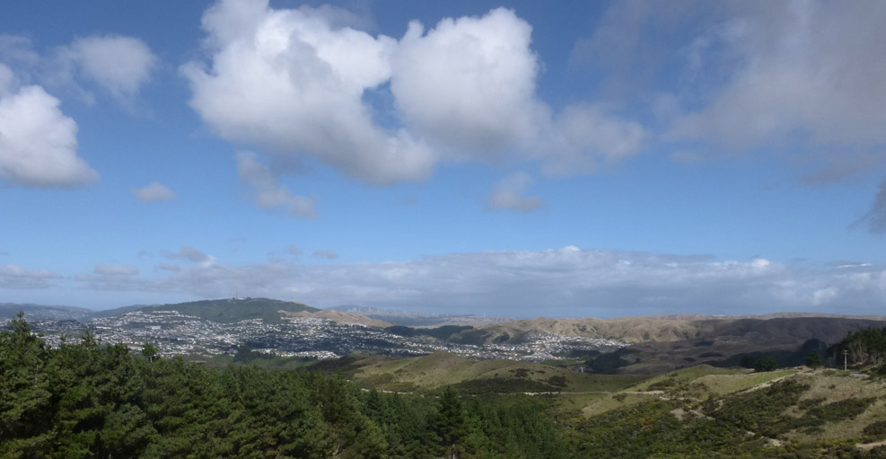
There’s views down to the harbour mouth in one direction, to the Meridian West Wind windfarm in the other, across to Tawa in the middle, Porirua away on the right, and across to Te Wai Pounamou at the back, with of course a view down to Takapu Valley somewhere in the foreground. Hold on, I’ll zoom in closer for you:
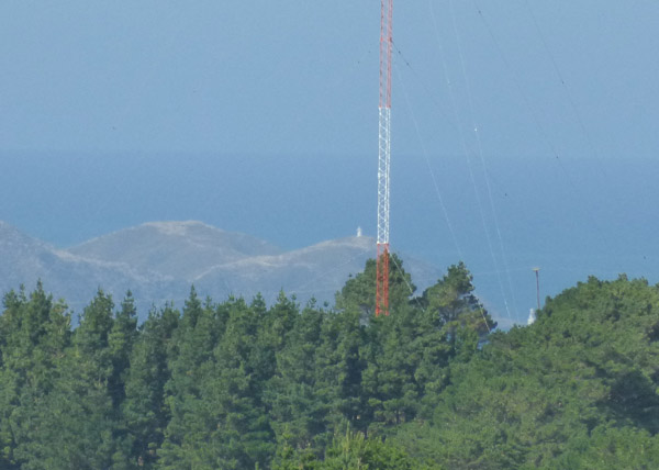
That’s an extreme telephoto shot of the lighthouses at Pencarrow, with a giant red transmitter pole in the way. Mount Kaukau?
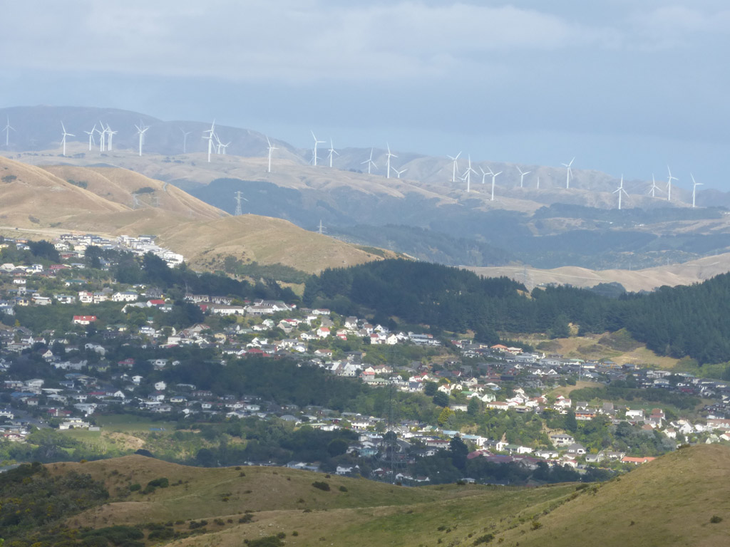
And here’s the middle ground – is that Tawa in the foreground, and is that Churton Park in the background?
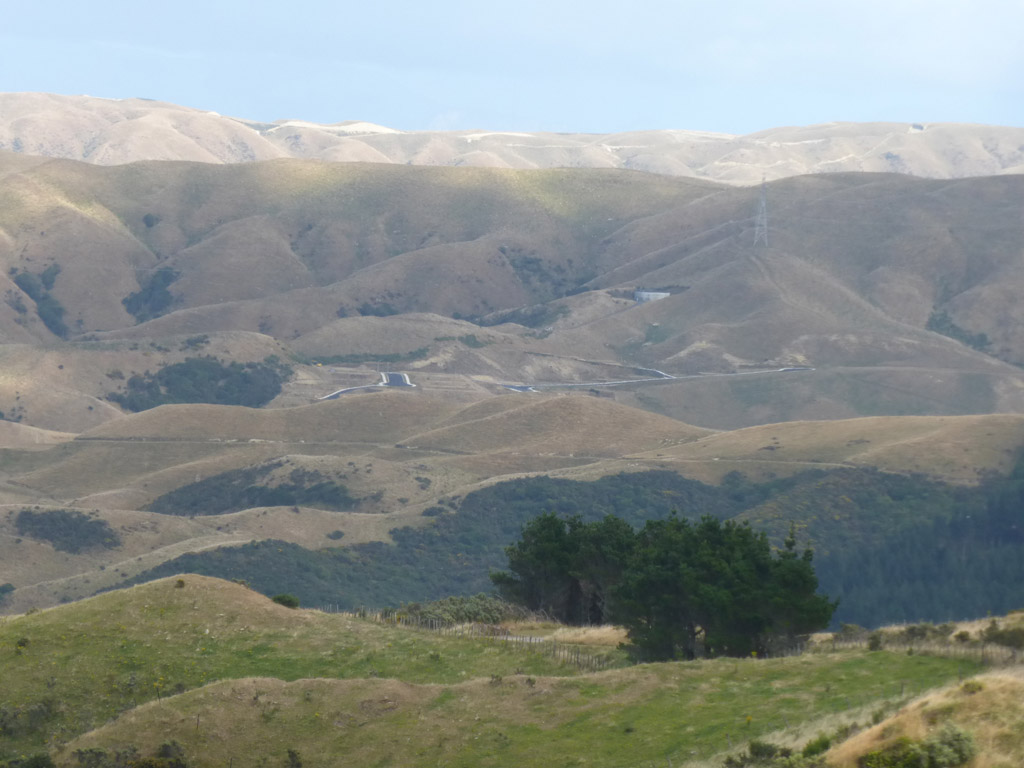
Whilst over here on the right, there is virtually nothing at all, apart from rolling hillside. And a strange start of a creeping cancer of suburbia rearing its ugly head…
I was actually so blown away by the view that i took loads of photos and then my battery ran out, so didn’t get to photograph what I had gone there for, whatever that was. And, I have no answers as to where the proposed road should go, to “short-cut” across the countryside from Petone to Tawa / Porirua, except to say that when I came back, southwards to Wellington on the Hutt Road, it took next to no time to get to Ngauranga on a nice flat road, and then up the well-maintained Ngauranga Gorge road. I have to say, I agree with Sav, and there seems to be absolutely no need for a link road at all…
Postscript:
Further to discussions with 60mPa below, i’ve added in two link shots, just to pick up how close the two sides actually are.
Notice to NZTA: just use the Lincolnshire Drive roads! Saves lots of dosh!

…


The mast is the old Radio Windy site isn’t it? I guess Mediaworks is still blasting something out on AM for someone somewhere who might be listening.
Max, I think that the new “creeping cancer” piece of roading could be the Westchester Road off of the Glenside road roundabout – next time you feel like an explorer, take a drive either side of the Churton Park offramp – downhill joins Middleton with a new bridge off to Westchester and the uphill side has a roundabout that points towards the Lincolnshire Farms area.
Transit may be (un)wittingly sowing seeds of confusion but on the ground some links look obvious
I suspect that the reason why Transit want the link road is analogous to the Pahiatua Track – not quicker but on a different route so invaluable in case of blockage on the main road
In the future I promise to stop mentioning the dread Churton Park if you promise to stop the Ayn Rand references – deal?
But i like the Ayn Rand references! Her books are unmitigated crap, and so, i guess, was the film, except I still loved it, in a camp Barbarella manner – you know the scene, where the noble man in the quarry gets slapped by the haughty wench (on a horse? or did i just imagine her wearing jopdurs?) and then they clinch and kiss and probably fuck quite vigourously, cos that’s what noble men in quarries in Ayn Rand novels do…
There, you owe me 14 Churton Park references now…
Max, you truly are the best fish.
…or just a very odd fish, perhaps. Sorry for the rude word before (must remember not to say fuck online – write it out 100 times…)
I think you’re right about Westchester Drive et al – if you look on a map, there are very nearly properties touching between the back blocks of Westchester, and the far reaches of Horokiwi. I’m not at all convinced that NZTA actually need to build a new road across, but i totally agree that the present road is grossly inadequate if they ever did join the loose ends up. Once the ends are joined, then traffic runs through, and changes everything forever.
I’m reminded of the fracas over the proposal (made a few years ago) to join up Ohariu Valley to Makara Valley. Again, its just through the fence really, but racism was flying that day – and bizarrely, the people of Makara thought that all the inbreds of Ohariu were going to come driving through, and that the entire population of Porirua would do a drive by…
So the roads were never joined…
I think Julian is correct. The top of the frame is cropped but did it have a star of horizontal spikes coming out the top? If so, yes that’s the 2XW transmitter which now transmits The Breeze which used to be Radio Windy.
Useless info from the back of my brain from when I “worked” for the Post Office radio division over the summer holidays back in the 1980’s….
Back in the day, “Windy” was enormously popular in Wellington. They wanted to increase their transmitting power but the Post Office said “nyet”, so they dropped the frequency from 1080 kHz (just above 2ZB) down to 890 kHz (and then later 891 kHz) which would result in a slightly increased range. The problem then was that the mast was too short (the mast having to be a proportion of the wavelength to resonate correctly. Lower frequency = increased wavelength). As they weren’t allowed to extend the aerial either they added the radiating spikes to effectively lengthen the mast
Hang on – I sense some editorialising in the phrase “creeping cancer of suburbia rearing it’s ugly head”, like it’s a bad thing. :-)
Seriously, though, this is the geographic centre of Wellington, if people don’t live here, where else can we send them? Kingston? Brown Owl.
At least all the new sections are nice and small, a bit like high density housing, and with no pesky lawns to mow.
Julian it should be pointed out that, amongst those possessed of eyeballs and a working brain, large swathes of the new Churton Park are considered to be the place where good taste curled up in a corner and died.
While this view may easily be dismissed as mere snobbery I would exhort you to take a drive around there one day should you feel a bit down and need a good laugh. Or cry. Same same.
Just top up the gas tank before you go..
Max, which bit of Makara/Ohariu wasn’t joined? I’m not following you. I keep thinking of Takarau Gorge which used to be the last unsealed road in the Wgtn region up until mebbe 15 years ago?
“it should be pointed out that, amongst those possessed of eyeballs and a working brain, large swathes of the new Churton Park are considered to be the place where good taste curled up in a corner and died”
I think we need a random quote widget somewhere on the site that replays saved quotes, we can start with this one.
Erentz – that’s beyond my capabilities, but if you know how to do it, go ahead!
60 – yes, my mistake. I think that it was Ohariu that wasn’t joined up to Porirua, and if you look carefully at the map, there is a tiny road that does link them (at least on google) but the Ohariu people didn’t want the turbines coming in from Porirua along that road, as that would mean it would be widened, and hence cars, and thus people, was the fear. At present I presume that hoons and bogans from Porirua can’t travel along narrow back-country roads for fear of bottoming out their lowered suspension…