I’m all in favour of cycleways – they are a great addition to the city, and may even allow me one day to ride a bike in Wellington again. It is a process that is long overdue, although many car-driving persons are up in arms, as this delivery of cycleways is also going hand in hand with the abolition of some on-road car parks. Bound to be contentious – as indeed it is – and also bound to get it wrong some time, although probably completely right most of the time. So, let’s look at the cycleways being proposed from the city up to Brooklyn. Have they got it right?
It is a little hard to find the official documents (they are here) and so I urge you, if you are affected, to put in a submission. You have until 23 July. There has been some good discussion of this, as usual, over on the Wellington.Scoop site here.
But also to stick your nose out, if you are not affected. That has clearly NOT been happening on the consultation on the Golden Mile, as the official letter signed by loads of people, seemed to be mainly composed of people who have nothing to do with the Golden Mile. I feel that I should name and shame some of those dicks who let their pen get their better of them – maybe later. But for now, here are some pix from the plans produced by Jacobs for the WCC.
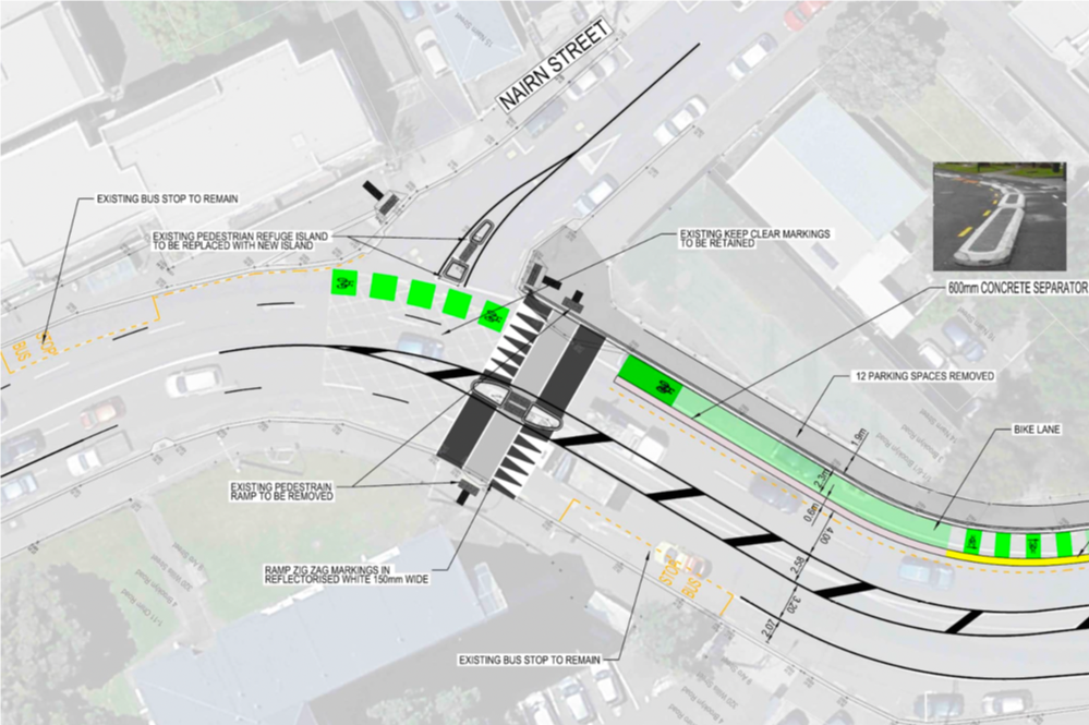
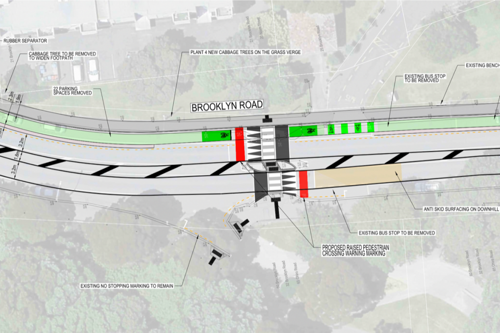
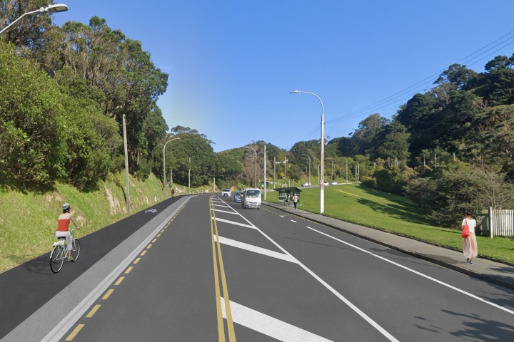
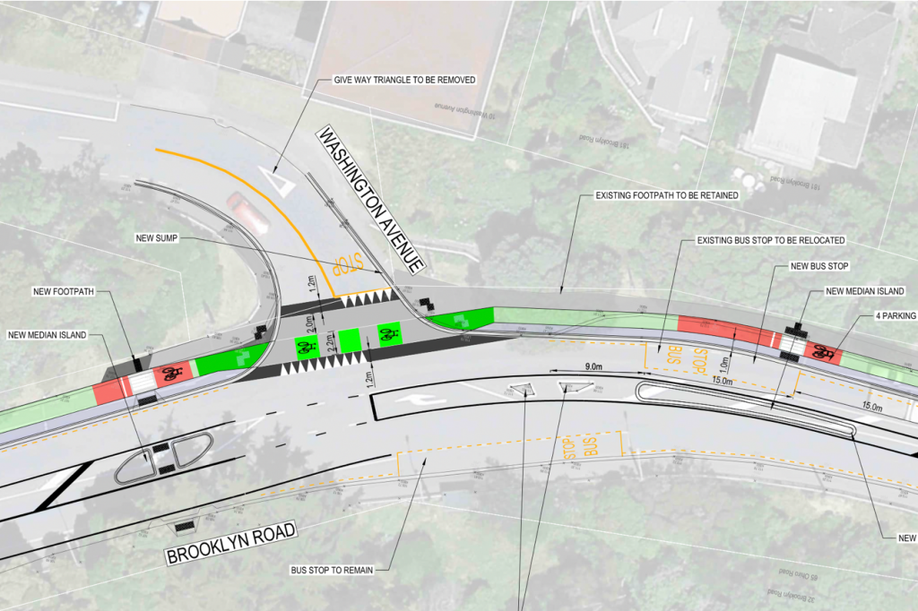
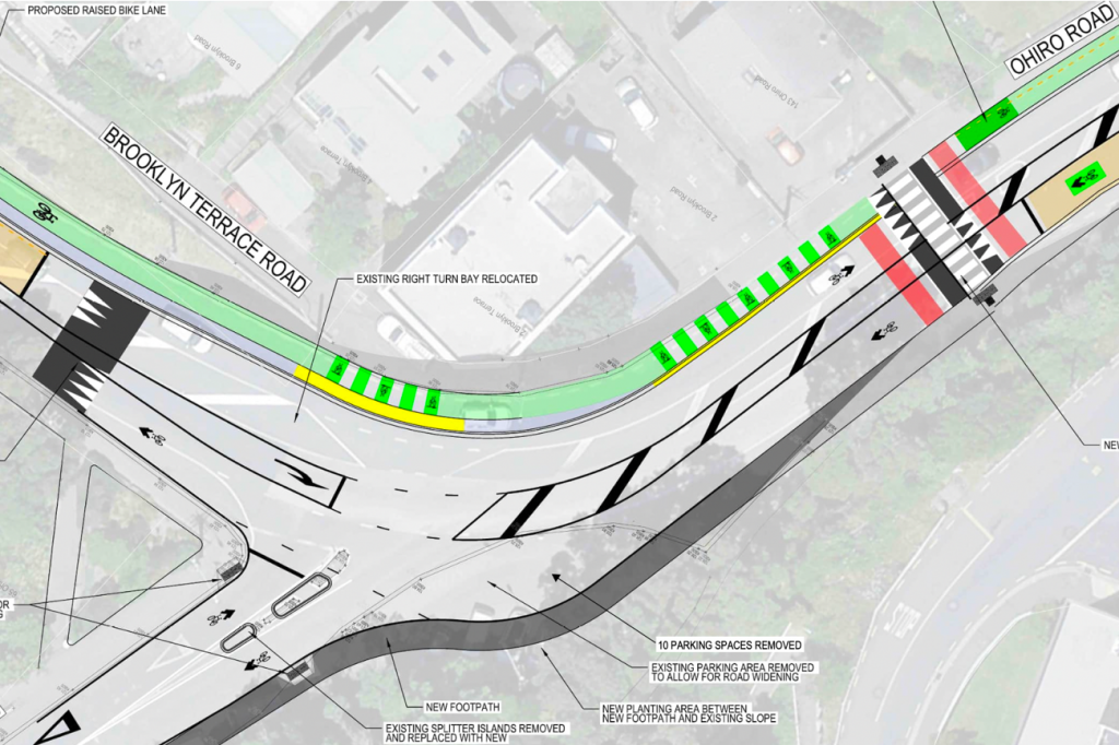
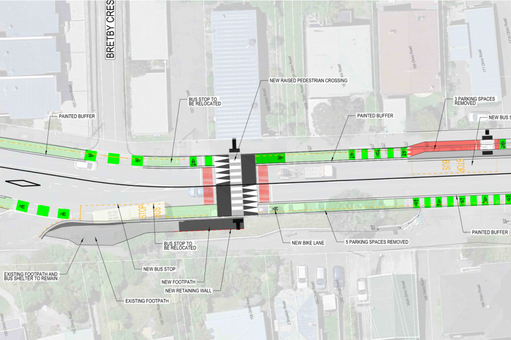
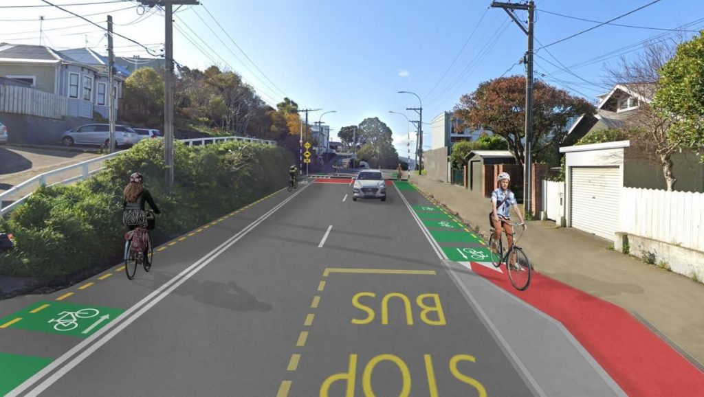
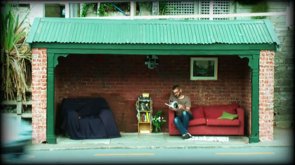
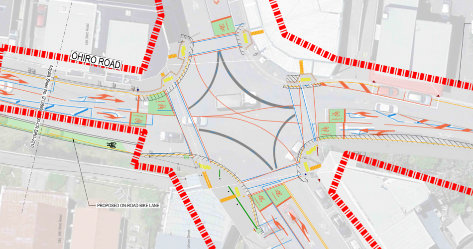
This picture and plan above is the main thing that strikes me as fairly pointless. Yes, by all means, put in a place for people to cross the road, but surely put it in line with some logical desire lines for walking. Can anyone tell me what the point would be of having a pedestrian crossing that crosses the road from outside someone’s house, to a blank wall covered in grass and shrubs on the other side of the street? Eh? I’m fairly sure that is probably the least most useful place to cross, along the entire street. As can be seen form the picture above, there is not even a footpath on the other side, and the curiously raised piece of road is not accessible from there. Move it one way or the other, or delete it altogether, its fairly bloody useless there. Plus, I think that it does away with the coolest bus stop in Wellington, which Maximus featured here on the Fish many years ago.
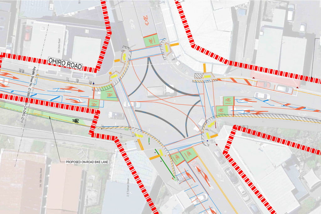
I’m sure that there is a rational reason why this main intersection is not part of this cycleway package, but the official documentation says that it is out of scope, as it is being done by WCC. But surely, I hear you say, it is all being done by WCC? Apparently not – or perhaps it is just a different funding package. Still – its all ok as long as the two schemes work in together, right! Right?
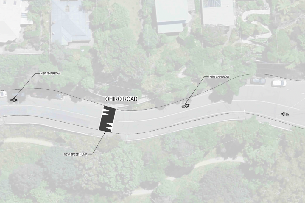
I’m going to refrain from commenting on this, as it is really not aimed at me. So, over to you.


Last time I worked in the area there were quite a few pedestrians walking down to that “walk into a wall” crossing area but it was up at the crest of the hill
Helen St (the really wide one) down through Tanera Cres
The pedestrians go up the ridges a lot like deer travel in the bush
Incidentally, just out of sight on the left of that pic is a really nice piece of recycling – a second hand house moved on top of a new garage – there are a couple of those on that street
On the subject of design, any idea who is responsible for the cool bench on the entrance to Central Park opposite Washington Ave?
I think I recall that either Local or Isthmus (both landscape architects) had been responsible for the Central Park upgrade – so probably one of them ?
As far as I can make out your puzzling crossing is at the spot where I used to take a deep breath and cross from the southbound bus stop over to the bottom of Tanera Crescent and all the delights beyond.
The blank wall is actually the backdrop to the coolest bus shelter and extends on either side of the intersection. At the moment you have to perform a weird pirouette around the sharp end of the northern section of the retaining wall, watching out for main line traffic on Ohiro Rd and the wide arcs described by cars making the blind turn from Tanera. All going well, you gain the sanctuary of a stub of broken curb before crossing the side street to get back on the footpath.
Seems like a good candidate for a pedestrian crossing to me. .
Well, that’s good to hear – cos it makes no sense on paper, but evidently makes good sense in real life. Even if that does involve you pirouetting on small pieces of broken concrete.
The crossing to the wall makes sense with how Brooklynites use that busstop. Lots of people cross Ohiro there because there’s no footpath at street level on that busstop side. Most people don’t want to cross the road further down and then climb uphill and walk down the stairs to the stop. They’ve actually done a lot of really good local consultation on how cyclists, pedestrians and bus passengers use the area. The number of parks going from there aren’t going to be popular though – they’re mainly used by residents who don’t have offstreet parking, and they’re always full overnight.
BTW – it’s the Malaysian embassy that’s in Brooklyn, not the Thai one!
Thanks HSM – glad it makes sense to all you Brooklynites, although it still makes no sense to me. But that’s why I left it up to you all to make comments – I’m clearly not a regular enough visitor to the area.
The crossing is to link Tanera Cres/Helen Street with the outbound bus stop. The footpath and retaining wall is being extended to put the crossing as far south as possible (away from that horrible hairpin intersection).
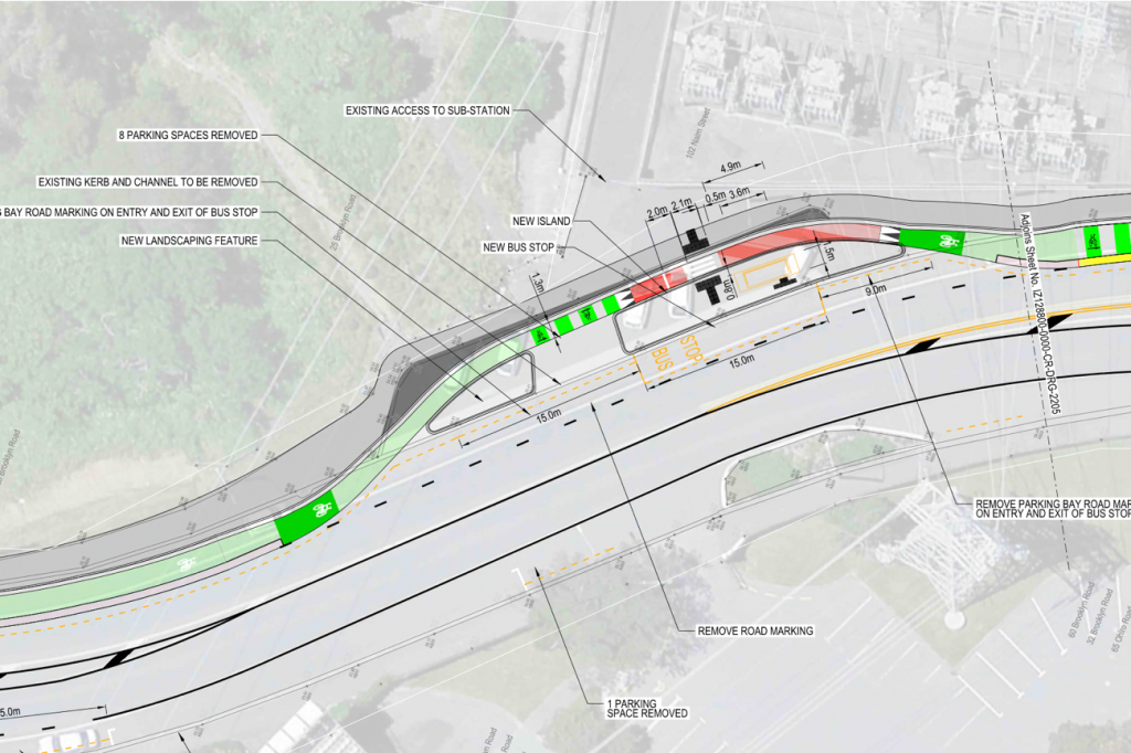
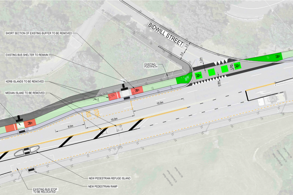
There will just be 1 bus stop between the top of Brooklyn Rd and the lights instead of 2 currently. Makes total sense, I always thought it was bonkers to have 2 within 300 metres.
I hope the new lane widths on Brooklyn Rd will be wide enough to handle buses on the bends. I have my doubts about the road design skills of LGWM after seeing <3m wide traffic lanes on the Bowen St bends – all the buses trespass over the double yellow lines to handle the corners comfortably. So dangerous and so avoidable. There’s some lovely WCC peeps there every morning (4 of them – where do they come from?) videoing the bus lanes to make sure no errant drivers use them (good!), but I bet my rates increase they don’t even look for buses cruising outside their lanes.
So – can anyone tell me if the area within the Red band on the last plans makes sense to them? I’m not sure why it is in a separate contract – but does the actual plan, as drawn here, make sense?
They’ve been working on the intersection for the last 6 months or so, repairing pavements and waterpipes, realigning lanes and parking and adding turning arrows to the traffic lights. I presume it was separate because it was a bunch of issues unrelated to the bike lane and public transport (though they did move one Ohiro road bus stop further away from the intersection and even closer to another bus stop)
The new arrows are almost ready to go by the looks of things last week. Probably good to have the tricky intersection work completed ahead of the other (intrasection?) work.
And.. at least we have red and green arrows, unlike Christchurch.