Following on from Sea Monkey’s photos last week of a giant crane amidst a sea of abandoned prefab house parts at the Countdown supermarket near the Tawa off ramp, the Eye of the Fish has been looking a little closer. We went out to site and found to our consternation that the number of houses on site appeared to be getting less each day – where were the houses going? Was someone stealing them ? Were the receivers taking the houses back to the factory? What was actually happening on site?
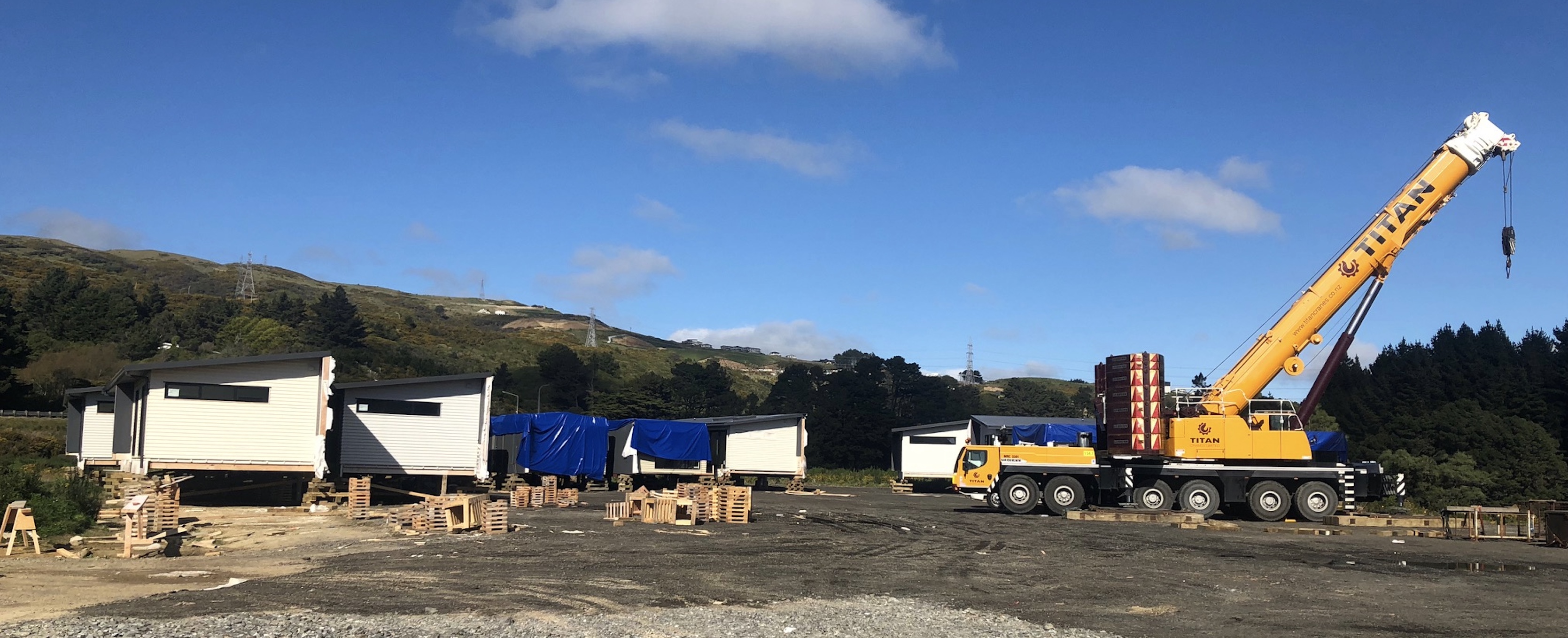
Luckily, the answer is all good. Over the past several months the contractors have been building platforms for the houses to sit on – and over the past couple of days the mighty Titan crane has been lowering houses over edge, stacking them 2 high in their finished arrangement. Looks like there will be a little work stitching the cladding together around the middle, but overall, of course, the units are looking great – onsite for only a couple of days and already looking complete. That is the beauty of Prefabrication as a means of production.
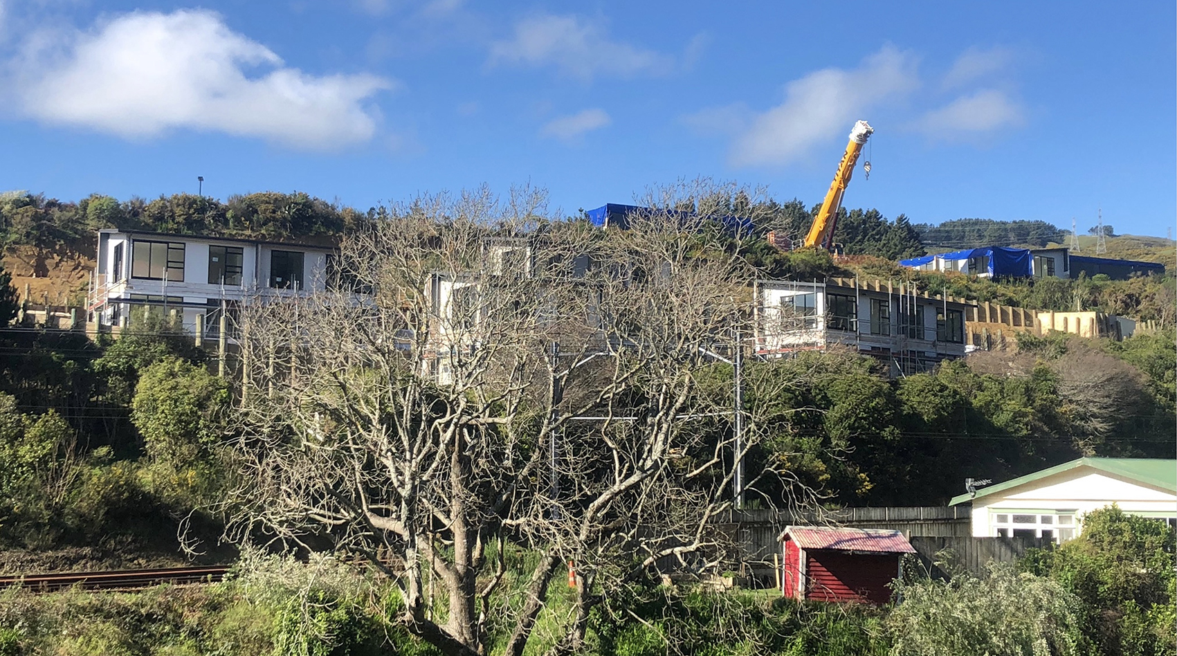
The site is an odd one, it must be admitted, with it being right next to the supermarket and the highway, almost directly above the Tawa creek and the Kapiti train line, right across from the Women’s Prison, etc, but also faces north-west, with the houses all being designed for the sun. They’re pretty simple houses – as basic is as possible – but I’m still going to go and visit just to check out their build quality, when at last it is open to the public.
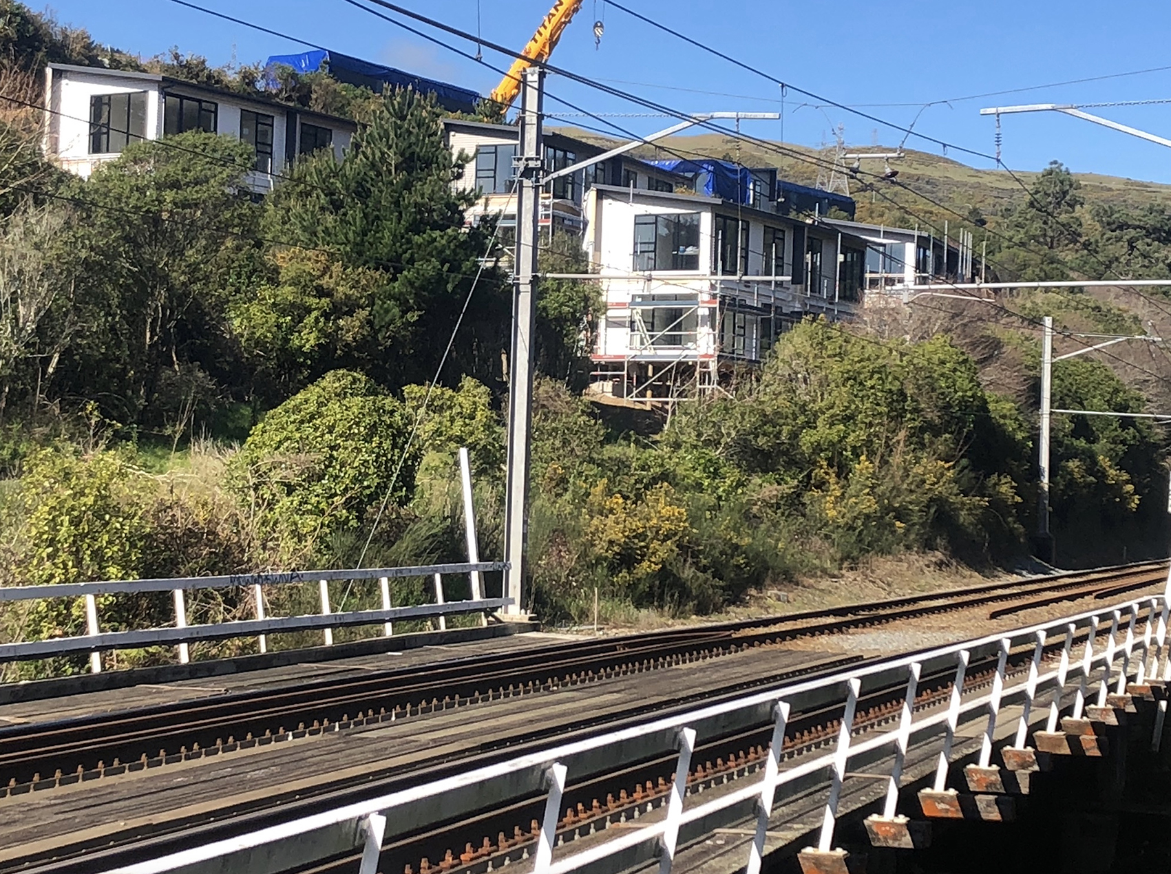
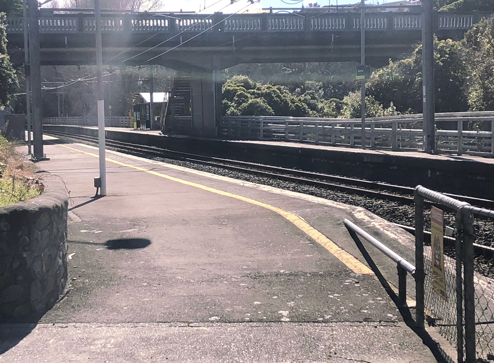
The big question for me though, is: given that the housing is less than 100m to the Takapu Road rail station, how do they get there? There is, after all, not just a railway in the way, but a stream – and a rail bridge across that stream. I would have loved it if the designers had designed in a fresh little garden path straight to the rail station, but am very much less interested if the inhabitants are planning to drive into town.
As it is, I’m guessing that Kiwirail have not been keen to have private access onto their least-used station, and are forcing the inhabitants of the Matrix to instead take the blue pill and walk down the supermarket road, across the busy traffic bridge, and onto the station platforms that way. That’s fine: it’ll do.
I’m trusting that there is enough money left in the receiver’s pockets that they can get this project completed, sold off, and the money gets paid back to the relevant creditors. I’m also hoping, just quietly, that the name of Matrix Homes gets cleared, the factory gets re-opened, and the prefab revolution continues apace. It’s important for NZ that it does. And these small homes are just a first step along that way.


Re: least-used station, I’m sure Kenepuru would take the gong for the Kapiti line (pre-Porirua. It was in competition for this with Muri, before that station’s closure in April 2011.
Whene’er I travelate through Takapu Road on the railed locomotive vehicle during both peaks, there are always dozens of pax getting on and off.
https://en.wikipedia.org/wiki/Muri_railway_station
Aaah, my little seamonkey madness friend, then you have seen wonders on the old main trunk line that I have not ! Whenever I’ve gone on that line, i’ve not seen many get off there at all. But I agree – Kenepuru would indeed be even more sparsely populated.
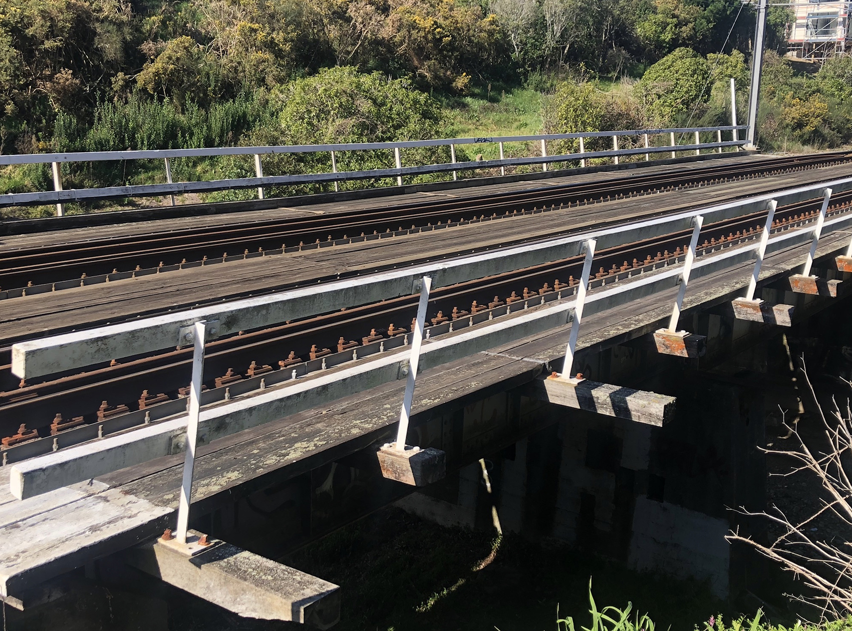
I just spotted that there are even timber planks across that bridge – don’t know about you, but if I was going to go to work from here, it looks like a nice simple stroll down through the shrubbery and across the old bridge. Noice.
Hi Leviathan and Sea Monkey.
I chaired the hearing for the Countdown Supermarket on Takapu Island a few years ago. At that time there was an expectation that the rest of the ‘island’ would be developed, and the part nearest the station (which is well used) was being considered by GWRC for an extension to the existing park and ride.
One of the conditions we put on Countdown came from some assertive use of the District Plan requirement that development provide for active transport and public transport (ie not everyone accessing the ‘island’ would have to use a car. We required that Countdown would contribute to creating a pedestrian / cycle link between the ‘island’ and Takapu station / which would therefore also link to Ara Tawa – the shared path that runs all the way from Takapu station to Porirua town centre.
Our thinking was that a bridge from the railway station would allow pedestrians and cyclists to avoid having to cross the busy main road off the motorway.
As there has been to date no development since the Countdown supermarket nothing more has happened, but it is something I will ask the consents and planning team about.
We should always be looking to get the best possible outcomes, not just the barely adequate.
Warmest regards
Andy
Id like to see the shared pathway extended from Takapu Rd to Johnsonville. I do not like cycling on Middleton Rd, its very narrow in places.
Didn’t WCC already put in a cycling path from Jville to Porirua?
JFD – from Porirua to Takapu Road, the cycle path is a pure joy. After that, not so much. All that was done between Tawa and J’ville was a strip of asphalt laid over part of the shoulder on Middleton Road. Nothing to make you feel separated in the least. Safer yes, but not safe.
To be fair though, you are really limited for space, unless you invest massively in retaining structures and also energy dissipation solutions in the waterway. That stream can fair tear through there in an extreme weather event, and has done, undermining parts of the road (which have recently been repaired).
Is Middleton Road that wild, twisty, back country road like something out of Deliverance? If so, then yep, I’d be amazed if a quality cycle path ever manifested itself there….
Levi – correct, it is (although I would reserve your judgement about Deliverance – it’s actually a nice walk/bike, safety bubble distance notwithstanding) and I share the same amazement level.
It’s one of the quirky parts of Wellington that I love so much – Middleton Road, Makara Road, Ohariu Valley, and Paekakariki Hill Road – all totally mad ! Although, the maddest of them all has to be Devon St in Art Valley…..
Sometimes I wonder what drugs our founding forebears were on when they made some of those roads…. Rally of Sardinia has nothing on Paekak Hill Road !@
As someone who marooned a long-wheelbase Bedford van belonging to the Auckland University Students Association van on curb of THAT hairpin on Devon St the first time I ever drove in Wellington, I salute our glorious traffic engineers!
Speaking of the Tawa to Porirua Cyclepath,
This gives me a chance to get something off my chest that hopefully Andy F could follow up on
Point 1. Its great, For a family with young kids (5 and 7) on bikes its probably the safest cycleway in Wellington ( other than the waterfront).
point 2. There is absolutely no publicity about it anywhere on the WCC council website,
Look under cycleways – nope, only talks about new ones being built,
https://wellington.govt.nz/services/parking-and-roads/cycling
I can vaguely find a little green line linking Tawa in Porirua on this page,
https://www.transportprojects.org.nz/the-cycle-network/
But there is no what or where it might be….
Look under walking paths, nothing, not even on the “citywide map and guide”
https://wellington.govt.nz/recreation/enjoy-the-outdoors/walks-and-walkways/citywide-map-and-guide
I tell other friends with young kids learning to bike that we take ours out to Takapu Road station and they ride their bikes from there to Porirua. We get looked at like we are inhumane monsters, with comments of, how do they do that?, what about the cars? isn’t it dangerous?
When I say there is a great cycleway, they say we’ve never heard about it, where can we find out information about it…..
That was the first Cycle-path that Mayor Wade-Brown initiated – I thought that she was mistaken at the time for doing one so far out of town (to the rest of us living IN Wellington, Tawa may as well be Whangarei…) – but in retrospect, with the total bloody disaster that the Island Bay Cycle Path debacle has turned into, she was absolutely bang on the money.
Doesn’t excuse WCC from not publicising it though! Get on the case WCC !
Middleton Road could very easily be made cycle safe and friendly. There is a nearby parallel road called The Motorway that motor vehicles could be required to use. This would only need the installation of retractable bollards to prevent all motor traffic except suburban buses and emergency vehicles from being through traffic along Middleton Road.
e.g. https://www.youtube.com/watch?v=GuWujAnd5lk
Off topic, but since Levi has mentioned Island Bay, bollards could also simplify the cycleway extension up through Berhampore. Retracting bollards at Wakefield Park and Britomart Street would remove through traffic from Berhampore (making it a much more pleasant suburb) and allow safe cycling on the existing roadway. Because there’s no immediate parallel road I predict bus and cycle use would increase. A win win. Such schemes are common in the Netherlands where it is made not possible to drive through the centre of a town (a long journey on a ring road is required), but direct cycling and walking are possible.
I was more thinking rather than Middleton Rd a pathway on the Rowells Rd side of the Tracks to connect Jvill to the shared path at Takapu Rd.