
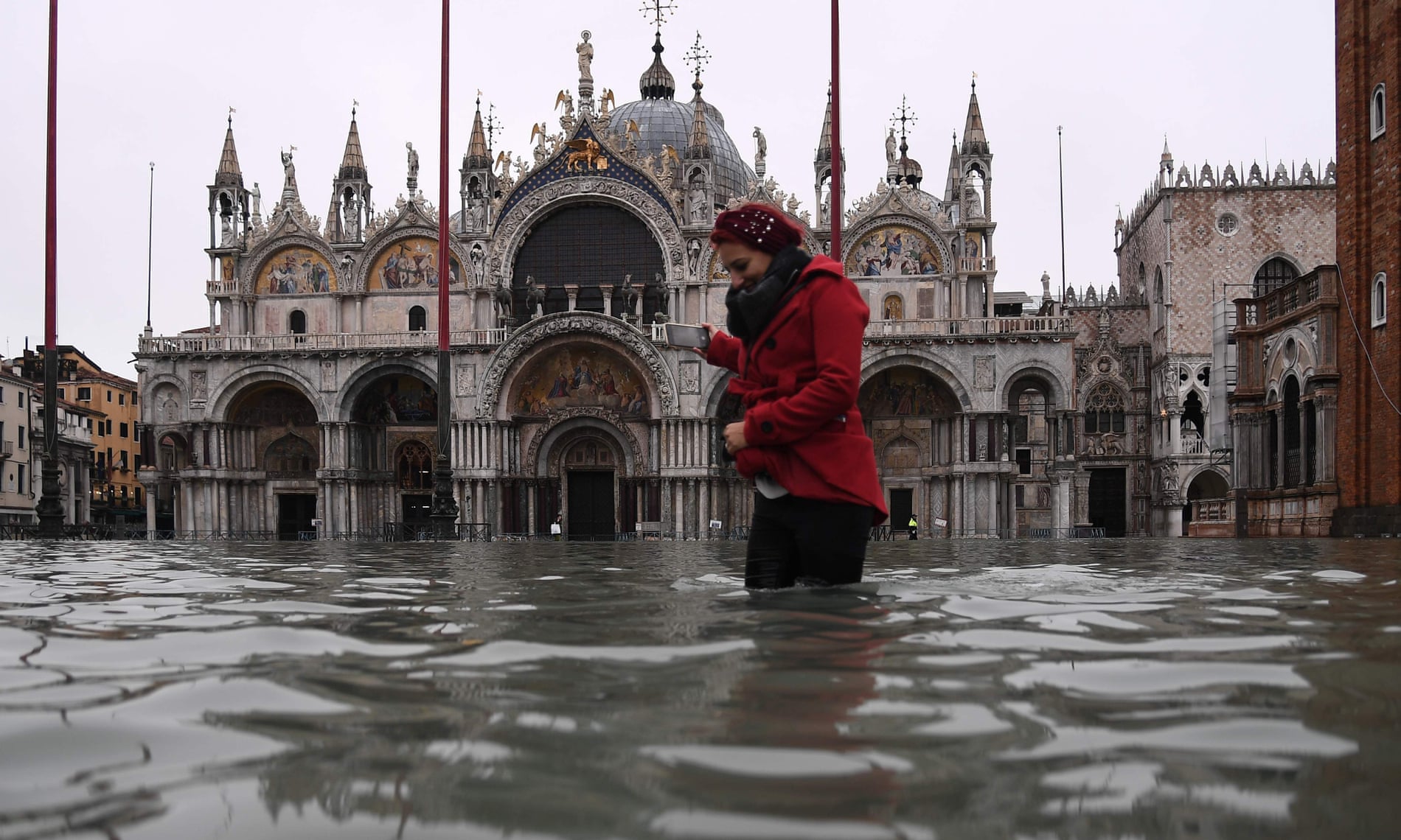
Venice is flooding, as we speak, with a tide that is the second highest ever recorded. Only 1966 was higher. Venice has flood gates, being built by Project Noah – Italy being Italy, it is incomplete. Venice being built on mudflats in a river delta, you can’t be exactly surprised – it is much like Bangladesh, or the Hutt, but is arguably better looking than both of those.
Wellington is not built on a flood plain, but is for the most part, barely above water. Lambton Quay is only 2m to 2.5m above AMHWS (average mean high water springs,), which in itself is a fairly bogus measurement as it varies all the time dependent on the tides and the moon and the amount of pixie dust in the measuring cup – but even now, at present, when we have a storm event, lots of rain and wind from the wrong direction causing a storm surge, we can get salt water forcing itself into the stormwater system and almost bubbling up from the gutters along Lambton Quay.
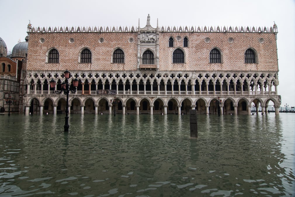
Venice is of course closer to the waterline than Wellington, being in places only 64cm above their version of AMHWS (St Marks Square is the lowest point, hence it floods the most often – “aqua alta”). But today, with a rise of 187cm, about 80% of the city is flooding.
How would Wellington cope? How set up are we to combat a flood event / sea level rise?


“How would Wellington cope? How set up are we to combat a flood event / sea level rise? ”
Prey for a decent (but not too decent) earthquake on the wairarapa fault….,
(we got about 2m of uplift in 1855….. which ended plans use the “basin lake” as an inland dock…..
Other than that I suspect a dyke along lyall bay, and locks/ flood barrier at wellington heads will be the likely solution in 100 years time….
greenwelly – if we ever put locks / floor barrier at Wellington Heads, then bang goes any ferries in and out, or any large cargo ships etc. Basically: never going to work there.
Given that Sealevel rise was forecast at about 1m by 2100 and is now forecast to be at least 1.4m by 2100 (only 80 years away) and far higher long term, then it would seem we need to be thinking far more cleverer than that….
Thinking about when would be a good time to re-site the terminal to the other side of the airport so it’s access is not vulnerable to rising damp along Cobham Drive/Lyall Bay?
Or where the alternative to SH2 might run.
Or at what point Seatoun becomes once more dependent on a ferry service.
Sea-walls locks, and dykes? Doesn’t New Zealand have difficulty building things that don’t leak?
Taihape’s looking attractive. . .
It is an interesting problem with dykes and sea walls – exactly where do you draw the line? Literally – a line. Raised barrier. The Dutch did, in truth, draw one single line along their coastline, in a place called Zeeland – which we are named after of course, New Zealand being the long flat place that is mostly surrounded by the sea. I think GreenWelly’s hopes that perhaps we might rely on going up again in the next big Quake, is problematic. So is a suggestion to wall us off at Wellington heads.
Realistically, Kilbirnie, Lyall Bay, Rongotai – they’re history. Literally formed out of the debri of a past tsunami which overswept them and left behind a giant sand bar, anybody buying there should know they are on borrowed time. It is the CBD that is more of a worry… former Harbour Board land along the waterfront, all being created out of thin air (or actually, out of water) which does need a wall.
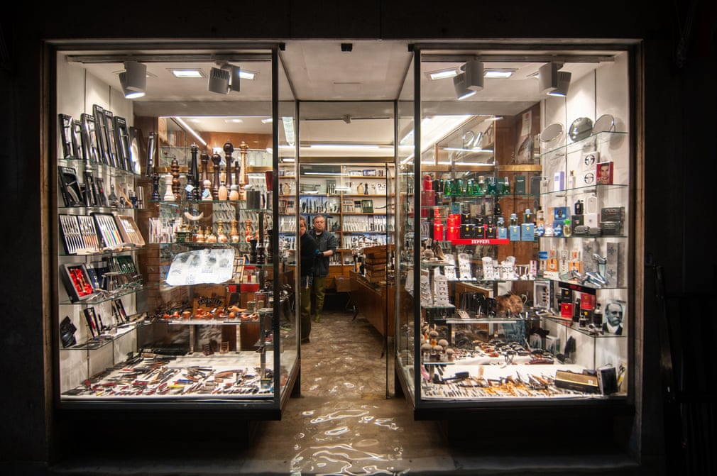
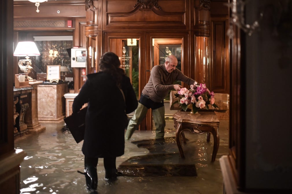
The thing that surprises me the most about Venice is that, given how often it happens, they seem to be both surprised and ill-prepared for it. I mean, you know, build your shops with waterproof fittings on the lower 1m of your shop walls for a start. Use stone rather than timber and gib. Have gumboots ready by the front door. It’s not like it hasn’t happened before… and you just know it will happen again…
Why fight it? Start digging the canals now. Vaporetto line along Calle Lambtoni!
Even if some locks could be built that would admit ferries and ships there is the small matter of the Hutt River which keeps trying to fill the cup of Port Nick up
Obviously an aqueduct is in order
I believe an earlier EOTF post involved the concept of damming the heads and growing tulips in the now-dry harbour? Or was it all a fever dream?
Good point starkive – and yes, great point 60MPa – the Hutt River, yes, that may have a slight effect that could ruin Greenwelly’s carefully-laid plans…
I was checking the archives (now dreadfully out of date again) to see what we had written – i think that Minimus wrote a great piece on filling in the harbour once but I can’t find it – but I did find this piece by my forefather Maximus on a very similar subject to this post above: http://eyeofthefish.org/seaside-cities-rising-waters/ Evidently, great minds think alike.
How’s this for a bit of moist irony?
https://www.theguardian.com/world/2019/nov/15/venice-council-flooded-moments-after-rejecting-climate-crisis-plan
indeed – I’m not 100% sure of the Italian swearwords for “what the heck is this crap I have to put up with now?” but it will involve many gestures of arms, clicking of teeth, gesticulating forearms, and at least one “Basta!”
Even better/worse!
https://twitter.com/CarlosMorenoFr/status/1195093882985426944