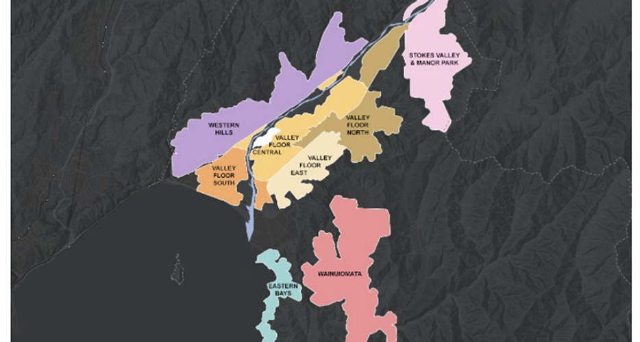
In all the fun and fuss over things like the Election, the country’s love affair / hatred of Winston (there is something very 1984 about Winston being the BiG Brother watching over us / controlling our every move), we (well, me) may have taken our eye off the ball. Well, not the ball, but the Hutt. It seems that the Hutt has fully adopted the MDRS changes proposed by the Government, to the extent that all the following things, which were proposed, have now been implemented, and are now operative. This includes some revisions to the Proposed District Plan, and there are many pages that look like this (only usually more words and less diagrams).
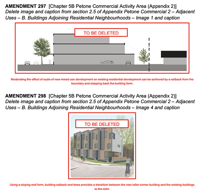
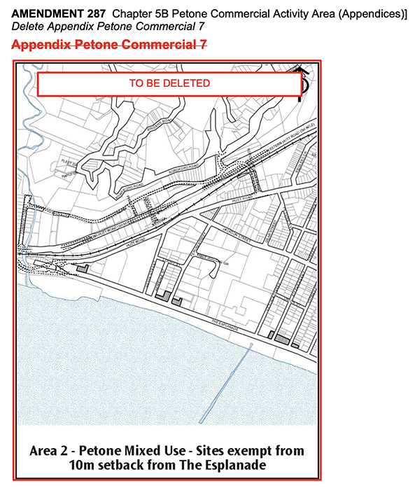
I would have thought that a diagram like this/these was quite useful. Apparently not. They have been deleted in their entirety. Possibly they may have been replaced by others. Or perhaps not. It is unclear. There was also going to be a zone with a low height setbacks for the Light Commercial zone in Petone, but that appears to have been canned as well. See below.
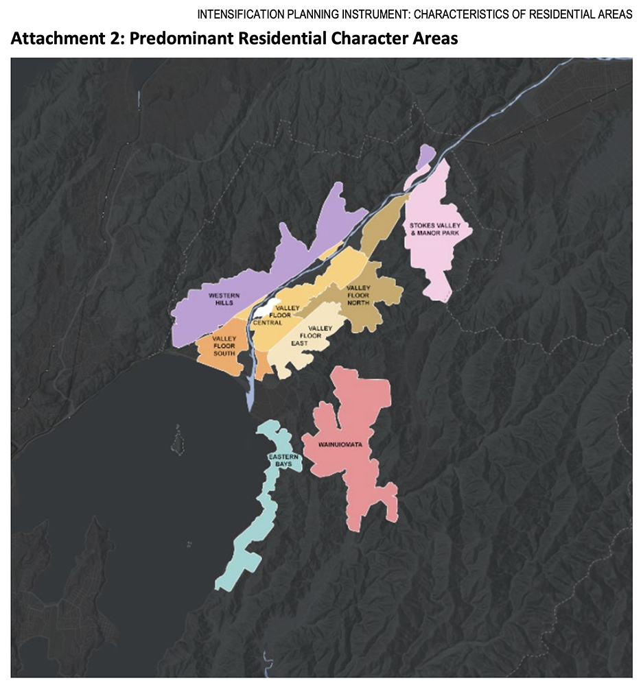
Key changes recommended under Plan Change 56
- Reductions in the size of the High Density and Medium Density Residential Activity Areas in parts of Harbour View, Korokoro, Manor Park, Normandale, and Tirohanga
- Increases in the size of the High Density Residential Activity Area in parts of Moera and Naenae (long overdue, and already happening)
- In Eastbourne, Stokes Valley, and Wainuiomata change from High Density Residential to Medium Density Residential but simultaneously apply a higher height limit of 18m (approx. five storeys) and over a wider area (18m in Wainuiomata? That’s tall for a suburb which is currently resolutely just 4m tall…!)
- Increase the height limit from 22m to 36m (approximately ten storeys) immediately adjacent to the city centre (I really want to see some maps of that – but I can’t get the maps feature to work. Anyone have any luck?)
- Not proceeding with the proposed new residential heritage areas of Hardham Crescent, Hutt Road Railway, Moera Railway, Petone Foreshore, Petone State Flats, and Wainuiomata Terracrete Homes (because, alleged Heritage)
- A slight expansion of the Jackson Street Heritage Area to include 352, 358, and 362-364 Jackson Street (because, alleged Heritage)
- A lower height limit on regional council-owned land near Korokoro urupā, from 22m to 12m (six storeys to three) (because, respect for the dead? Say what? )
- A selectively more generous recession plane— in the High Density Residential Activity Area for developments that provide a significant number of new homes, to encourage buildings to be located closer to the street (more generous = double speak for taller? less sunny? more generous actually meaning more nasty or less good? Double plus ungood?)
- A simplified resource consent pathway to encourage more small-scale commercial activities in High Density Residential areas at the ground floor of apartment buildings (Hallelujah !!)
Plan Change 56, including the panel’s recommendations, became operative on 21 September.
Note: The Government requires this change to the District Plan to run on a streamlined process under the Resource Management Act, and there is no process for appeal by Council or any other group or individual.
Let us know what you think – is this a good thing or a bad thing? Or just a thing? How does it affect you? Or your livelihood?


,b>GIS Maps outage
We currently have an issue with our GIS and Mapping Services. There is an outage and the following services are unavailable: GIS Maps, LIM Payments, Report a Problem, Rubbish Collection Address searches and historic aerials. The address function on the Too Good To Waste website is also impacted. We’re sorry for the inconvenience and we’re working to get these back up and running as quickly as possible. Thanks for your patience as we work on this.
Seems like it’s not just you Nemo.
Thanks for that. Explains why I could not find the Maps ! What do you reckon, SeaMonkey? What changes are we going to see in the Hutt? Does it affect you at all?
Personally, no; professionally, perhaps?
Map Service is back up and running now too.
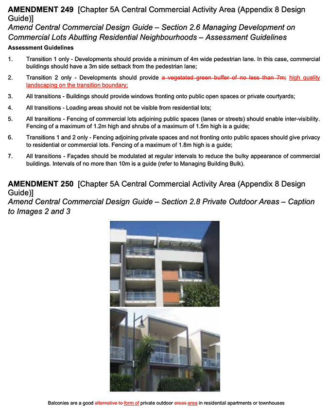
I don’t know about you, but I find this both fascinating and boring at the same time. Boring to read, and to wade through all the dross of the committee’s work, ticking the boxes and crossing the Ts, but also fascinating to see the workings of the brain of whoever made these changes. Take for instance the picture above, where someone has carefully removed the requirement for a “7m wide vegetated green buffer”, and replaced that request with “high quality landscaping on the transition boundary”. While before there was a factual, functional requirement (7m), now there is a more wussy, nebulous requirement, that will probably require a judge to adjudicate on: “high quality landscaping”. That’s such a hard requirement to determine and to prove. Who is going to adjudicate on whether your 6 planted coprosmas and mixed bag of muelenbeckias will result in a high quality result? Does landscaping include hard landscape as well as soft? If i pave it in bricks, does that make it quality?
I think the bullet points you have noted are changes to what was initially proposed in Plan Change 56. So not changes from how the district plan currently is, but changes from how it was initially proposed to be in future (if that makes sense).
Overall my understanding is that much of the valley floor in Hutt City is now zoned 6 stories. They are allowing 6 storeys 800 metres from train stations and Petone and 1200 metres from the edge of the CBD.
Possibly those pictures are no longer relevant as they have been supersceded by higher zoning.
Thanks Captain. I really despair on how impenetrable all this gumpf is – so opaque to most people.
I reckon if you did a poll amongst Huttites as to what the height level was near their home, I suspect that none of them would know what the effect on their property was…