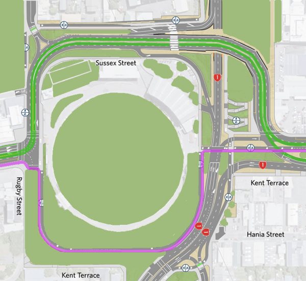
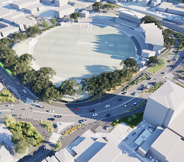
We’re part of the way through the public “consultation” phase of the NZTA schemes for “improvements” around the Basin Reserve, and so far we’ve only heard one side of the story. For whatever reasons, political, Machiavellian, or incompetence, only the “two options” have been proffered to the public by the roading lobby. That’s a real pity – as I’ve noted already, and which Scoop picked up on, one of these “options” is not really even slightly feasible – and so we have got a fait accompli – here is the official option, take it now and tell us how much you like it.
That’s not consultation, that’s just insultation.
It’s also a bit of a shooting yourself in the foot action, in my ever so humble opinion. By shutting off the other options, and burying them deep in their twenty zillion pages of documentation on this project, they’ve lost the chance to show the public the real truth on what other options are there, and what the reasons were that they are not being pursued. There may be real reasons why it has been presented this way – as it turns out, we have only the one feasible option to discuss, and to look at in the NZTA roadshow of charm and biscuits that has been on at the Basin this weekend.

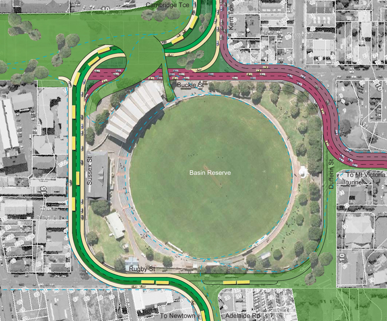
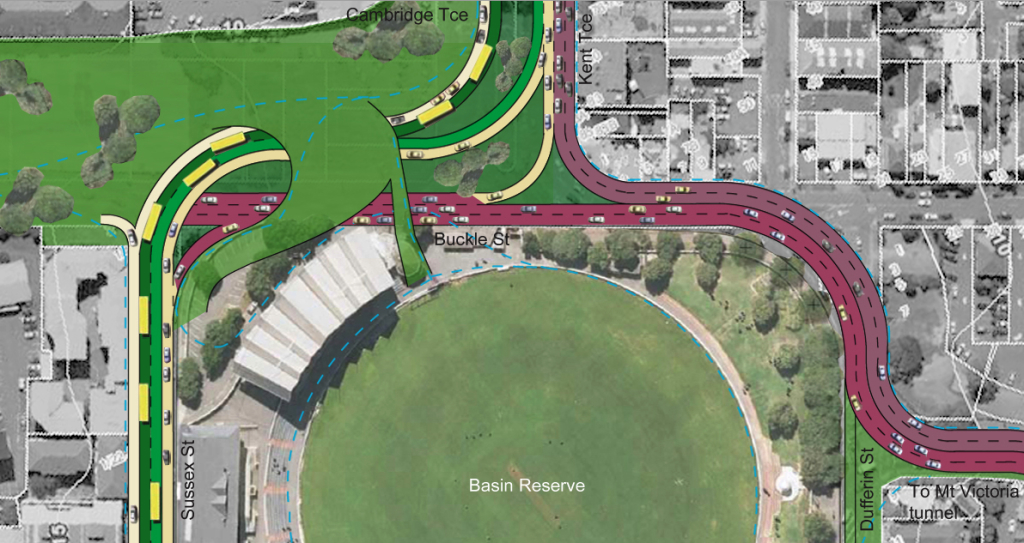
But in a snub of the nose to the back room traffic boffins at NZTA, a group from the Architectural Centre has put up an alternative to the official scheme, and it seems like a real goer. They hinted on something like this back in February 2010, with a submission to the Council on the 2040 initiative, where a bit of “think different” thinking was evident for the Basin (as well as a wonderful curly roller coaster idea on the Outer Tee). Since then the Arch Centre seems to have been spending a bit of time building up an arsenal of arguments as to why the Basin is special and shouldn’t be treated to an overpass – of which I’d basically agree to the Nth degree.
Curiously, none of the myriad of options that NZTA have shown us that they have explored, seem to have looked at something as outwardly simple as that shown by Arch Centre’s “Option X” – basically that the east-west State Highway should go swooping under the north-south local road. I dunno – seems like a simple, logical thing to do to me. No need for that awful silly aerial highway that we call a “flyover”, and that NZTA are calling (rather optimistically) a “bridge” (note to NZTA – don’t try to be silly – its a flyover, not a bridge, and you know the difference as much as we do).
NZTA have done some sums on Basin options, but they seem to have looked at some rather ridiculously expensive options such as tunneling all the way from Paterson St all the way over to the other side of Taranaki St, through the presumably cluggy awkward mud of the Basin along the way. Such options have been discounted for reasons of Aquatic wildlife as much as Cost. Did you know that the Wellington inner-city waterways are full of eels? No, neither did I. Makes you a little wary of going wading in the reeds in Waitangi Park to look for that lost ball…
Costs are the real reasons though, that NZTA’s tunnel options have been discounted around the Basin. Interestingly, a huge amount of study has been done on the rationale around putting the State Highway underneath the Memorial Park – it seems to have been an accepted part of the design for quite some time, and yet now looks almost totally discounted, despite the Arch Centre’s scheme showing how well the road works when it is underground.
I’ve got a lot more to note on this, but right now I’m having issues posting pictures into this – the new server is playing up – so I’m going to stop there and recommend you go to the Arch Centre site and have a look at their argument.


This is quite brilliant! A few points tho:
The south to west movement involves an underground merge lane which is a little strange. Cost minimisation means designers will be tempted to have a narrow short merge lane and if motorists mess it up they might crash in to the tunnel wall.
There is no south to east movement.
It’d be nice to see a version that included eastward traffic on the bypass. Presumably this traffic isn’t going to drive along Vivian St for the rest of eternity. It’d be easier to design this now, rather than having to retrofit it in the future.
davidp – actually, one of the things buried deep in the NZTA archives is the possibility of them making Buckle St and the bypass 2 way. I’m not sure how serious they are about it, but it is definitely in there as a 10-20 year option. They’re safeguarding their option to make it all two way, and hence to get out of Vivian St. Not sure what that would do for this scheme shown here. Looks as though it might be able to cope with that…
I think it is quite elegant in its simplicity. Not sure it will work though.
The bus lanes are in the middle lane. How will they be accessed?
Where is the school drop point for all the buses from the eastern suburbs? And why are there buses in the green space to the south?
How do vehicles from newtown access the tunnel? Do you seriously think you can get away with one general lane in and out of newtown?
How does the governor general get home? How is St marks serviced?
Where is the tunnels western exit and how does that work?
What’s happened to the creche?
Just looking at this more, how do people from the eastern suburbs access Cambridge terrace or Tory St?
You seem to be treating that traffic as solely focussed on moving to taranaki St and beyond? Is courtenay pl of no interest to the eastern folk?
Voila. This is the way to go. Nice work arch centre. I think it needs some evolution (e.g. in response to Insiders questions there are solutions), but the key to finding a solution here is making the decision to run north/south traffic together on sussex st, that changes everything and puts the planners on the path to a better solution. I also think this can probably be achieved in phases. Phase 1, east/west flows via north side of basin with at grade intersection with the necessary widening works to turn sussex into two way north/south. Phase 2 two way tunnel under Memorial park and reconfiguration of intersection to separate grade with sussex flying over the portal to the memorial park tunnel. Did some drawings of such an option way back when the flyover was first proposed but the councillors (and mayor) I emailed didn’t seem to keen on the concept (too much of a compromise I think!). Travelling so don’t have them with me or would post.
This is what save the basin should get going with, a compromise solution, not a no roads ever solution.
Also again I say we can do more with the eastern side of the basin to allow smoother flowing traffic under a nice pedestrian/cycling over bridge, and by opening the basin up — really that fence needs to be torn down, it should be an open public park (i mean actually feel like a public park) except when cricket is being played then the temporary fencing can be slotting in.
Insider – you might want to post those questions over on the Arch Centre website, they may be able to answer them more than I can. But yes, generally, I’d agree with Erentz that these are all solvable. The general Principal is that access to schools and Gov General etc is all off the local N-S road rather than directly off SH1.
Anybody interested in a discussion if we need to spend all this money on roads anyway, and not on healthcare, kindergarten or nature conservation? NZTA expects more traffic and therefore more roads are required, but from simple observation more car-pooling, a bit of extra public transport and better cycle-/footpaths might do the trick with petrol prices ever going higher.
With all the broadband upgrding going on we should be able to work remotely anyway, allowing to work less days in the office, or more flexibility to avoid traffic peaks…?
But of course designers want to design something, rather than ask themselves if it is really necessary, eh?
Hans: I don’t think it is so much a question of “designers wanting to design something” – but more like Government saying to NZTA that they have to spend the money to get public servants faster to the airport on Friday afternoons, and so that trucks can get from the city to the airport freight terminal with fresh produce. That’s the real driver behind the NZTA project.
Hans – yes Arch centre have taken a look at some of these issues too:
http://architecture.org.nz/2011/07/06/traffic-congestion-part-1-why-are-the-dompost-being-such-d1cks/
There are two parts to the post, the first suggesting that there might not even be that much of a problem, and the second one examining some of the non-built solutions that might (or might not) be useful to think about…
They have made other arguments as well, which Maximus has linked to above, but as the links don’t clearly stand out within the text of fishland, I re-post it here for your pleasure:
http://architecture.org.nz/basin/
looks like abit of a cluster fuck to me. It destroys the only semi decent edge/entrance to the basin at the end of adelaide rd. The open spaces left over at the north western corner look marginal and are not associated with any decent edges. They are also counter to the actual topography. What a terrible end to Kent and Cambridge.
Congrulations Archtecture Centre on suggesting an alternative. I am sure if you had the dollars that NZTA have spent on the proposal the technical issues would be sorted out.
However like Hans I believe that the cost and benefits do not stack up to any intervention here. Isn’t it for every $1 spent there is only 50c return on the NZTA proposal. How does this work in our fiscially responsible times?
Also in reply to Alan large oversize, wide and dangerous good trucks will not be travelling through the tunnels, they will still be going around the bays from Cobham Drive and around Oriental Bay! And therefore still theatening us poor cyclists on this route.
max>actually, one of the things buried deep in the NZTA archives is the possibility of them making Buckle St and the bypass 2 way
If we did this and had to tunnel under the new memorial park (as it should do) then I’d tunnel the whole south bound direction. And that isn’t hard to design because there isn’t much need for on and off ramps. An exit at Vivian St allows south bound traffic to access Cuba, Taranaki, and Tory, and hence suburbs like Mt Cook and Brooklyn.
So… At the new Terrace Tunnel portal I’d take the two through lanes and direct them gently downwards. A separate exit tunnel would stay at the same grade in the direction of Vivian St. Or maybe both Vivian and Ghuznee, if you want. The through lanes would pass under the dental clinic and other buildings in that area, under Cuba, Taranaki, and Tory, and emerge just before the Basin where there would be a multi-way junction.
It is hard to do a tunnel that simple in the northbound direction because Vivian St is the only full length city street in the area. Ghuznee, Abel Smith, and Webb are all truncated. The memorial park would obviously truncate Buckle St. You’d need on and off ramps at Taranaki St, and an off ramp at Victoria St.
If you tunneled both directions, then I’d be inclined to build a linear park between Victoria St and the Basin. Obviously the cross streets mean it wouldn’t be continuous, but it could be a nice improvement to the city.
Richy – you’re right about one thing – it is a really, really difficult area to make it work and keep it looking good at the same time.
I wouldn’t say that it was a clusterfuck – nor that it is counter to the actual topography. But each to their own opinion. More debate please! – there is more going on over at the Arch Centre website as well, where Insider’s comments have been posted, and some replies given.
What’s most disappointing about the Architecture Centre’s enlightened approach is that the NZTA refuse to even consider it. They were given the early concepts multiple times in the two years since the Arch Centre put pen to paper, yet the cut-and-cover designs are nowhere to be seen in the list of alternatives.
On Saturday I went down to the NZTA Sales Office at the Basin – which does bear an alarming resemblance to a dodgy timeshare operation – and asked why they hadn’t considered it. The salespeople feigned complete ignorance and airily waved away the idea as “uneconomic” – despite their own plans to spend hundreds of millions of dollars on a project that will never show any economic benefit.
It’s almost as if NZTA is willfully designing the ugliest and stupidest piece of roading it can, holding up two fingers to Wellington in the process.
As an aside, it is interesting to note that in the Do Minimum (not Minimus) option for the Total Corridor, it includes the 8(!)-laning of Aotea Quay (as outlined in NZTA’s Total Corridor Technical Note).
WTF?!
The Tunnel to Newtown link is too short and there is no Newtown to Tunnel link. I assume they want Newtonians to use Mt Vic Tunnel but this wouldn’t allow it easliy.