
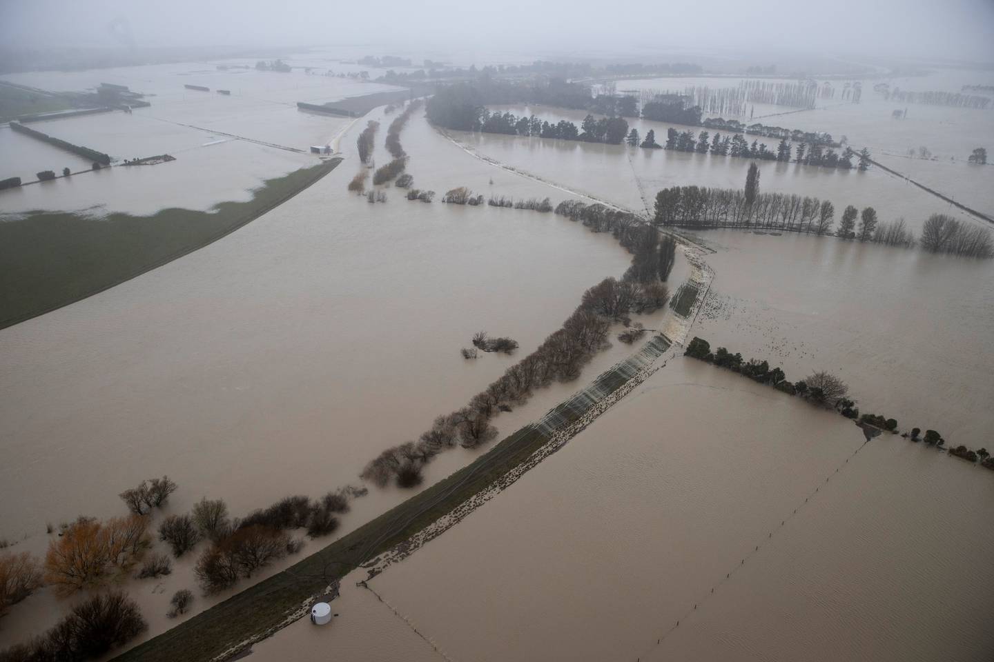
How many 1 in a 100 year events have we had lately? 400mm of rain in Akaroa down south sounds suspiciously like this is more of a 1 in a thousand year event – that’s rainfall in Westport proportions! And meanwhile, of course, we have some rain up here in Wellington and inevitably, Plimmerton gets flooded out. Why is this?
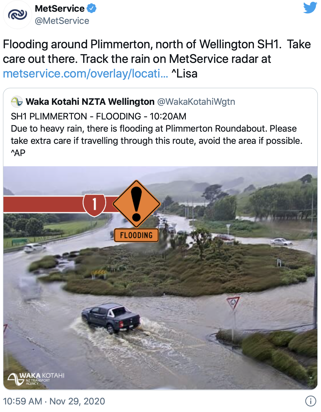
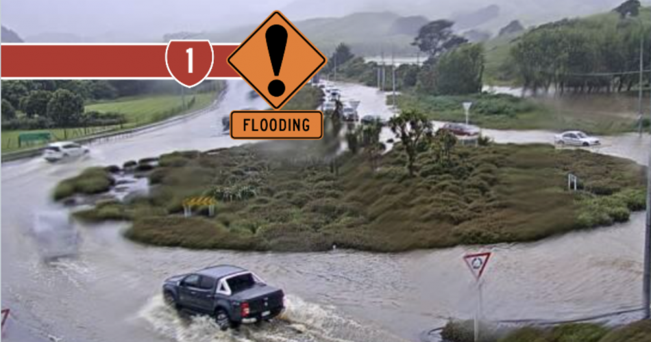
I’m glad you asked. Plimmerton Roundabout has flooded out again – I know because I have a friend who lives nearby who has been flooded out 3 times in as many years. It is so boringly predictable – year after year the area suffers a flash flood and all hell breaks loose. Trucks and cars can’t get through the giant puddle and the SH1 gets closed. Every year, without fail. Why is this?
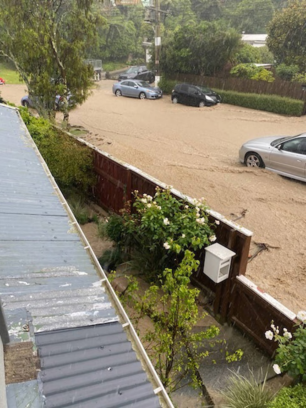
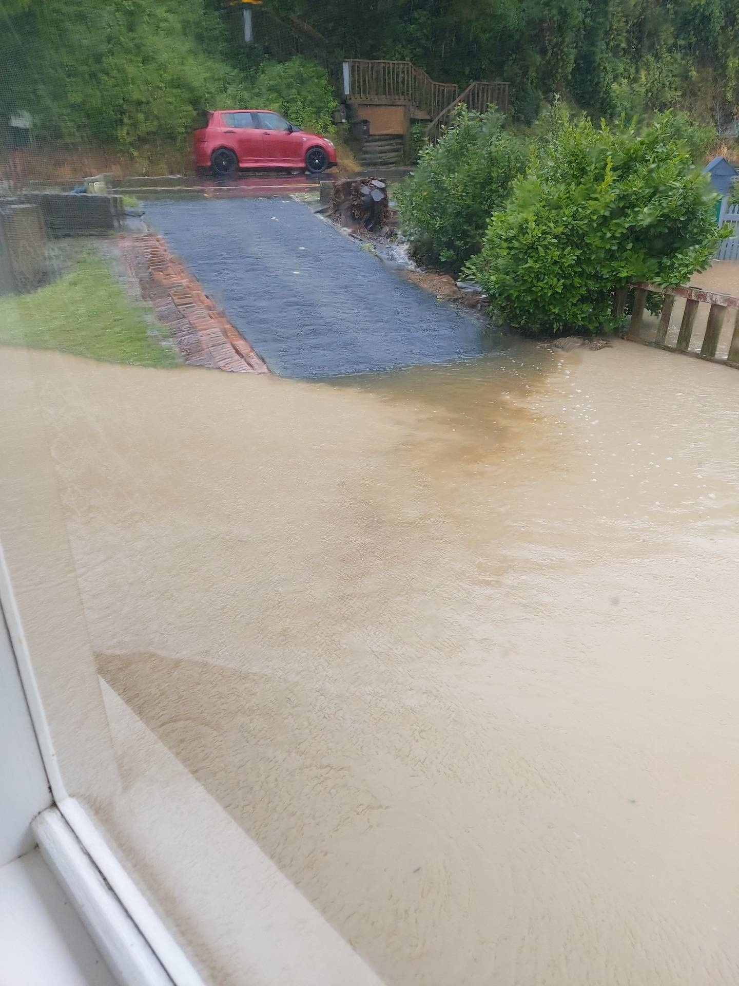
Even more issues are caused down the nearby Airlie Road and Cluny Road, where, predictably, these issues occur equally often – while both areas will share the same storm / downpour, the barriers put in their way are a lot different and the results are more predictable. On the SH1 route there is a roundabout in the way – and that gets flooded. On Airlie / Cluny there are some one hundred houses in the way, built directly on the well-known flood plain – and inevitably the water rises and runs straight through the houses. Every year, it seems – twice so far this year.
It seems to come as a surprise to the cash-strapped Porirua Council – clearing the drains won’t have the slightest bit of difference. The problem of course is catchment size related to the eventual outlet size. The same thing that we are seeing in Canterbury, where the delicate “braided rivers” are currently running flat out, with braids all flying loose and flailing around all over the shop. At least they are more or less expecting it down there. Up here, In Wellington and Porirua, it seems to come as a surprise each and every time it occurs. Why is this?
I thought I’d show some maps I’ve prepared – this first one is the catchment zone of the Taupo Swamp (a celebrated wildlife wetland) which the SH1 runs through. The blue area is the area which is generally recognised as belonging to the Taupo Swamp, while the greenish area is an approximation of the areas that actually drain into it. Rather large, isn’t it. Where does all that water go?
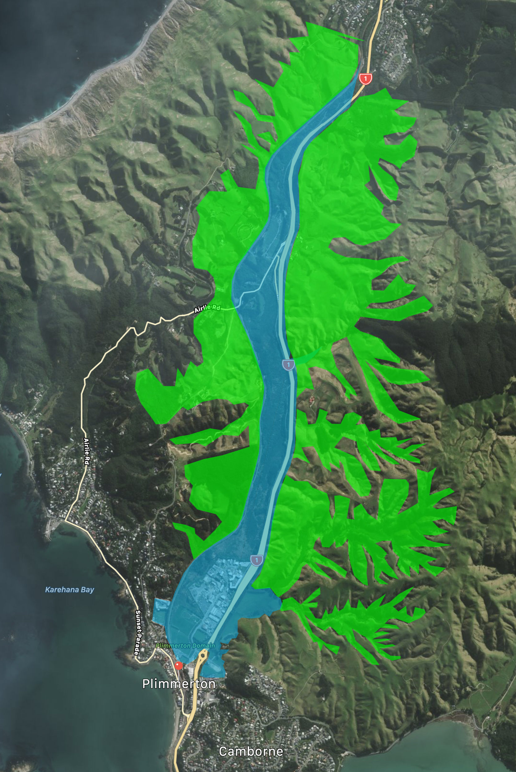
Well, this second map shows where, unfortunately, the water is asked to go – down the Tāupo Stream, which of course after a day like today, is gushing like Lake Taupo’s Huka Falls. As you can see, it is a very narrow and narrow winding little route – quite clearly not up to the standard required of taking the runoff of one of the Wellington region’s largest native wetlands.

I think, at a guess, that all this simply used to go out to the beach at Plimmerton, and has been cut off from discharging properly ever since a train line and housing was built along the waterfront. It’s no wonder therefore that the Tāupo wants to burst its banks – that’s the vaguely turquoise wiggle in the picture above. The area in blue above is the low-lying lands that was formerly a swamp – and in all honesty, should be ripped up and made back into swamp again. It is no wonder that the roundabout gets so frequently flooded, when all the areas surrounding it are already sodden and wanting to disgorge to the sea. So what?
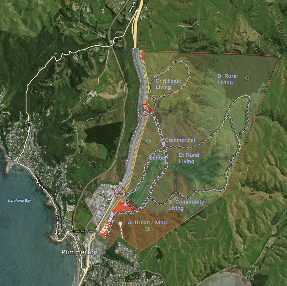
Well, you’d have to ask the Minister for the Environment “so what”, as they have recently given permission for Plimmerton Farm to be turned into a vast new subdivision. Housing for the rich on medium-sized lifestyle blocks, to be exact. “Community living” and “Rural Living” and “Hillside Living”. Have a look at the map above – spot any issues there? Any potential issues perhaps with the paving over of 20-30% of the area with non-permeable surfaces? Roadways? Houses? Extra run-off? Any issues that could be foreseen? Apparently not. Despite record numbers of people putting in their submissions, basically all of them were placated with obsequious flapdoodle and the project will go ahead, despite its many, many faults.
I despair….
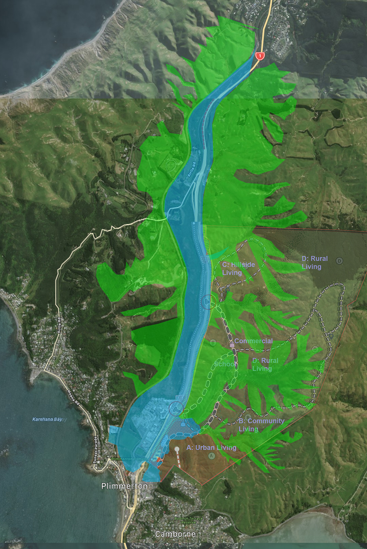
Here’s a mashup of the two maps – Plimmerton Farm proposed development and Tāupo Swamp wetland extent, including areas that contribute to its runoff. For a start, the area in red is the area for Retail intensification – big box retail, car parking, hard surfaces, in the middle of the area that already floods extensively every time it rains. And its on the other side of the road from the rest of SH1 retail, so either people will try and cross on foot, or will drive from one side of the street to the other. It’s a bit hard to see. What if I make the natural green stuff a bit stronger and easier to see. Below. Now can you see why I am getting hot behind the collar?


A well-functioning wetland acts like a sponge. So in the past Taupo swamp may have done a better job at slowing the high flows of water down into Plimmerton, but as you’ve pointed out, the reclamations, roads, other hard surfaces etc. have impacted on this function and the Plimmerton Farms (ridiculous name btw) is only going to make it worse.
Perhaps Plimmerton Farms developer could remedy this by paying for new and/or enhanced wetland capacity within and adjacent to the development to restore more of the wetland function in the area?
Good point Ben – and yes, there was extensive submittals on this point by many of the submitters, especially from the Friends of the Taupo Swamp, who made that very point. There is an answer somewhere in the final decision on the plan change 18 – I can’t recall if they did take that into account or not.
Ten or so years ago I built a storage facility at the northern end of the industrial park reclamation – right next to and three or four metres above the wetland. I’m not sure what your maps indicate. Does this seem like a particularly at-risk area or is that further down stream?
If it is 3-4m above the wetland, then it won’t be at risk unless the water levels rise 3 meters or more – which really won’t happen. Is that the secret film location? Ooops, sorry, not so secret now. It’s interesting though – that reclamation (presumably done by others, not by you) does make things worse for others – it narrows the width of the swamp and restricts the amount of absorbency, and probably makes the likelihood of flooding even higher, as the remaining water then barrels through at a increased rate. That’s all according to my “not a technical hydro engineer” eye – just using common sense, which seems to be missing from the Porirua Council people who approved the industrial park. And also missing from the bright sparks at MfE who have approved this dumb plan for 5000 extra houses here…
You’re right of course in that I should have omitted the industrial park from the “flood prone” area – when they built it, they dumped hundreds of tonnes of gravel there so it is higher than the surrounding wetland. So you’re correct in that it won’t actually flood, although all around other pieces of land are losing their dryness….
To be honest, my big concern at the time of planning was exactly how much sea level rise might be needed to reverse the direction of watery travel and bring in the briny.
Maybe they should dig up SH1 and install a big-ass mofo pipe that discharges flood waters to the sea south of Plimmerton? Wait until TGM is opened (not long now?) and then do the works. Simple, and better than flooding out houses.
Good point, but one which I suspect is definitely never going to happen. Not just for reasons of cost and timing (if done, it should have been done a hundred years ago) but also for reasons of kaitiakitanga etc – as you probably will remember, issues of ownership of the foreshore, issues of traditional kaimoana gathering areas, issues of not wanting to pollute the beach at Plimmerton (the floodwater is polluted with dirt, dust and diesel) etc. Also: it is still Ngati Toa land round there – Te Rauparaha’s descendants – not the sort of thing they are likely to say “Yes, sure!” too….